 Mon GéoSource
Les pistes cyclables de l'ARC
Carte présentant les pistes cyclables sur le territoire de l'Agglomération de la Région de Compiègne (ARC).
Simple
- Date ( Publication )
- 2008-01-01
- Presentation form
- Digital map
- EPCI ( Place )
-
- CA de la Région de Compiègne
- GEMET - Concepts, version 2.4 ( Theme )
-
- transport
- bicyclette
- transport routier
- piste cyclable
- réseau routier
- Denominator
- 80000
- Metadata language
- fr
- Topic category
-
- Transportation
- Description
- CA de la Région de Compiègne
N
S
E
W
))
- Distribution format
-
-
PDF
(
1.7
)
-
PDF
(
1.7
)
- OnLine resource
-
Carte au format PDF
(
WWW:LINK-1.0-http--link
)
Carte au format PDF
- OnLine resource
-
Lien vers la fiche de métadonnées d'origine
(
WWW:LINK-1.0-http--link
)
Lien vers la fiche de métadonnées d'origine
- Statement
-
Graphisme : Michel Cazin - 03 23 20 25 20
Crédits texte : Services ARC / source principale : « Entre rivières et forêts, la communauté compiégnoise par Ph. BONNET-LABORDERIE, F. CALLAIS, A J-M BERNARD, éd. GEMOB, 2005 »
- File identifier
- 86d43b01-0023-478b-a836-447fed394095 XML
- Metadata language
- fr
- Character set
- UTF8
- Hierarchy level
- Dataset
- Date stamp
- 2019-11-21T14:35:11
- Metadata standard name
- ISO 19115:2003/19139
- Metadata standard version
- 1.0
Overviews
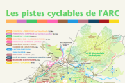
thumbnail
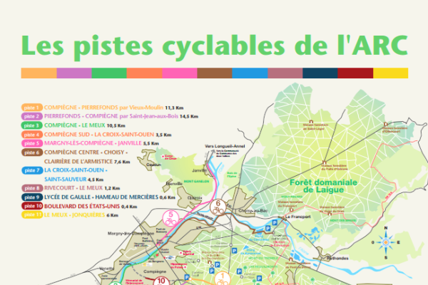
large_thumbnail
Spatial extent
N
S
E
W
Provided by

Associated resources
Not available