 Mon GéoSource
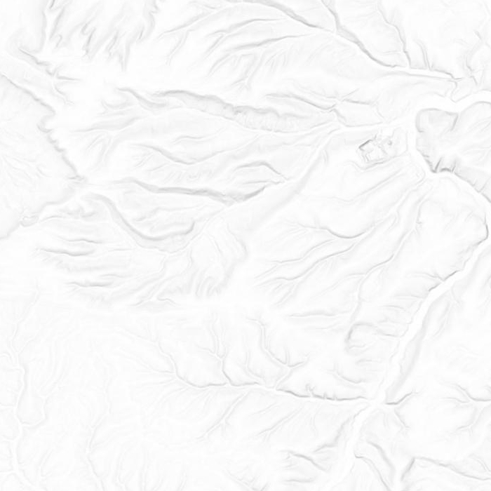
Ombrage Nord-Pas de Calais 2012-2013
Ombrage de la Région Nord - Pas de Calais sous forme d'image numérique.
Simple
- Date ( Creation )
- 2013-01-01
- Identifier
- c2981f20-1957-4293-8c75-3621b13fa79a
Owner
Conseil départemental du Pas-de-Calais - Service Information Géographique et Observatoire des Territoires
51 rue d'amiens
,
Arras
,
62000
,
0321216132
- Name
- GeoTIFF
- Version
- 1.0
- GEMET - INSPIRE themes, version 1.0 ( Theme )
-
- Altitude
- Keywords
-
- altitude
- données ouvertes
- mnt
- modèle numérique de terrain
- plateforme publique de l'information géographique
- Départements ( Place )
-
- NORD
- PAS-DE-CALAIS
- Use limitation
- Conseil départemental du Pas-de-Calais - PPIGE NPDC - MNT 2012 - 2013
- Access constraints
- Other restrictions
- Other constraints
- Pas de restriction d’accès public selon INSPIRE
- Access constraints
- Other restrictions
- Spatial representation type
- Grid
- Distance
- 10 http://standards.iso.org/ittf/PubliclyAvailableStandards/ISO_19139_Schemas/resources/uom/ML_gmxUom.xml#m
- Metadata language
- fr
- Character set
- UTF8
- Topic category
-
- Elevation
N
S
E
W
))
- Reference system identifier
- urn:ogc:def:crs:EPSG:2154
- Distribution format
-
-
GeoTIFF
(
1.0
)
-
GeoTIFF
(
1.0
)
- OnLine resource
- Données brutes ( WWW:DOWNLOAD-1.0-http--download )
- OnLine resource
- Ombrage - Télécharger sur DATA.GOUV.FR ( WWW:LINK-1.0-http--link )
- OnLine resource
-
opendata:ombrage_2012
(
OGC:WMS
)
Ombrage - 2012
- OnLine resource
- Service WMS de la PPIGE ( OGC:WMS-1.3.0-http-get-capabilities )
- Hierarchy level
- Dataset
- Statement
-
Produit par le Conseil départemental du Pas-de-Calais à partir du MNT GRID Nord-Pas de Calais - PPIGE - 2012 - 2013, avec l'outil gdal_dem du logiciel GDAL 1.11.
L'ombrage obtenu combine un éclairage oblique (azimuth de 315° et altitude de 90°) selon la formule de Horn, et une carte des pentes.
- File identifier
- urn:isogeo:metadata:uuid:c2981f20-1957-4293-8c75-3621b13fa79a XML
- Metadata language
- fr
- Character set
- UTF8
- Hierarchy level
- Dataset
- Date stamp
- 2019-11-22T08:45:33
- Metadata standard name
- ISO 19115 Geographic Information - Resource
- Metadata standard version
- 2003/Cor.1:2006
Overviews
ombrage
Spatial extent
N
S
E
W
Provided by

Associated resources
Not available