 Mon GéoSource
/Activités humaines/Cultures marines
Type of resources
Available actions
INSPIRE themes
Provided by
Years
Formats
Representation types
Update frequencies
status
Scale
-
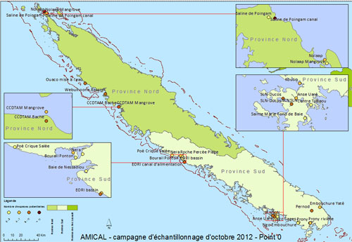
Localisation des sites échantillonnés lors de la première campagne de bioprospection du projet AMICAL (ADECAL/ IFREMER) en octobre 2012. Résultats des comptages de nombre d'espèces potentielles pour la production en photobioréacteur avec une estimation basse, une estimation haute et le potentiel de chaque site.
-
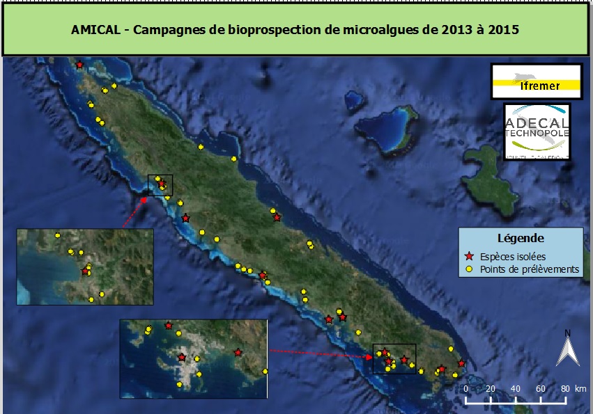
Localisation des sites échantillonnés lors des campagnes de bioprospection du projet AMICAL (ADECAL/ IFREMER) entre 2013 et 2015. - Localisation et identification des souches de microalgues isolées. - Dénombrement des différents groupes taxonomiques de micro-organismes photosynthétiques observés par site de prélèvement.
-
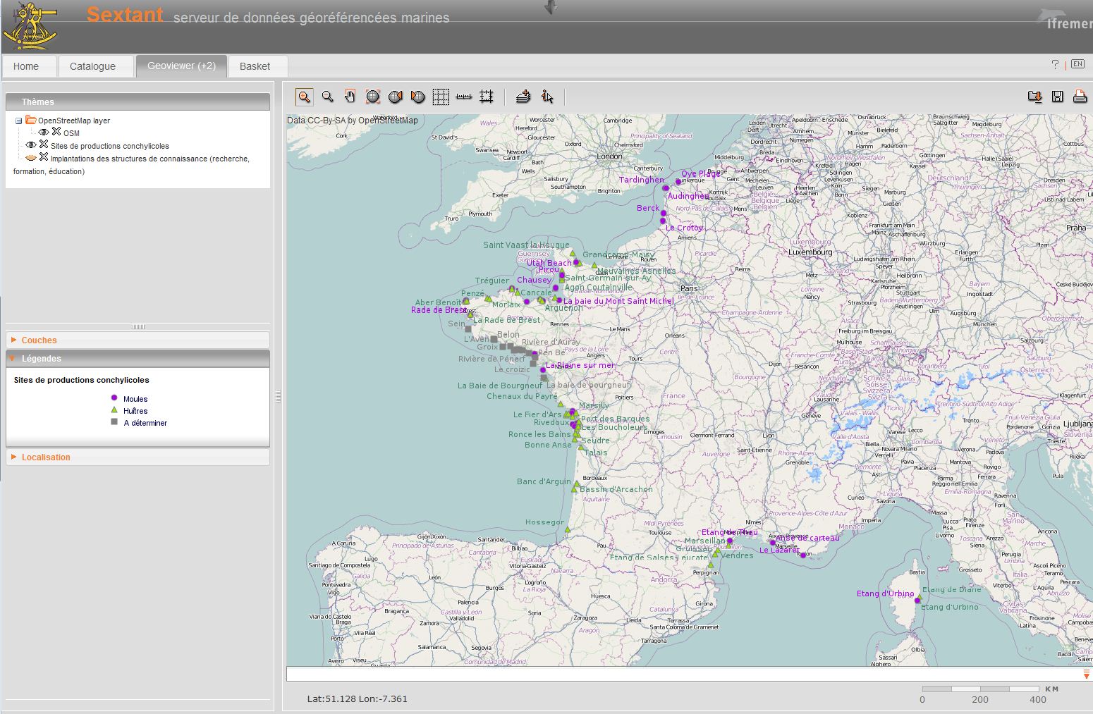
Shellfish farming areas can have different meanings. Sometimes their identification is prescribed and used for health classification of production areas. In Euroshell project, the choice was made to map the production areas whose identification makes sense for both scientists and professionals. A limited number of areas is then showed, often corresponding to a hydrographic reality. Indeed, the shellfish industry is mainly installed in estuaries, river mouths, bays, fjords, estuaries or lagoons. This map shows the shellfish production sites, which include several areas. Some information is given on species produced, the number of companies and / or concessions and / or producers, the approximate amount of production.
-
Concessions de cultures marines sur le département du Finistère. Données fournies par la DDAM du Finistère.
-
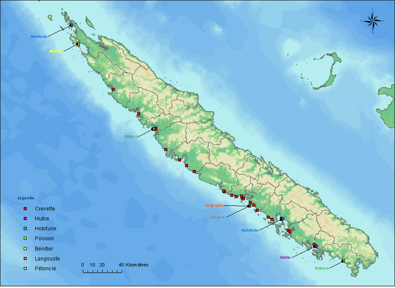
Localisation des installations aquacoles de Nouvelle-Calédonie.
-
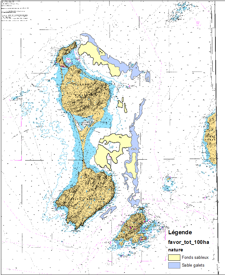
This data set was obtained during 2 ENVISION-IFREMER field campaigns carried out in 2007 and 2011 to sustain a Pectinid aquaculture project. This project was co-funded by ODEADOM and the public collectivity of Saint Pierre et Miquelon. Potential areas for further aquaculture exploitation and development on the Eastern coast of Saint Pierre et Miquelon.
-
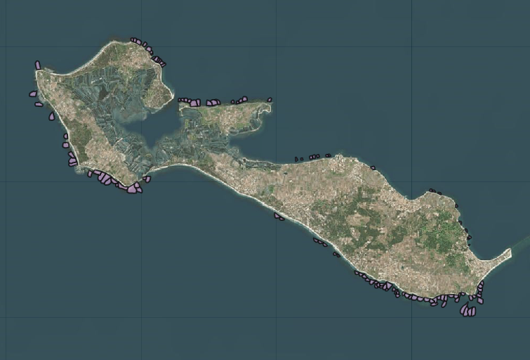
Cartographie actuelle des écluses à poissons présentes sur l'Île de Ré et des écluses ayant existé d'après consultation de sources historiques. Donnée disponible en téléchargement SHP ou en Flux http://mapd.sig.huma-num.fr/geolittopublic/carteWS.php?
-
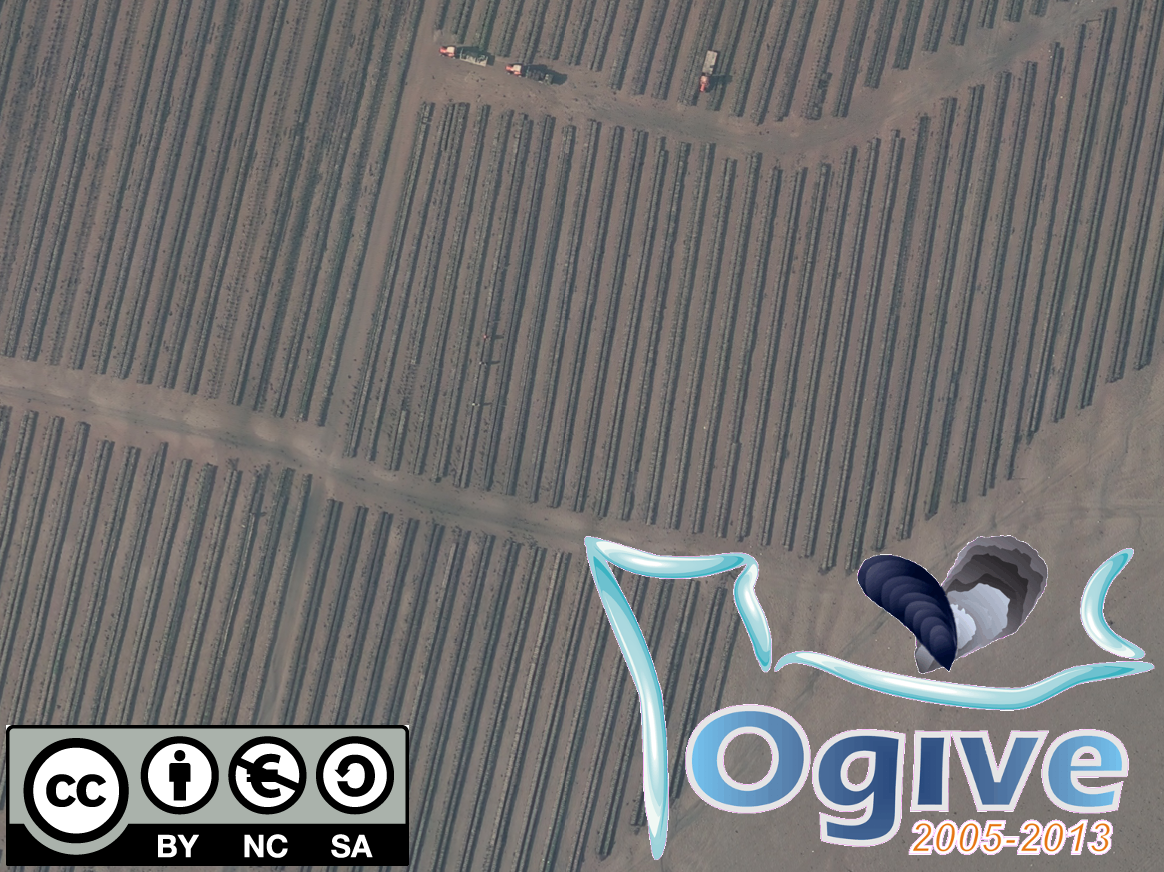
Photographies aériennes des zones de production conchylicoles de la Baie des Veys (Calvados) acquises pendant les grandes marées de la fin de l’été 2011 (Coefficient de marée 111-102-111-105) en parallèle de l’échantillonnage de terrain dans le cadre du projet OGIVE (Outils d’aide à la Gestion Intégrée et à la Valorisation des Ecosystèmes conchylicoles, 2005-2013).
-
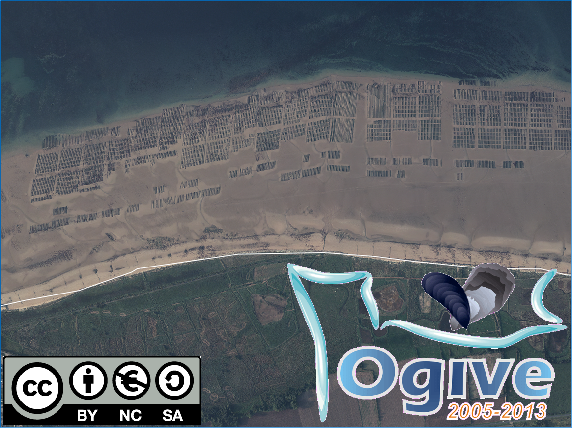
Photographies aériennes des zones de production conchylicoles de Meuvaines (Calvados) acquises pendant les grandes marées de la fin de l’été 2011 (Coefficient de marée 111-102-111-105) en parallèle de l’échantillonnage de terrain dans le cadre du projet OGIVE (Outils d’aide à la Gestion Intégrée et à la Valorisation des Ecosystèmes conchylicoles, 2005-2013).
-
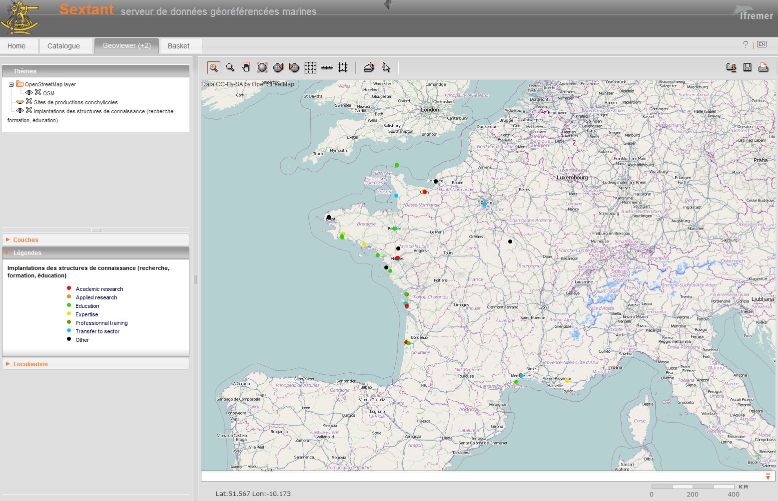
In order to bridge the gap between shellfish growers and scientists, a layer is built with the list of organizations thatproduce or transfer knowledge in the shellfish sector. Academic or applied research centers, experts, training and education sector, monitoring networks and regional centers are recorded and data are collected on their size, address, website link, fundings, etc.