Mon GéoSource
/Human Activities/Various
Type of resources
Available actions
Topics
INSPIRE themes
Keywords
Contact for the resource
Provided by
Representation types
Scale
Resolution
-
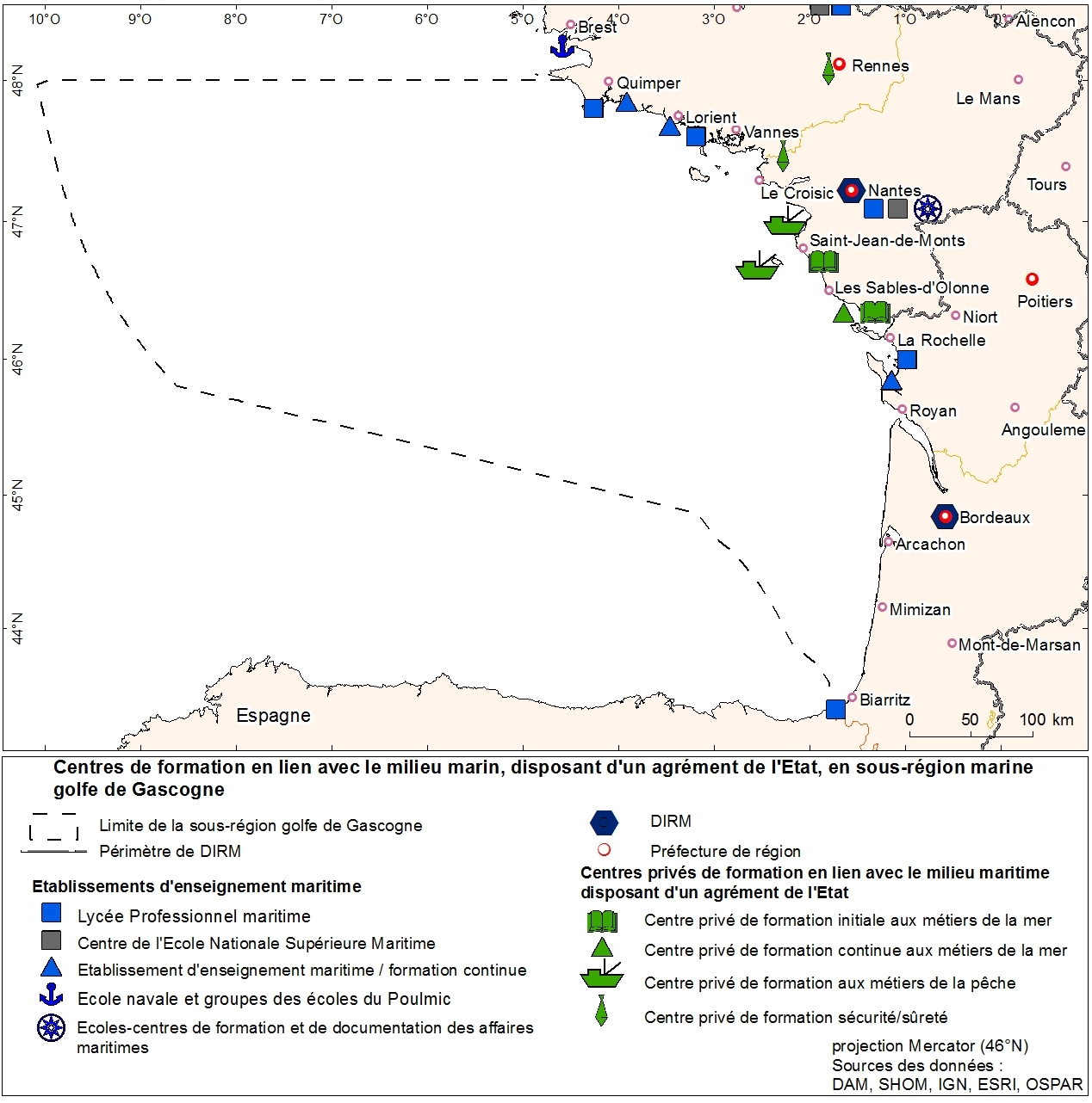
Agencies education in marine trades geolocalized to municipality. This information was produced as part of the initial assessment of the MSFD. Referent expert Sophie Devergie. WARNING: the spatial structure of the data must be improved because it contains superpositions of points (several training agencies per commune). Here the tool "Representation" of ArcGIS was used to facilitate the mapping of the data that does not meet basic standards of the topology. Ultimately, the quality of the data can be improved by refining the address geolocation.
-
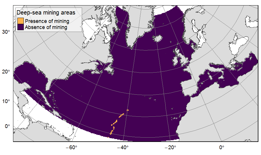
Presence of deep-sea mining exploration zones on the North Atlantic (18°N to 76°N and 36°E to 98°W). These areas correspond to the three polymetallic sulphides exploration contracts on the Mid-Atlantic Ridge, attributed to Poland, France and Russia. Each of the three contract areas is divided into 100 squares of 10km by 10km. Source polygons originated from the International Seabed Authority. The presence (value=1) of deep-sea mining was extracted in 25km * 25km gridsquares. This dataset was built to feed a basin-wide spatial conservation planning exercise, targeting the deep sea of the North Atlantic. The goal of this approach was to identify conservation priority areas for Vulnerable Marine Ecosystems (VMEs) and deep fish species, based on the distribution of species and habitats, human activities and current spatial management.
-
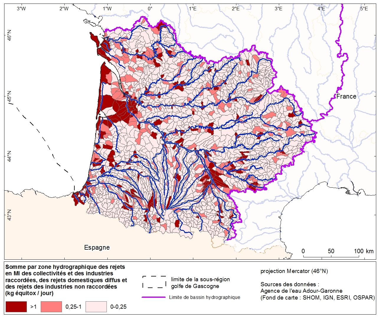
Discharges of nutrients (nitrogen, phosphorus and organic matter) and toxic releases (MI) per hydrographic zone from industries and communities of the Adour-Garonne basin. This data was collected as part of the initial assessment of the MSFD with the Water Agency of Adour-Garonne. Referent expert AAMP: Aurélie Blanck.
-
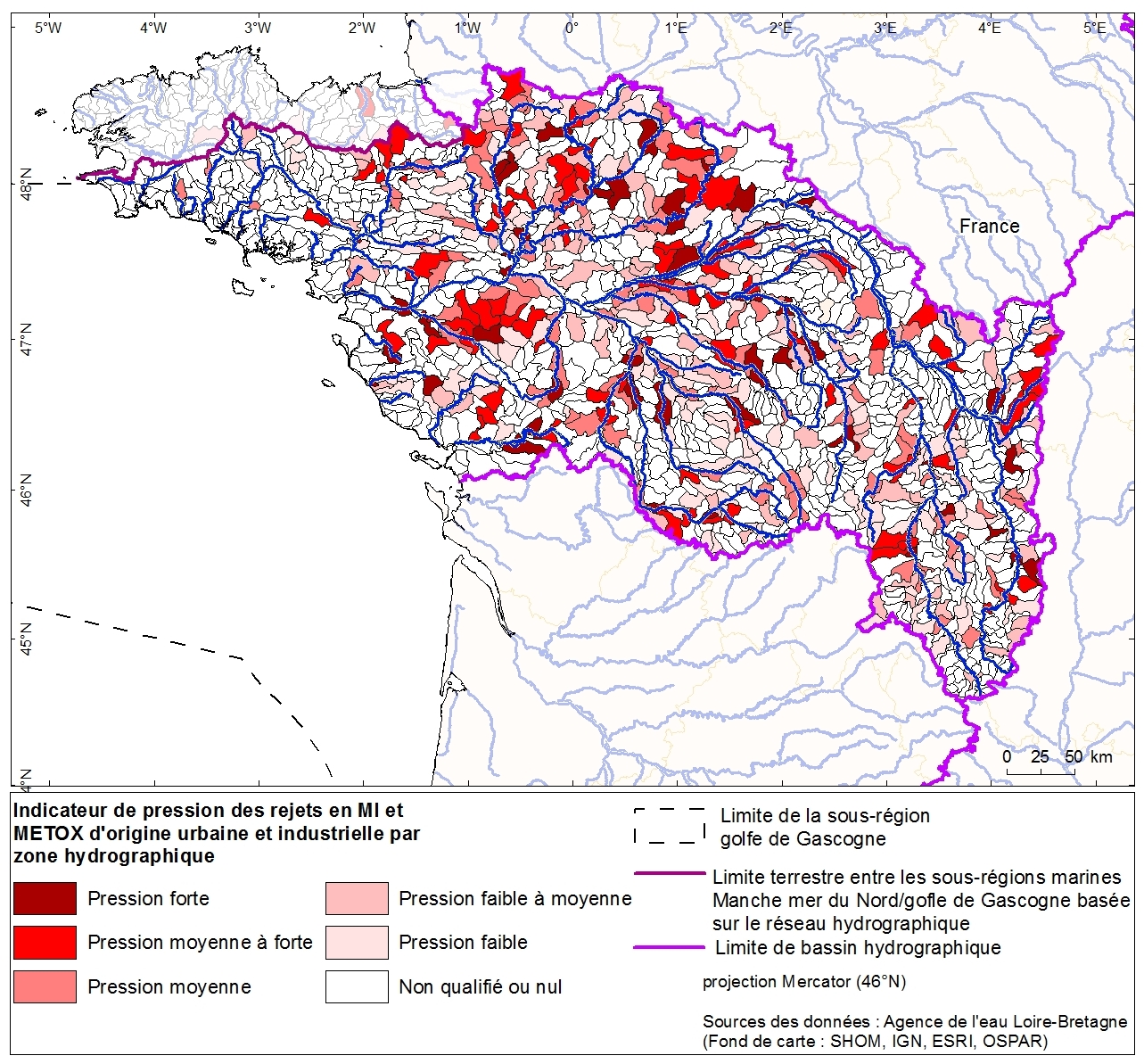
Toxic discharges from urban and industrial sources per hydrographic zone of the Loire Bretagne basin. This data was collected as part of the initial assessment of the MSFD with the Water Agency of Loire-Bretagne. Referent expert AAMP: Aurélie Blanck.
-
Zones corresponding to the delimitation of major watersheds and related marine areas in the Seine-Normandy basin for the assessment of pressures on the different water masses on the Normandy coast and marine sub region English Channel - North Sea. Nutrient discharges from industries and communities.
-
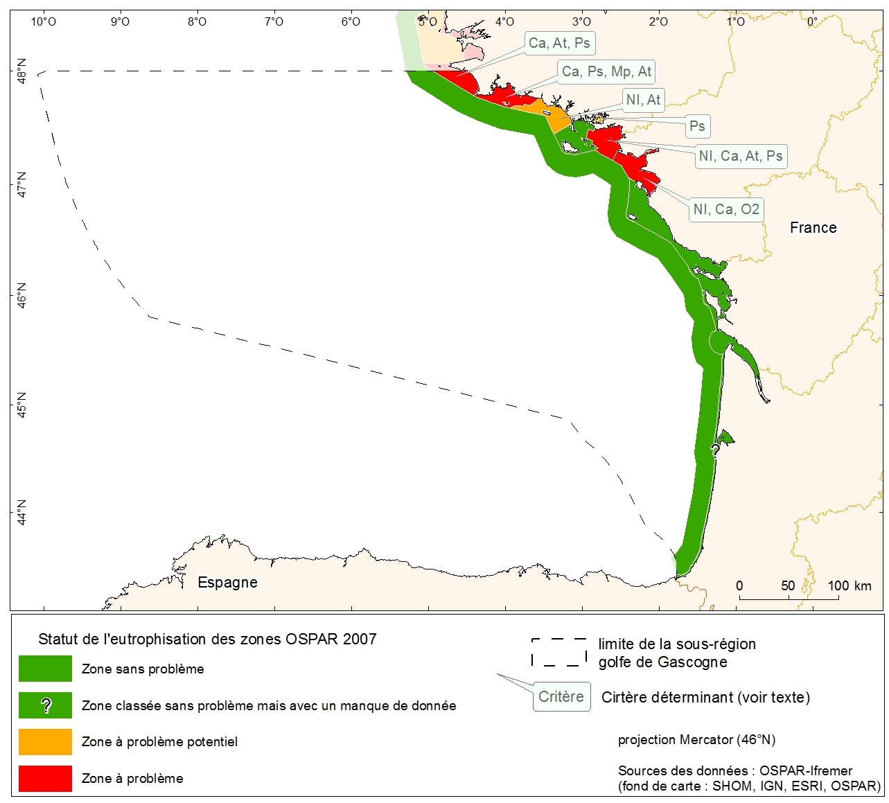
Eutrophication status of the OSPAR of 2007 zones of metropolitan France. Data collected in the course of "initial assessment" phase of the MSFD.
-
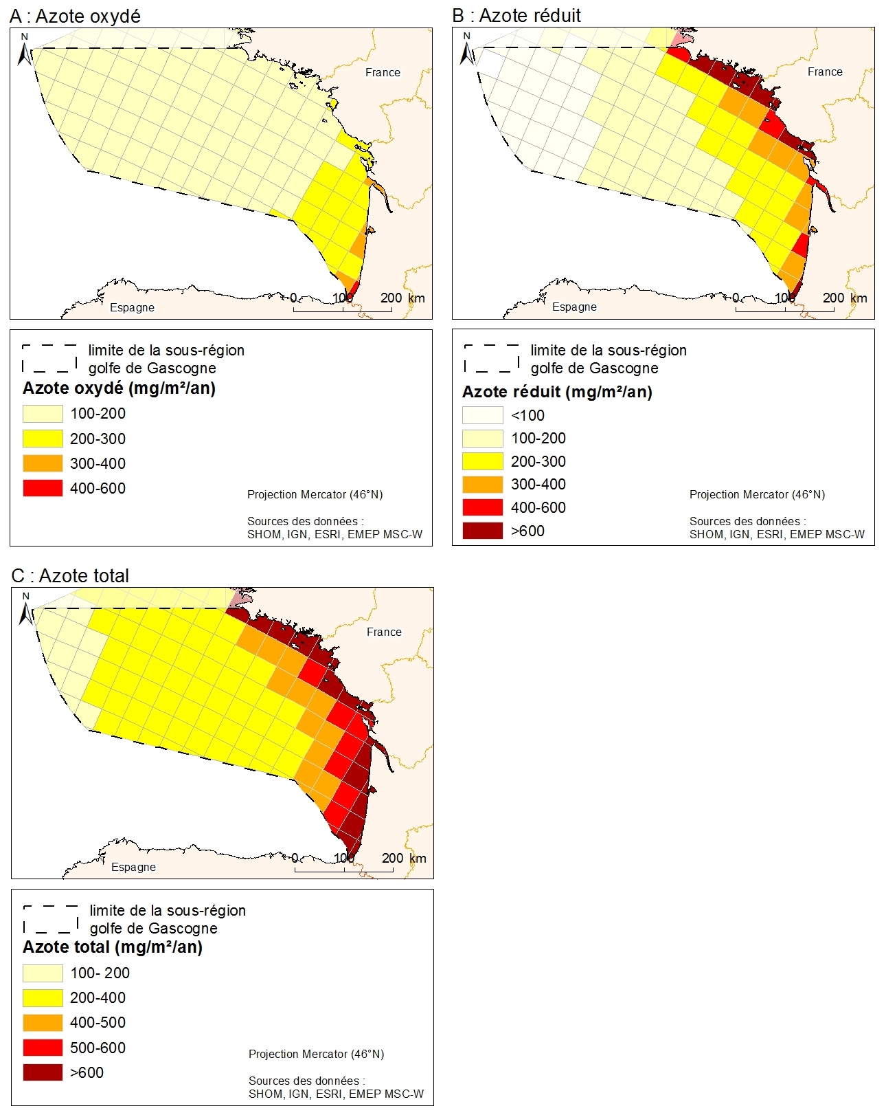
Data from atmospheric deposition of nitrogen are calculated from emissions data coupled with an atmospheric chemical transport model. Emissions data are from the EMEP program. They are public and available on the EMEP database and are based on emissions data (combustion, waste, transport, agriculture) collected by country. The models estimate atmospheric deposition of oxidized nitrogen, reduced nitrogen and total nitrogen for the period 1995-2008 from the emissions data and meteorological data. Models are driven by EMEP MSC-W (Meteorological Synthesizing Centre West). From the data downloaded from the EMEP, the MPA produced a GIS data format in shp by projecting the data on the EMEP grid projected in North Pole Stereographic
-