 Mon GéoSource
Ifremer/AAMP/INPN/CNRS/ULR/DREALPC/AELB/AEAG
Type of resources
INSPIRE themes
Provided by
Years
Formats
Representation types
Update frequencies
status
Scale
-
Stocks of Crepidula fornicata Linnaeus, 1758 in the Pertuis Charentais. Environmental state for 2011
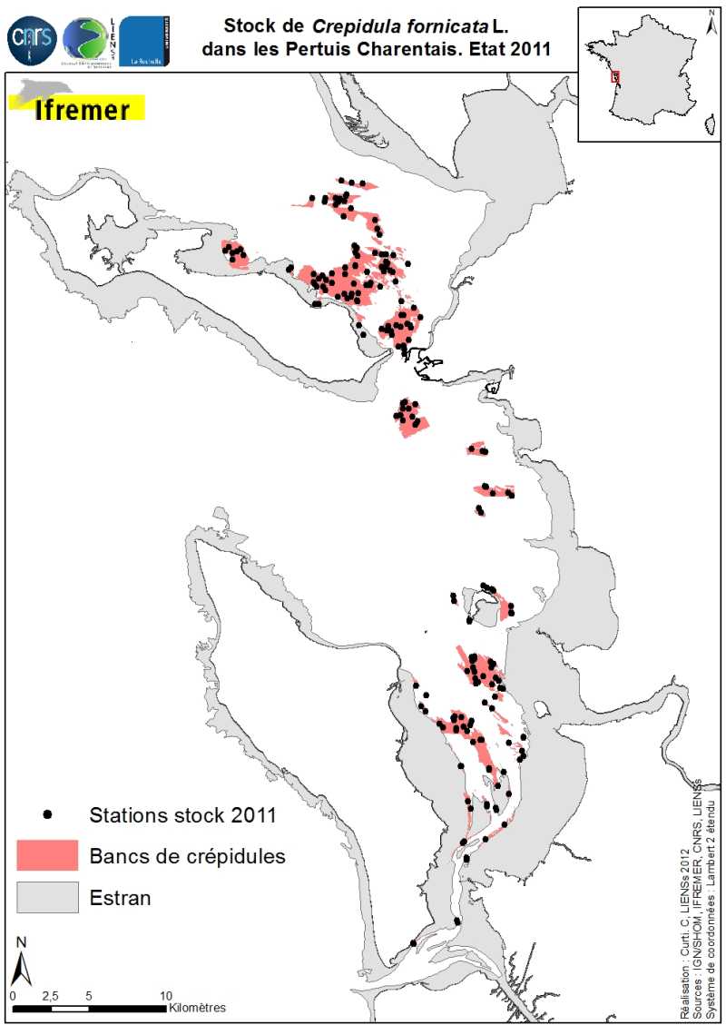
Stocks (abundance and biomass) of the slipper limpet Crepidula fornicata Linnaeus, 1758 in the Pertuis Charentais shallows were estimated in 2011 and mapped (Sauriau et al., 2011). The influence of the estimate includes the Pertuis Breton, the eastern part Pertuis Antioch Fouras peninsula and the Bay of Marennes-Oléron where the latter earlier estimates are available. Contours and surface areas of the crepidula were previously determined by acoustic imaging performed aboard the VO/Haliotis in 2008 and 2009, interpreted and validated by spot sampling in 2009 (Curti, 2009). Sampling stocks of 2011 is based on a stratified random sample of 40 banks with a proportional distribution of sampling of 200 stations between banks. The listing for each crepidula bank stocks (abundance in millions, biomass in tonnes) both living and dead, these shells may provide support to potential new colonization.
-
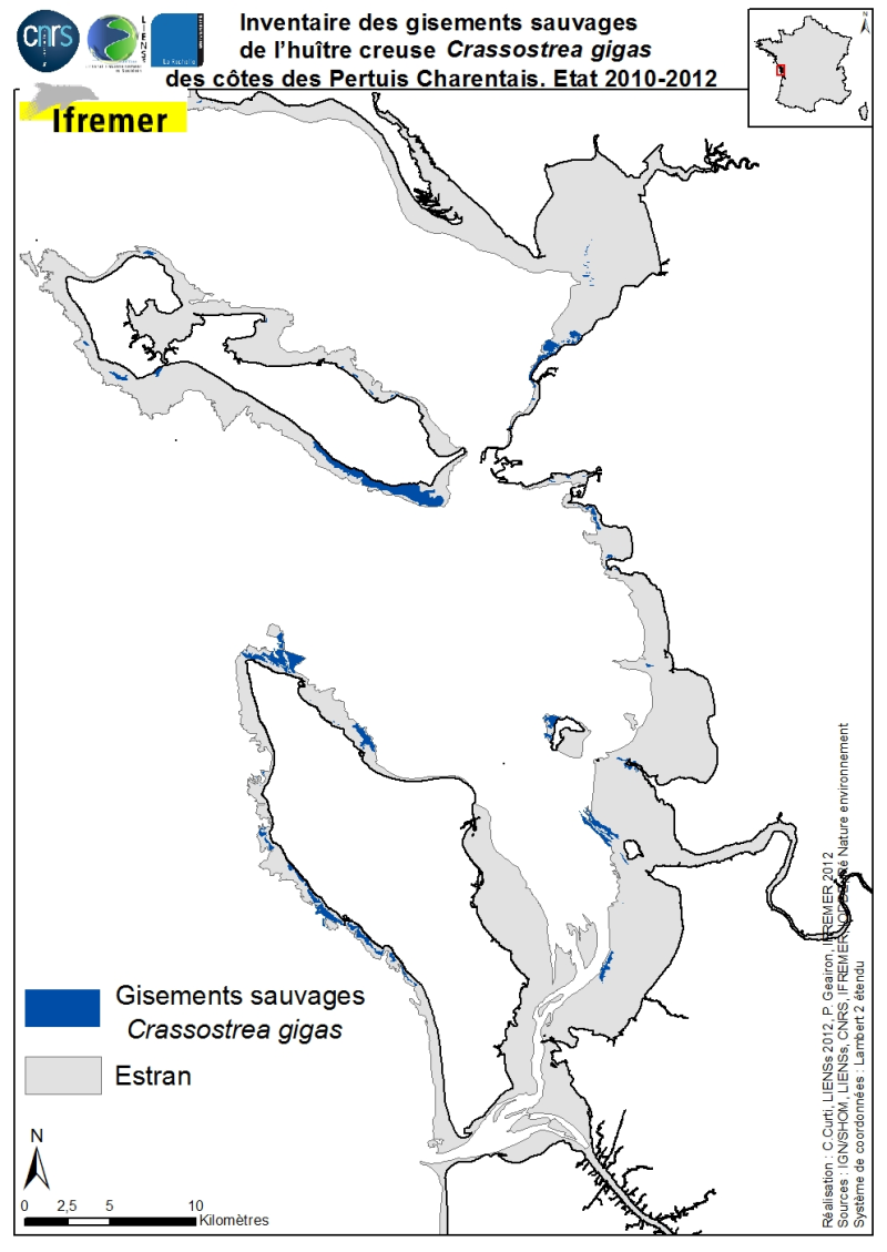
The geographical distribution of the main sources of wild Pacific oysters (Crassostrea gigas) (Thunberg, 1793) on the coasts of the Pertuis Charentais was compiled from 2010 to 2012. The inventory focuses on natural foreshore deposits (+ 6-0 m sea coast) and compiles two cartographic sources: 1) quantitative inventories made in 2010 by Ifremer from the Tranche sur Mer (Vendée) to Vaux-sur-Mer in 21 representative sites to estimate wild stocks of Pacific oysters and 2) inventory mapping of intertidal marine habitats mainly made by LIENSs (in cooperation with CREOCEAN, IODDE, Ré Nature Environnement and GEO-Transfert) under the project CARTHAM Natura 2000at sea of the Agency of Marine Protected Areas. Methodologies used by Ifremer to estimate the areas colonized combine thematic analysis in Geographic Information System (GIS) and field validations (Soletchnik et al., 2012). The methodologies used to estimate LIENSs extension of the intertidal habitat of the oysters combined aerial image analysis, remote sensing, field validations and thematic analysis using GIS (Cajeri et al., 2012).