 Mon GéoSource
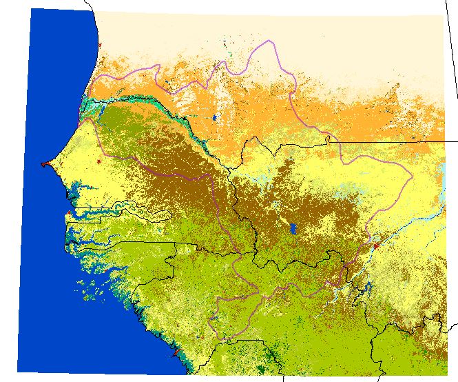
Carte raster de l'occupation du sol de l'ESA/CCI, à 300m, 2016, clip zone OMVS
Simple
- Date ( Creation )
- 2017-04-01
- GEMET - INSPIRE themes, version 1.0 ( Theme )
-
- Occupation des terres
- Keywords ( Theme )
-
- ESA CCI
- Occupation du sol
- Image satellite
- Access constraints
- Other restrictions
- Other constraints
- Pas de restriction d’accès public selon INSPIRE
- Use limitation
- Utilisation libre sous réserve de mentionner la source (a minima le nom du producteur) et la date de sa dernière mise à jour
- Distance
- 300 m
- Metadata language
- fre
- Character set
- UTF8
- Topic category
-
- Environment
))
- Begin date
- 2014-10-01
- End date
- 2016-03-31
- Reference system identifier
- GCS_WGS84
- Distribution format
-
-
GeoTIFF
(
1.0
)
-
GeoTIFF
(
1.0
)
- OnLine resource
- ESACCI-LC-L4-LCCS-Map-300m-P1Y-2015-v2.0.7.zip ( WWW:DOWNLOAD-1.0-http--download )
- Hierarchy level
- Dataset
Conformance result
- Date ( Publication )
- 2000-01-01
- Explanation
- cf. la spécification citée
- Pass
- No
- Name of measure
- -- Exactitude des caractéristiques topologiques explicitement encodées de la série de données, telles que décrites dans le champ d’application (obligatoire pour les données des thèmes Hydrographie et Réseaux de transport) --
- Statement
-
The CCI-LC project delivers consistent global LC maps at 300 m spatial resolution on an annual basis from 1992 to 2015. The Coordinate Reference System used for the global land cover database is a geographic coordinate system (GCS) based on the World Geodetic System 84 (WGS84) reference ellipsoid. The typology was defined using the Land Cover Classification System (LCCS) developed by the
United Nations (UN) Food and Agriculture Organization (FAO), with the view to be as much as
possible compatible with the GLC2000, GlobCover 2005 and 2009 products. In addition, the UNLCCS
was found quite compatible with the Plant Functional Types (PFTs) used in climate models
- File identifier
- 5008d775-0966-44d2-a60d-e70f40600726 XML
- Metadata language
- fr
- Character set
- UTF8
- Hierarchy level
- Dataset
- Hierarchy level name
- Série de données
- Date stamp
- 2018-01-24T19:17:09
- Metadata standard name
- ISO 19115:2003/19139
- Metadata standard version
- 1.0
Overviews

Spatial extent
Provided by
