 Mon GéoSource
D3: Commercially Exploited Species
Type of resources
Available actions
Topics
INSPIRE themes
Keywords
Contact for the resource
Provided by
Representation types
Update frequencies
status
Scale
-
-
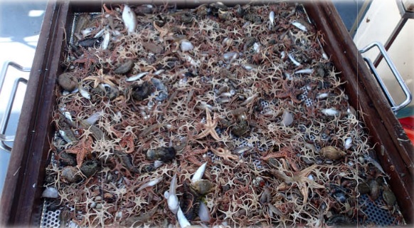
The objective of this cruise, which has been taking place in the English Channel - Baie de somme since 1980, over 5 days in September, is to evaluate the natural multi-year fluctuations of the stands and to analyze the possible impact of the nuclear power plant on the marine environment and resources. It makes it possible to determine annual indices of abundance and distribution of flatfish and other species (shrimp, pout, whiting).
-
Vessel Monitoring System (VMS) data is the data from the Community's satellite-based fishing vessel monitoring system, which provides data on the position, course and speed of vessels to fisheries authorities at regular intervals.
-
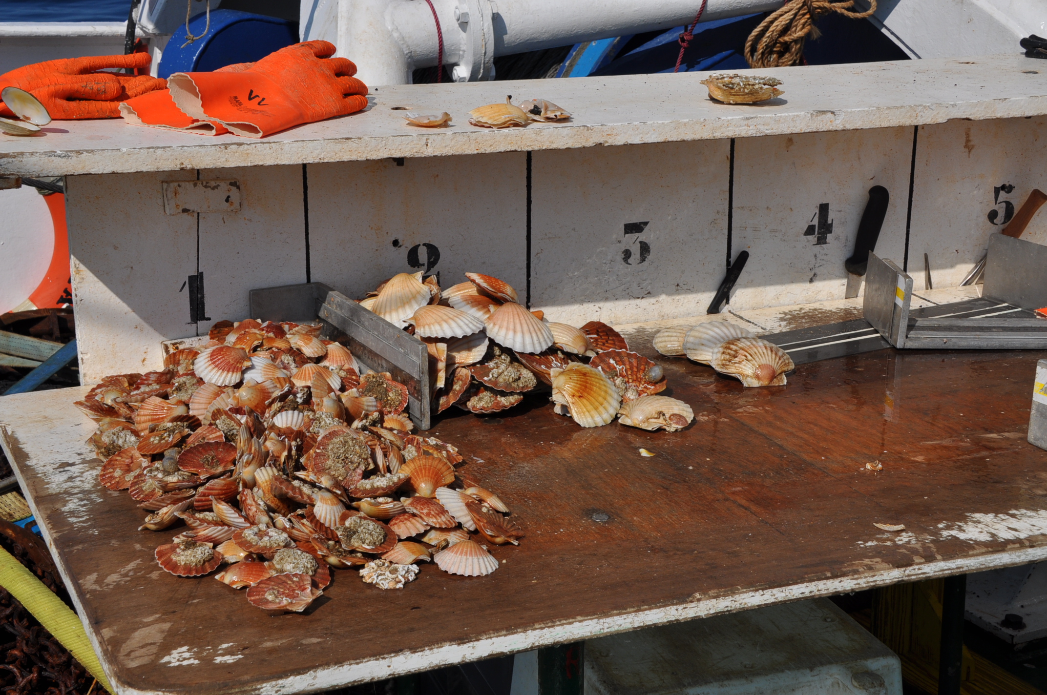
Within the framework of the establishment of a nuclear power plant on the coast of the town of Flamanville, Electricité de France has entrusted Ifremer with ecological and fishery studies on the site's surroundings. One of the expert assessments consists of conducting two shellfish fishing campaigns each year. Their objectives are to monitor the natural fluctuations of the main indicators selected during the start-up of the plant and to evaluate the impact of the plant on the surrounding fishery.
-
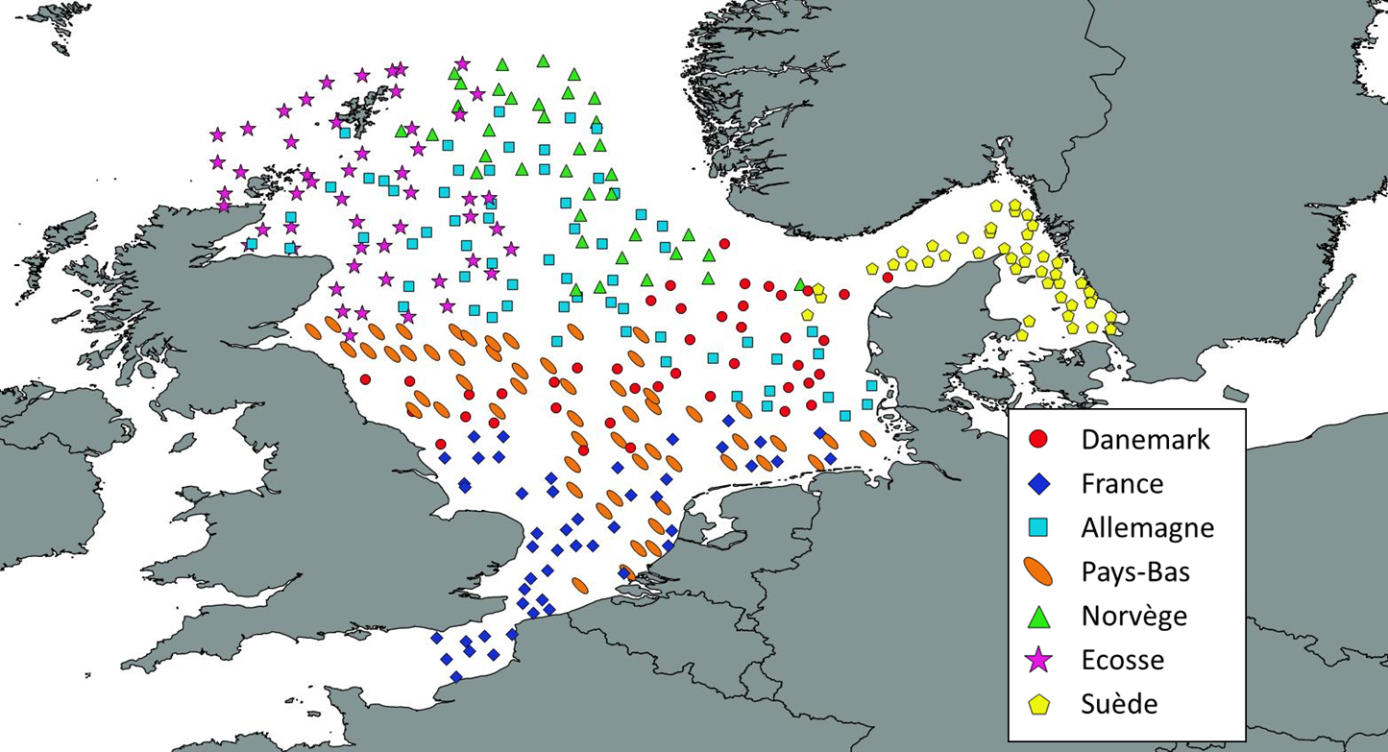
Like all EU Member States, France is obliged to collect and manage the data necessary to conduct the Common Fisheries Policy to assess the abundance and distribution of stocks. A "national multi-annual basic data collection programme" has therefore been set up in which scientific campaigns such as IBTS are integrated. This campaign is carried out in coordination with most of the countries bordering the North Sea, in the framework of the European Fisheries Data Collection Programme (DC-MAP). The research carried out over the last few decades has led to a shift away from fisheries issues stricto sensu (monospecific and geographically limited studies) towards a more integrated vision of the various components of marine ecosystems. This openness results from a desire to better understand the dynamics of exploited marine resources in order to improve diagnoses and management recommendations. The acquisition of data from these compartments at different stations makes it possible to establish a map of biotic and abiotic environmental parameters in the Channel and North Sea during the winter period, a period that is usually little studied, but which is crucial.
-
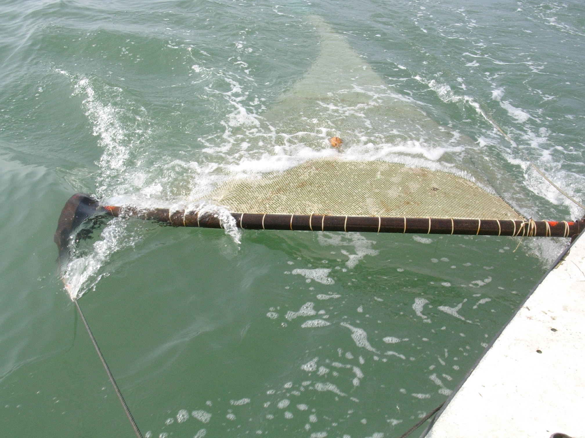
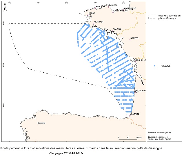
EVRWE is a multiannual survey with the following objectives: - Building up time series of abundance indices for the main dermersal and benthic species in the Celtic Sea and the Bay of Biscay. - Measuring inter-annual changes in their recruitment. - Mapping the spatial distributions of the species and their inter-annual variations, as well as looking for the origin of this variability (biotic and/or abiotic parameters, fisheries impact). - In the framework of the 'Bay of Biscay' challenge, the data collected are vital for understanding changes in faunal communities.
-
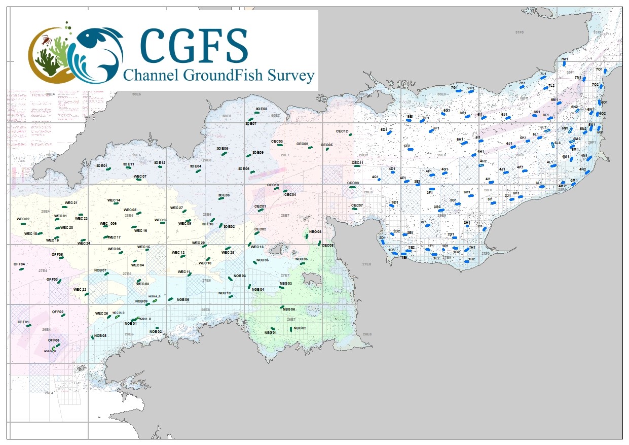
CGFS cruise aims to collect basic data to estimate the status of fisheries resources, by direct assessment of stock abundance and distribution, along with biological sampling of commercial catches. The CGFS campaign is carried out within the framework of this programme in the European project Contractualisation of Basic Fishery Data Collection (DCF). The abundance indices collected during this campaign are used by the ICES international working group "Demersal fisheries of the North Sea, Eastern Channel and Skagerrak" and complement the data from the English "Beam Trawl Survey" for the "Flatfish" working group.
-
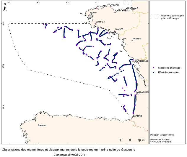
The objective of the PELGAS cruise is to monitor distribution and abundance of pelagic species fished in the Bay of Biscay, using two direct evaluation methods: acoustics and spawning estimates. The cruise was conducted in coordination with France, Spain and Portugal, in the framework of the European council regulations (EC No 1543/2000 of 29 June 2000 and No 1639/2001 of 25 July 2001).
-
Ecological study of coastal nurseries in the Bay of Biscay: abundance and the quality of benthic and demersal fish juveniles (targeted species: common sole, Solea solea L.), biological indicators, relationship with the physical parameters of the habitats (bathymetry, sediments, hydrology) and with associated epibenthic populations (trawls for observing invertebrates).
-
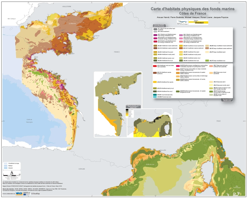
Eunis-classified physical habitats physiques resulting from the combination of three physical variables meshed at a resolution of 250 metres: nature of the substrates, biological area, shearing tension on the sea floor. Coasts of mainland France. Ifremer report "Hamdi Anouar, Vasquez Mickael, Populus Jacques (2010). Cartographie des habitats physiques Eunis - Côtes de France. Ifremer/AAMP agreement n° 09/12177764/FY. http://archimer.ifremer.fr/ doc/00026/13751/ "