 Mon GéoSource
IFREMER SIH
Type of resources
Available actions
Topics
INSPIRE themes
Keywords
Contact for the resource
Provided by
Years
Representation types
Update frequencies
status
Scale
-
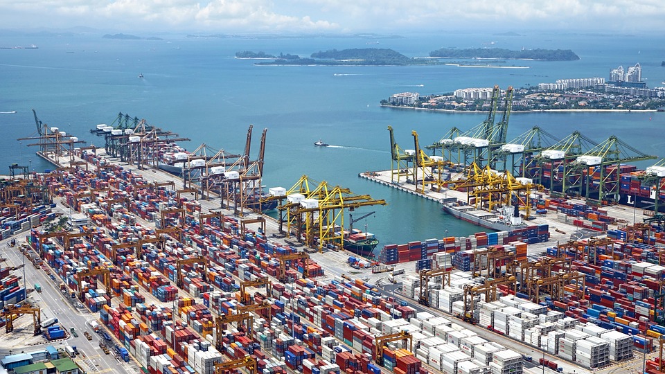
World list of seaports. In its 2021 version, the repository includes 13709 ports for 187 countries. The list of seaports has been drawn up on the basis of the information available in the European reference system of places used in the framework of the Common Fisheries Policy and, more particularly, by the Electronic Recording and Reporting System (ERS), the list of ports identified by the UNECE (2021-1). An assessment of the infrastructures present along the coastline made it possible to identify other ports that were not listed. Each geographical position has been verified with Google Earth in WGS84. Each port is associated with information relating to the country (ISO 3 coding), the UNECE or ERS 5-character coding, the name, the geographical position in WGS84 (latitude and longitude), the status of the port indicating whether it is referenced by Unece (UNECE), by the EU/ERS (ERS) or by both (UNECE/ERS) In case the port is not referenced by UNECE or ERS, the status is N/A. For French ports, the reference system integrates the ports of the French overseas departments and territories with the national codification. Inland ports have also been integrated in 2021.
-
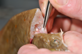
ObsBio, the collection of individual biological parameters such as size, weight, sex, age are necessary data to know by elevation, the share of the populations in the recruitment of young fish, in the natural mortality and in the mortality by fishing
-

The repository of commercially exploited species of interest in the Fisheries Information System is based on the FAO's ASFIS repository enriched with species of high commercial interest in France (metropolitan and overseas).
-
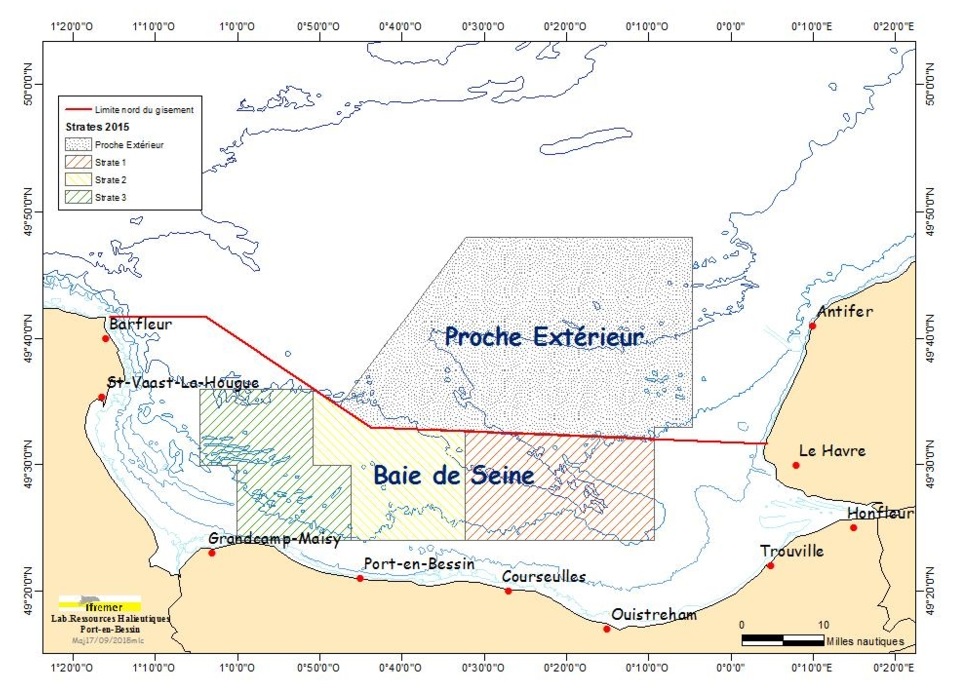
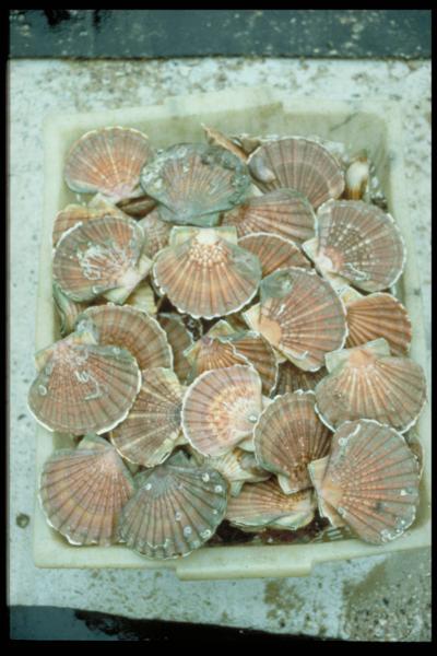
The COMOR cruises, which took place on the Thalia, aim to assess the abundance of the scallop stock (and if necessary to determine the presence of toxic algae) in the Seine Bay.
-
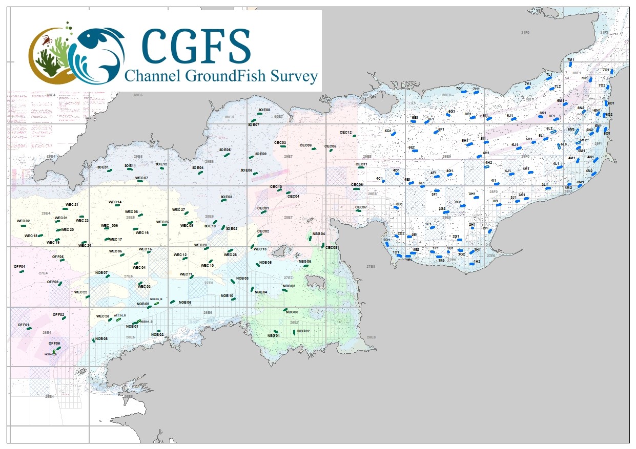
CGFS cruise aims to collect basic data to estimate the status of fisheries resources, by direct assessment of stock abundance and distribution, along with biological sampling of commercial catches. The CGFS campaign is carried out within the framework of this programme in the European project Contractualisation of Basic Fishery Data Collection (DCF). The abundance indices collected during this campaign are used by the ICES international working group "Demersal fisheries of the North Sea, Eastern Channel and Skagerrak" and complement the data from the English "Beam Trawl Survey" for the "Flatfish" working group.
-
The Bargip project : acquisition of scientific data and knowledge to produce advices on integrated management of European sea bass (Dicentrarchus labrax) in North-East Atlantic.
-
Like all EU Member States, France is obliged to collect and manage the data necessary to conduct the Common Fisheries Policy to assess the abundance and distribution of stocks. A "national multi-annual basic data collection programme" has therefore been set up in which scientific campaigns such as IBTS are integrated. This campaign is carried out in coordination with most of the countries bordering the North Sea, in the framework of the European Fisheries Data Collection Programme (DC-MAP). The research carried out over the last few decades has led to a shift away from fisheries issues stricto sensu (monospecific and geographically limited studies) towards a more integrated vision of the various components of marine ecosystems. This openness results from a desire to better understand the dynamics of exploited marine resources in order to improve diagnoses and management recommendations. The acquisition of data from these compartments at different stations makes it possible to establish a map of biotic and abiotic environmental parameters in the Channel and North Sea during the winter period, a period that is usually little studied, but which is crucial.
-
The repository of location in the Fisheries Information System is divided into 3 categories: places on land, areas at sea and regulatory areas at sea. Each of these is organised hierarchically. There are 93 levels of places in Harmonie: a metadata sheet exists for each of them with, when it exists, a geographical layer.
-
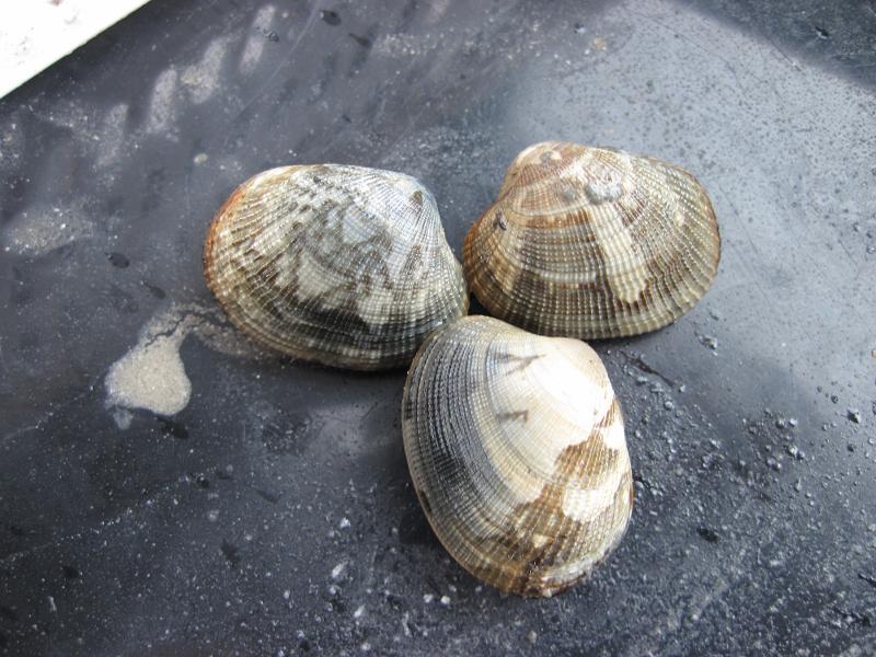
Since 2001, an annual stock assessment of Manila (Ruditapes philippinarum) and European (Ruditapes decussatus) clams has been carried out in March in the Gulf of Morbihan and the Noyalo River. The objectives of this survey are : 1) estimate by direct assessment, the biomass of the stock and its geographical distribution; 2) estimate the exploitable biomass and exploitation potential for the sampled sites in particular, in areas reserved for professional fishing; 3) to establish a diagnosis, with a medium-term vision, on the state of the stock; 4) to propose the implementation of appropriate management measures. Two cruises were also carried out in 1996 and 1997.
-
The aim of these cruises, which took place on the Thalia, was to evaluate the abundance of the scallop stock in the Charentais channels.