 Mon GéoSource
ISAS-15 temperature and salinity gridded fields
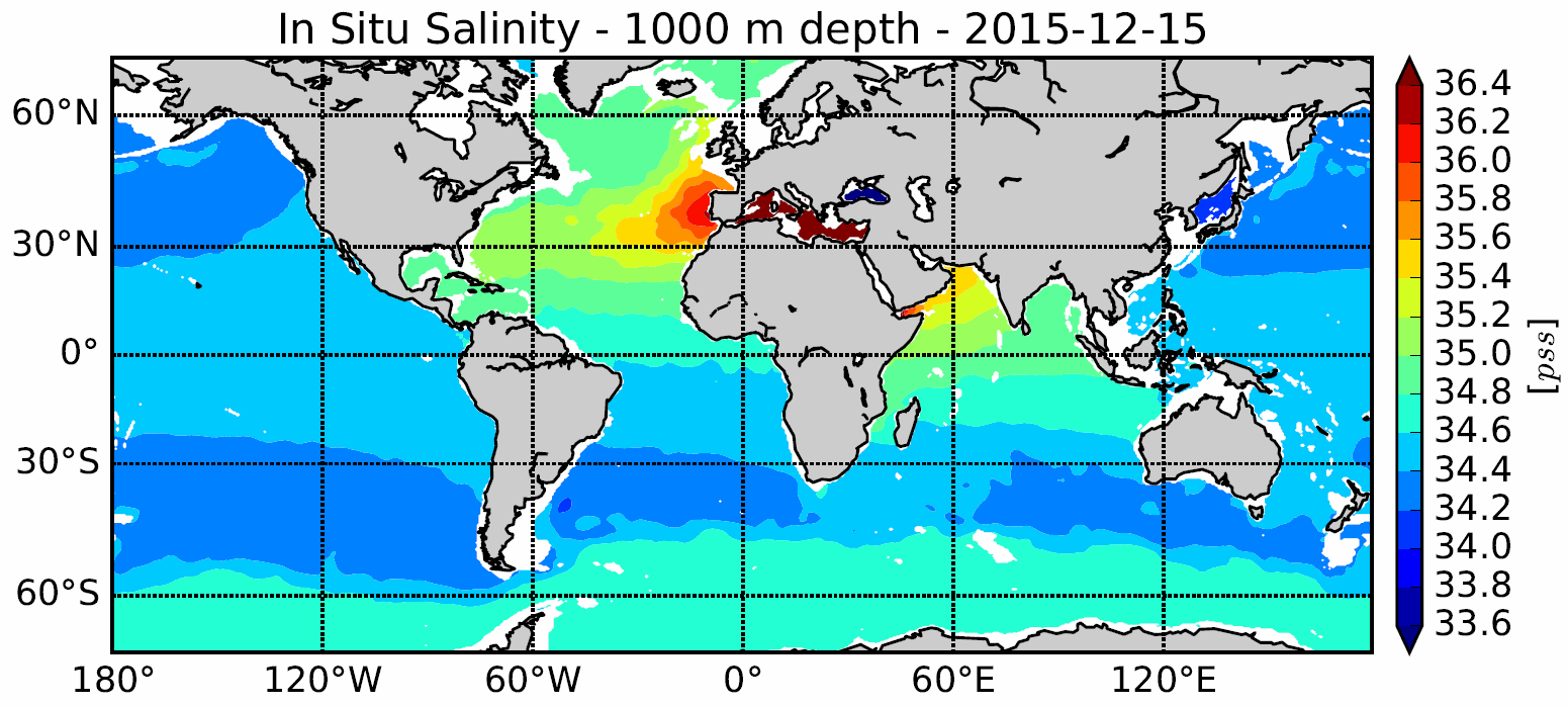
The In Situ Analysis System (ISAS) was developed to produce gridded fields of temperature and salinity that preserve as much as possible the time and space sampling capabilities of the Argo network of profiling floats. Since the first global re-analysis performed in 2009, the system has been extended to accommodate all types of vertical profile as well as time series. ISAS gridded fields are entirely based on in-situ measurements. The system aims at monitoring the time evolution of ocean properties for climatological studies and allowing easy computation of climate indices. A careful delayed mode processing of the 2002-2015 dataset has been carried out using version 7 of ISAS and updating the statistics to produce the ISAS-15 analysis.
Simple
- Date ( Publication )
- 2017-01-01T00:00:00
- Identifier
- 14b77ddf-73cd-4084-b4e9-311654209a10
- Identifier
- DOI:10.17882/52367
- Credit
- Ifremer, LPO – UMR 6523 CNRS, Ifremer, IRD, UBO
- Status
- On going
Author
IFREMER
-
Prigent-Mazella Annaig
02 98 22 44 96
Centre Bretagne - ZI de la Pointe du Diable - CS 10070 - 29280 Plouzané
,
Brest
,
France
02 98 22 43 18
02 98 22 44 96
Publisher
IFREMER / IDM/SISMER
+33 (0)2 98.22.46.44
http://www.ifremer.fr/sismer/
Centre IFREMER de Brest BP 70
,
PLOUZANE
,
29280
,
France
+33 (0)2 98.22.49.16
+33 (0)2 98.22.46.44
http://www.ifremer.fr/sismer/
- Maintenance and update frequency
- As needed
- Keywords ( Theme )
-
- climate variability
- ocean heat content
- fresh water cycle
- Thématique SST Satellite
- GEMET - INSPIRE themes, version 1.0 GEMET - INSPIRE themes, version 1.0 ( Theme )
-
- Oceanographic geographical features
- Variables ODATIS Variables ODATIS ( Theme )
-
- /Physical Oceanography/Temperature
- /Physical Oceanography/Salinity
- Centre de données ODATIS Centre de données ODATIS ( Theme )
-
- CDS-IS-SISMER
- Type de jeux de donnée ODATIS Type de jeux de donnée ODATIS ( Theme )
-
- /Données dérivées/Données de type modèle
- Thèmatiques ODATIS Thèmatiques ODATIS ( Theme )
-
- Added-value products
- Use limitation
- CC-BY
- Access constraints
- Other restrictions
- Other constraints
- A user should acknowledge use of data in all publications and products where such data are used.
- Spatial representation type
- Grid
- Denominator
- 1000000
- Metadata language
- en
- Character set
- UTF8
- Topic category
-
- Oceans
N
S
E
W
))
Vertical extent
- Reference system identifier
- EPSG / WGS 84 (EPSG:4326) / 7.9
- Number of dimensions
- 0
- Hierarchy level
- Dataset
Conformance result
- Date ( Creation )
- 2012-01-16
- Explanation
- Non évalué
- Pass
- No
- File identifier
- 5af9fe23-c18d-4a3e-a646-ea4ba9288d88 XML
- Metadata language
- fr
- Character set
- UTF8
- Hierarchy level
- Dataset
- Date stamp
- 2019-04-19T13:43:29
- Metadata standard name
- ISO 19115:2003/19139 - SEXTANT
- Metadata standard version
- 1.0
Overviews
Spatial extent
N
S
E
W
Provided by

Associated resources
Not available