 Mon GéoSource
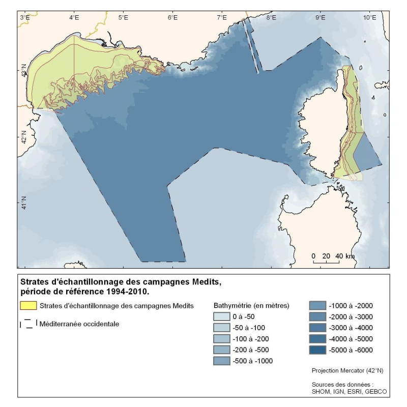
Strata sampling for the Medits campaigns in the Gulf of Lion and the Corsica coast.
Polygons defined for the sampling points distribution in the Medits campaigns. MEDITS, 2007.
International bottom trawl survey in the Mediterranean (Medits). Instruction manual. Version 5. Ifremer, Nantes. http://archimer.ifremer.fr/doc/00002/11321/. 60 p.
Simple
- Alternate title
- Medits-Strates_GdLion
- Alternate title
- Medits-Strates_Corse
- Date ( Creation )
- 2010-10-31
- Date ( Publication )
- 2010-10-31
- Identifier
- IFR_MEDITS_Strates_MEDITS_p_wgs84
- Credit
- Ifremer
- Thèmes Sextant Thèmes Sextant ( Theme )
-
- /Physical Environment/Physical Habitats
- Keywords ( Theme )
-
- Strate ; Echantillonage
- Population ichtyologiques démersales du plateau continental
- Keywords ( Place )
-
- Golfe de Gascogne
- Atlantique
- GEMET - INSPIRE themes, version 1.0 GEMET - INSPIRE themes, version 1.0 ( Theme )
-
- Statistical units
- Sous-regions marines Sous-regions marines ( Place )
-
- Western Mediterranean
- Access constraints
- License
- Use constraints
- License
- Classification
- Unclassified
- Spatial representation type
- Vector
- Metadata language
- fr
- Character set
- UTF8
- Topic category
-
- Oceans
- Biota
N
S
E
W
))
- Begin date
- 1994-01-01T09:48:00
- End date
- 2010-01-01T09:48:00
- Reference system identifier
- EPSG / WGS84 géographiques / 7.4
- Distribution format
-
-
shape ESRI
(
ARcGIS 9.3.1
)
-
shape ESRI
(
ARcGIS 9.3.1
)
- OnLine resource
- site internet Ifremer dédié à la Directive Cadre Stratégie pour le Milieu Marin ( WWW:LINK )
- OnLine resource
-
carthothèque DCSMM
(
WWW:LINK
)
Populations ichtyologiques démersales du plateau continental
- OnLine resource
- Medits-Strates_GdLion_Corse_WGS84 ( OGC:WMS )
- Hierarchy level
- Dataset
- Statement
- Zonal data from the Medits campaigns series from 1994 to 2010, according to a stratification based on bathymetry and latitude.
- File identifier
- df2ab83e-a073-4a82-aa24-2c9269ecfbac XML
- Metadata language
- fr
- Character set
- UTF8
- Hierarchy level
- Dataset
- Hierarchy level name
- Jeu de données
- Date stamp
- 2020-06-04T00:27:24
- Metadata standard name
- ISO 19115:2003/19139 - SEXTANT
- Metadata standard version
- 1.0
Overviews
Spatial extent
N
S
E
W
Provided by

Associated resources
Not available