 Mon GéoSource
Shape ESRI
Type of resources
Available actions
INSPIRE themes
Provided by
Years
Formats
Representation types
-
The term "boulder fields" covers areas of boulders of the lowest levels of the foreshore which are uncovered during low tides. They are not really part of the mediolittoral (intertidal zone) but what is now defined as the fringe tip (or emerging or upper part) of the infralittoral. More generally, boulder fields, formed by the fragmentation of the rocks in place, are located at the foot of rocky cliffs or between rocky headlands and flats. They are only accessible on foot during tidal coefficients greater than or equal to 95. Boulder fields naturally harbor a high biodiversity due to their position at the bottom of the foreshore, but the wealth of fauna and flora also depends greatly on the type of architectural habitat. Three broad categories of boulder fields are distinguished: Sediment blocks, blocks of bedrock and blocks on blocks.
-
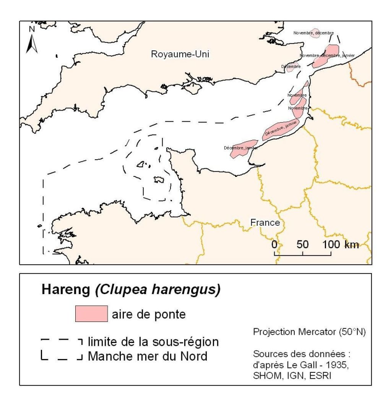
Distribution of spawning herring in the North Atlantic (Clupea harengus) in the Eastern Channel (Downs herring) between November and January. Eggs are laid on the gravel bottom between 20 and 40 m deep.