 Mon GéoSource
Température
Type of resources
Available actions
INSPIRE themes
Provided by
Years
Representation types
Update frequencies
status
Scale
Resolution
-
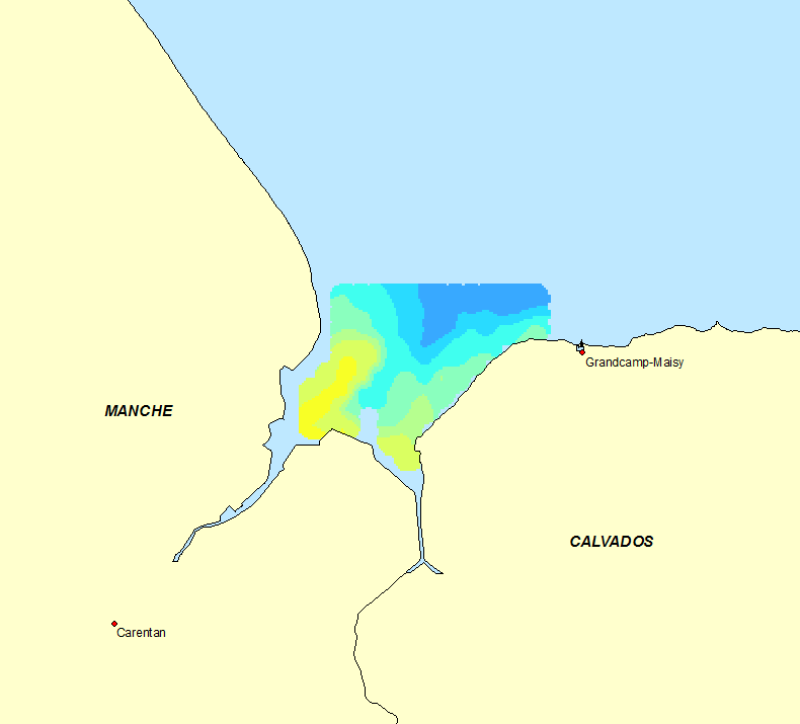
Répartition spatiale de la température de l’eau de mer observée de manière ponctuelle en 2007 sur le site de la Baie des Veys. Ces cartographies ont été réalisées dans le cadre du projet OGIVE (Outils d’aide à la Gestion Intégrée et à la Valorisation des Ecosystèmes conchylicoles de Basse-Normandie, 2005-2013). La carte est le produit de l’interpolation d’observations réalisées lors de deux campagnes d’échantillonnage les 5 et 6 juin et les 4 et 5 septembre 2007, sur 90 points de prélèvement. La température a été observée à l’aide d’une sonde multi-paramètres de type YSI 6600. Elle est exprimée en °C.
-
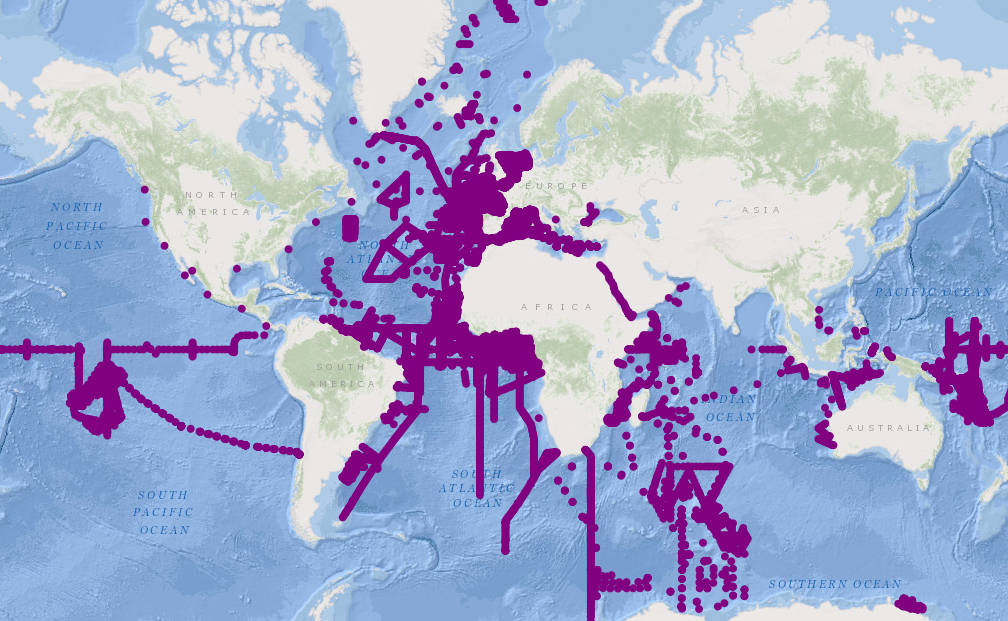
CTD data collected during the French oceanographic cruises or joint programs.
-
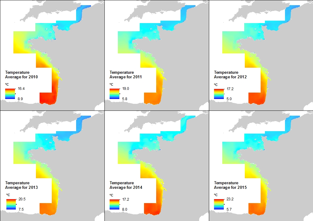
This annual statistics at 500m horizontal resolution was produced from the archived time series of MARS 3D physics model hindcast runs along French Atlantic Coast. The variable that is available here is the Temperature. Values are expressed in Celsius Degrees. The vertical level is the sea surface.
-
The national multidisciplinary RECOPESCA programme is a collaboration between volunteer fishermen and scientists for the automated collection of geolocated physical and fisheries environmental data from the coastal domain. The principle consists of installing sensors on gear to measure environmental parameters, from the surface to the bottom, and to record detailed data on fishing activity and effort. The data acquired feeds the operational coastal oceanography database (coastal component of Coriolis) and the fisheries database of the SIH (Harmonie). The programme thus responds to research issues (physical and fisheries), the implementation of the ecosystem approach to fisheries, support for public policies (DCSMM, DCF, CMEMS) and Ifremer's innovation in the coastal field.