 Mon GéoSource
zone fonctionnelle
Type of resources
Available actions
INSPIRE themes
Provided by
Representation types
Scale
-
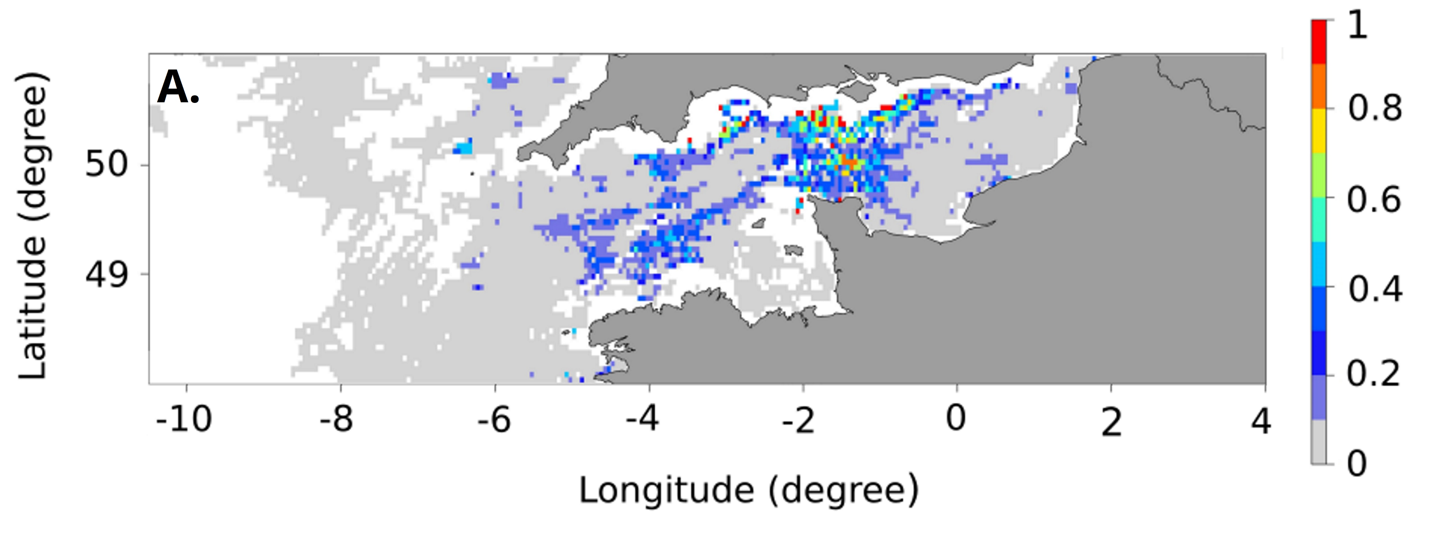
Ces cartes représentent la probabilité mensuelle d'être une frayère de bar pour chaque mois de la période de reproduction (de janvier à avril), et la probabilité moyenne d'être une frayère de bar sur l'ensemble des mois de reproduction en Manche - mer Celtique. Ces cartes de probabilité ont été calculées en réalisant une analyse géostatistique des données de pêche de navires géolocalisés, et ont une résolution spatiale de 3 par 3 miles nautiques.
-
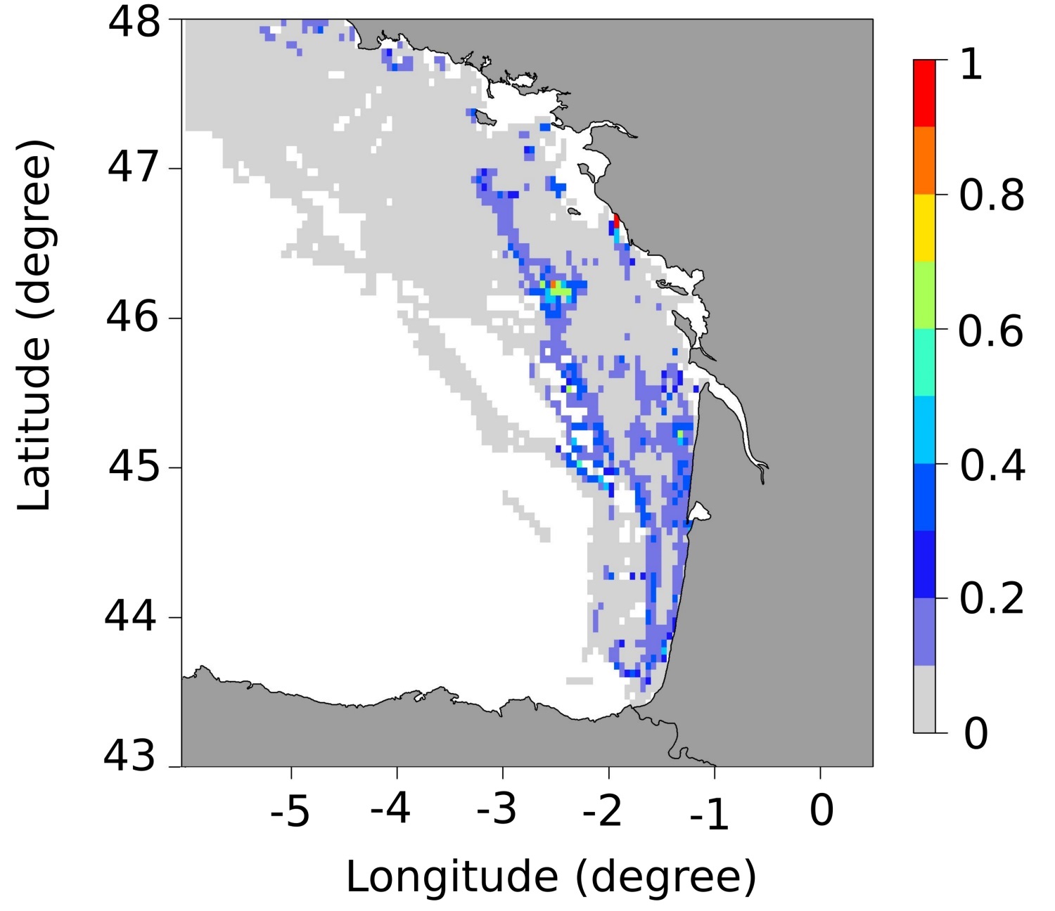
Ces cartes représentent la probabilité mensuelle d'être une frayère de bar pour chaque mois de la période de reproduction (de janvier à mars), et la probabilité moyenne d'être une frayère de bar sur l'ensemble des mois de reproduction dans le golfe de Gascogne. Ces cartes de probabilité ont été calculées en réalisant une analyse géostatistique des données de pêche de navires géolocalisés, et ont une résolution spatiale de 3 par 3 miles nautiques.