 Mon GéoSource
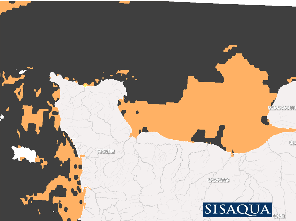
Nature des fonds marins sur l'emprise d'étude du projet Sisaqua
Simple
- Date ( Publication )
- 2017-05-18T12:00:00
- Identifier
-
FR-330-715-368-00305-ifr_LERN_OGIVE_NATURE-FONDS-SISAQUA
02 31 51 56 01
- Credit
- SISAQUA (Ifremer LERN)
02 31 51 56 01
02 31 51 56 01
- Maintenance and update frequency
- Not planned
- Thèmes Sextant ( Theme )
-
- /Activités humaines/Cultures marines
- GEMET - INSPIRE themes, version 1.0 ( Theme )
-
- Parcelles cadastrales
- Keywords ( Place )
-
- Normandie
- littoral
- Keywords ( Theme )
-
- conchyliculture
- ostréiculture
- mytiliculture
- Use limitation
- Données sous Licence Creative Commons - Attribution + Pas d’Utilisation Commerciale + Partage dans les mêmes conditions (BY-NC-SA) : http://creativecommons.fr/licences/
- Access constraints
- Other restrictions
- Use constraints
- License
- Other constraints
- Citation obligatoire de la mention suivante : "Source : Ifremer LER-N, Projet SISAQUA, 2017"
- Spatial representation type
- Grid
- Denominator
- 500
- Metadata language
- fr
- Character set
- UTF8
- Topic category
-
- Imagery base maps earth cover
))
- Begin date
- 2011-08-30T01:00:00
- End date
- 2011-09-08T23:00:00
- Reference system identifier
- EPSG / WGS 84 (EPSG:4326) / 8.6
- Number of dimensions
- 2
- Dimension name
- Column
- Dimension name
- Row
- Cell geometry
- Area
- Distribution format
-
-
ECW
(
SDK 5.0
)
-
ECW
(
SDK 5.0
)
- OnLine resource
-
Projet OGIVE (Site Web Ifremer LERN)
(
WWW:LINK
)
Présentation du projet OGIVE (Site WEB Ifremer LERN)
- OnLine resource
-
IFR_LERLN_ST_GERMAIN_2011
(
OGC:WMS
)
Saint Germain – Photos aériennes – 2011
- OnLine resource
- http://wwz.ifremer.fr/lern/Nos-projets/OGIVE-ecosystemes-conchylicoles ( WWW:LINK )
- OnLine resource
-
IFR_LERLN_PORTBAIL_2011
(
OGC:WMS
)
Portbail – Photos aériennes – 2011
- OnLine resource
-
IFR_LERLN_HAVRE_LESSAY_AGON_2011
(
OGC:WMS
)
Havre Lessay - Agon – Photos aériennes – 2011
- OnLine resource
-
IFR_LERLN_SUD_SIENNE_2011
(
OGC:WMS
)
Sud Sienne – Photos aériennes – 2011
- Hierarchy level
- Dataset
- Statement
- Couche Raster générée par le LERN à partir de la carte des sédiments superficiels de la Manche, dite "de Larsonneur". Par regroupement des différentes catégories de la carte initiale 3 catégories de nature du fond ont pu être discriminées : roches, sable, vases.
- File identifier
- 57718b44-4264-486b-bc43-416a64edcdad XML
- Metadata language
- fr
- Character set
- UTF8
- Parent identifier
- b2964cc3-a23f-4d20-95a0-72fff57ae403 b2964cc3-a23f-4d20-95a0-72fff57ae403
- Hierarchy level
- Dataset
- Date stamp
- 2018-01-18T13:19:44
- Metadata standard name
- ISO 19115:2003/19139 - SEXTANT
- Metadata standard version
- 1.0
02 31 51 56 01
Overviews
Spatial extent
Provided by
