 Mon GéoSource
Oceanographic cruise - NOURSOM (NOURriceries Baie de SOMme)
Simple
- Date ( Publication )
- 2015-10-15
- Identifier
- FR-DCSMM-PDS-NOURSOM
- Presentation form
- Digital profile
- Credit
- IFREMER
- Status
- Completed
- Maintenance and update frequency
- historical
- Keywords ( Theme )
-
- Indicators
- Population
- Communauty
- Nuclear power plant
- GEMET - INSPIRE themes, version 1.0 GEMET - INSPIRE themes, version 1.0 ( Theme )
-
- Environmental monitoring facilities
- Sous-regions marines Sous-regions marines ( Place )
-
- /Metropolitan France/Channel-North Sea
- DCSMM : Type d'espace concerné DCSMM : Type d'espace concerné ( Theme )
-
- Pas d'espace particulier concerné
- DCSMM : Descripteurs DCSMM : Descripteurs ( Theme )
-
- D3: Commercially Exploited Species
- D1: Deep-sea benthic habitats
- DCSMM : Méthodes de recueil des données DCSMM : Méthodes de recueil des données ( Theme )
-
- Observation directe
- Observation par transect
- Piégeage, capture
- Thèmes Sextant Thèmes Sextant ( Theme )
-
- /Human Activities/Coastal monitoring networks
- SIH - Façade maritime SIH - Façade maritime ( Theme )
-
- Manche - Mer du Nord
- SIH - Types de jeu de données SIH - Types de jeu de données ( Theme )
-
- /Observed Data/Campaigns
- Thématiques - SIMM Thématiques - SIMM ( Theme )
-
- /Environmental Status/Pollution
- /Uses and Human Activities/Fisheries and aquaculture
- /Environmental Status/Species
- Type de jeux de donnée ODATIS Type de jeux de donnée ODATIS ( Theme )
-
- /in-situ observations/Sea cruises
- Access constraints
- Restricted
- Unique resource identifier
- https://doi.org/10.18142/22
- Association Type
- Cross reference
- Initiative Type
- Platform
- Metadata language
- fr
- Character set
- UTF8
- Topic category
-
- Environment
- Begin date
- 1987-03-01
))
- Supplemental Information
-
Financers :
EDF
IFREMER
- Distribution format
-
-
(
)
-
(
)
- OnLine resource
- The state of exploited communities off the French coast ( WWW:LINK )
- OnLine resource
- Population and community indices from fisheries monitoring cruises in which Ifremer participates ( WWW:LINK )
- Hierarchy level
- Dataset
Conformance result
- Date ( Creation )
- Explanation
- Not rated
- Pass
- No
- Statement
-
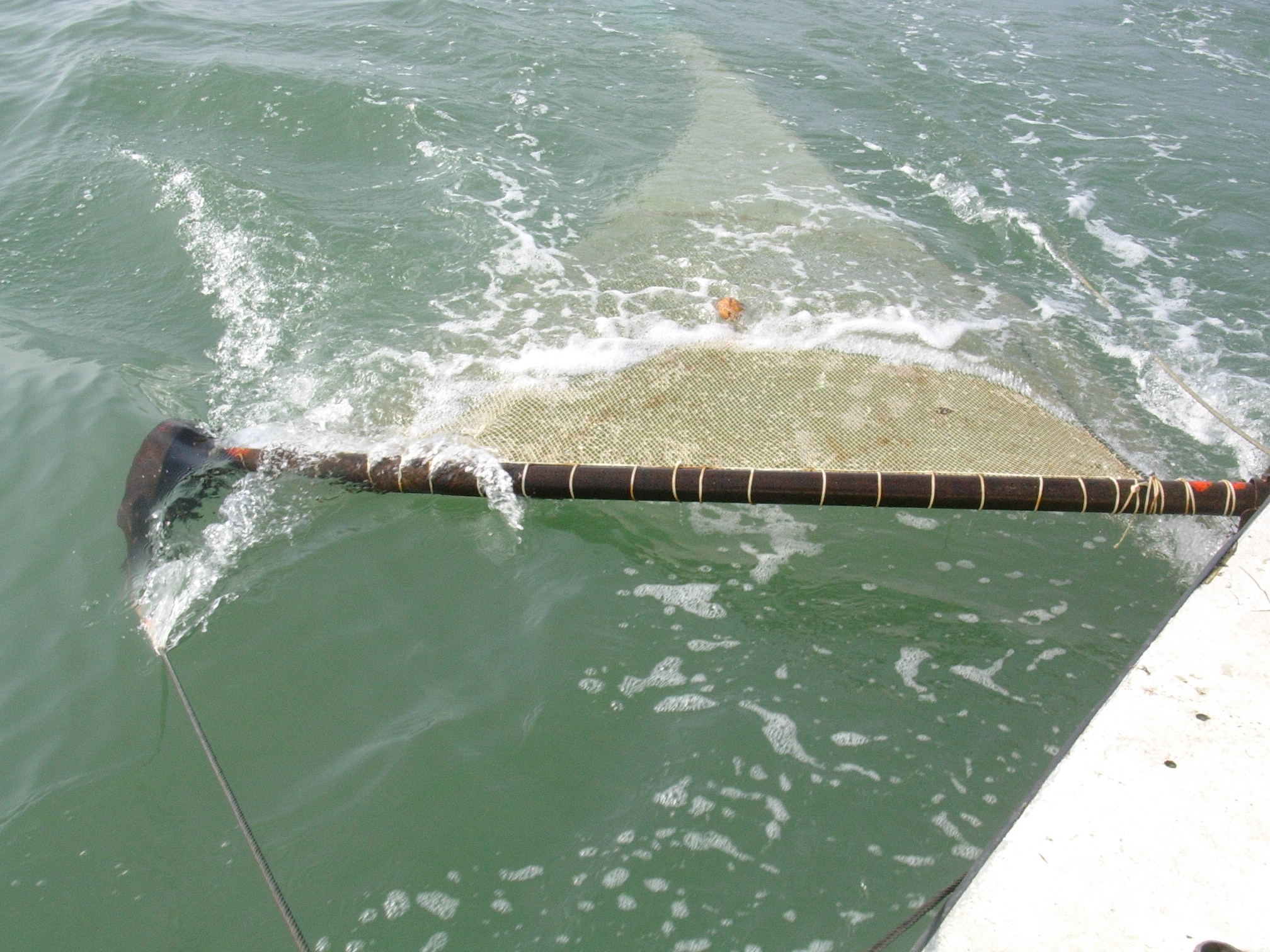
Sampling is carried out using 3-metre (CP3) and 2-metre (CP2) beam trawls fitted with a scraper (Cochard 2002). The sampling protocol provides for 50 hauls distributed in the 4 strata (monitored areas). 34 hauls were carried out with the CP3 outside the bay, and 16 with the CP2 inside the bay and in its immediate vicinity. At each haul, all the species caught are sorted and the individuals are counted and weighed. All fish of commercial interest are measured.
Changes in strategy can affect the data collected. Thus the sampling effort, which was higher in the early years (60 or so tows), was reduced from 1998 onwards (50 tows) and the D stratum was removed. A total of 81 taxa were identified: 46 were fish and 35 were invertebrates.
Within the framework of the SIH cruises, population indicators are presented for the 36 species encountered in at least 5% of the catches per haul and whose density is at least equal to 5 individuals/km2 . These are divided into 26 species of fish, 3 species of cephalopod molluscs and 7 species of crustaceans. Size indicators are presented for a smaller number of fish species of commercial interest.
• Sample plan(s) :
Stratified.
• Precision of data type :
Abundance
• Parameter(s) observed or measured:
Size, age, density/km².
Evolution of species, biodiversity.
• Resolution of parameter(s) :
Density, biological characteristics
• Format(s):
The available data exist in the format: csv
- File identifier
- 98ac17c5-8d70-455e-9496-aafb0dd4ae17 XML
- Metadata language
- fr
- Character set
- UTF8
- Parent identifier
- Oceanographic cruises - Observations for fisheries monitoring 99e16a35-8090-4897-aa2b-c5c0951aabea
- Hierarchy level
- Dataset
- Date stamp
- 2022-07-20T14:27:26.563Z
- Metadata standard name
- ISO 19115:2003/19139 - SEXTANT
- Metadata standard version
- 1.0
Overviews
Spatial extent
Provided by
