 Mon GéoSource
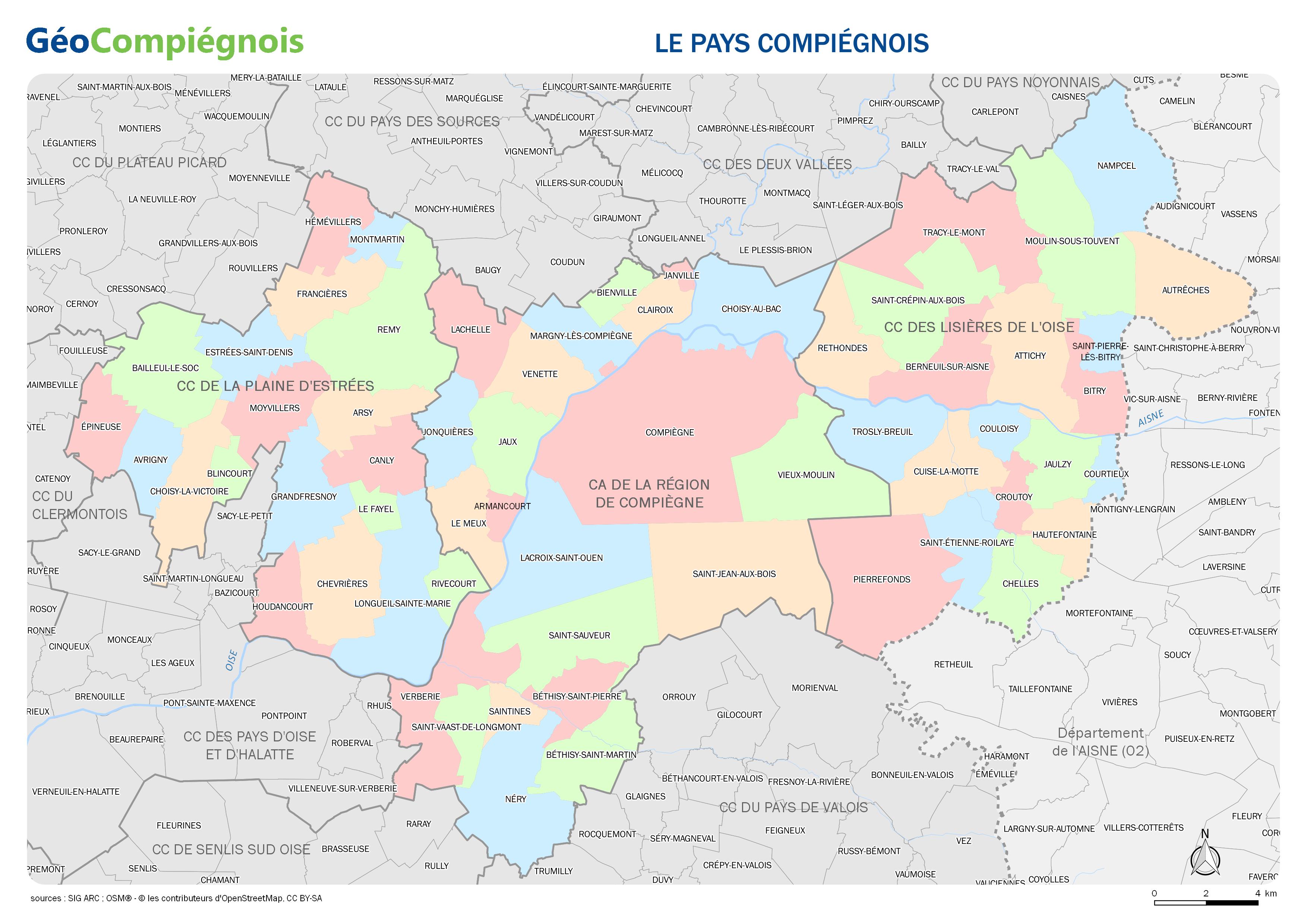
Limites administratives des collectivités du Pays Compiégnois
Carte administrative des communes et intercommunalités constituant le Pays Compiégnois.
Simple
- Date ( Publication )
- 2017-01-03T09:00:00
- Presentation form
- Digital map
Point of contact
No information provided.
- GEMET - INSPIRE themes, version 1.0 ( Theme )
-
- Unités administratives
- Keywords ( Theme )
-
- Administratif
- Limite
- Périmètre
- Collectivités du Pays Compiégnois ( Place )
-
- Pays-Compiégnois
- GEMET - Concepts, version 2.4 ( Theme )
-
- carte
- Use constraints
- Copyright
- Use limitation
- Utilisation libre sous réserve de mentionner la source (a minima le nom du producteur) et la date de sa dernière mise à jour
- Denominator
- 200000
- Metadata language
- fr
- Topic category
-
- Boundaries
- Description
- Pays-Compiégnois
N
S
E
W
))
- Reference system identifier
- EPSG / RGF93 / Lambert-93 (EPSG:2154) / 7.9
- Distribution format
-
-
JPEG
(
{{format_version}}
)
-
JPEG
(
{{format_version}}
)
- OnLine resource
- APC_carte_administrative ( WWW:LINK-1.0-http--link )
- File identifier
- 2c97e3ba-2f99-4f0d-9009-f7cf3e877018 XML
- Metadata language
- fr
- Character set
- UTF8
- Hierarchy level
- Dataset
- Date stamp
- 2017-01-03T14:43:09
- Metadata standard name
- ISO 19115:2003/19139
- Metadata standard version
- 1.0
Metadata author
No information provided.
Overviews
Spatial extent
N
S
E
W
Provided by

Associated resources
Not available