 Mon GéoSource
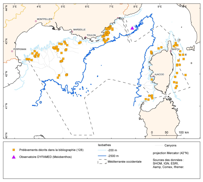
List of benthic fauna samples from the bibliography conducted between 1957 and 2006 in the French Mediterranean
The data are provided as a layer of points representing the benthic samples (operations) in the French Mediterranean.
The lists of species identified corresponding to these sampling points are given in the bibliographic references indicated in the layer.
Simple
- Date ( Creation )
- 2011-06-01
- Identifier
- DATA_sample_biblio_MED_2011
- Credit
- Ifremer Toulon LER/PAC
- Thèmes Sextant Thèmes Sextant ( Theme )
-
- /Human Activities/Scientific Activities
- Keywords ( Discipline )
-
- bibliography
- Keywords ( Theme )
-
- Fauna
- Campaign
- Operations
- Samples
- Bathyal and abyssal biota
- hard bottom
- soft bottom
- GEMET - INSPIRE themes, version 1.0 GEMET - INSPIRE themes, version 1.0 ( Theme )
-
- Species distribution
- Keywords ( Place )
-
- Western Mediterranean
- Bathyal
- Sous-regions marines Sous-regions marines ( Place )
-
- /Metropolitan France/Western Mediterranean
- Thématiques - SIMM Thématiques - SIMM ( Theme )
-
- /Environmental Status/Species
- Research
- Type de jeux de donnée ODATIS Type de jeux de donnée ODATIS ( Theme )
-
- /in-situ observations/Sea cruises
- Access constraints
- Copyright
- Use constraints
- Copyright
- Classification
- Unclassified
- Spatial representation type
- Vector
- Distance
- 5000 metre
- Metadata language
- fr
- Character set
- UTF8
- Topic category
-
- Biota
N
S
E
W
))
- Begin date
- 1957-01-01T17:39:00
- End date
- 2006-12-31T17:39:00
- Reference system identifier
- EPSG / WGS84 géographiques / 7.4
- Geometric object type
- Point
- Geometric object count
- 286
- Distribution format
-
-
shape ESRI
(
ArcGIS 9.3.1
)
-
shape ESRI
(
ArcGIS 9.3.1
)
- OnLine resource
-
carthothèque DCSMM
(
WWW:LINK
)
Hard bottom biocenosis of bathyal and abyssal biota
- OnLine resource
- site internet Ifremer dédié à la Directive Cadre Stratégie pour le Milieu Marin ( WWW:LINK )
- Hierarchy level
- Dataset
- Statement
- Scanning of sampling points in the French Mediterranean made from maps in the bibliographic references indicated in the layer.
- File identifier
- 36f18817-64f0-402d-9231-85d1ca55441a XML
- Metadata language
- fr
- Character set
- UTF8
- Hierarchy level
- Dataset
- Hierarchy level name
- Jeu de données
- Date stamp
- 2020-06-04T00:30:50
- Metadata standard name
- ISO 19115:2003/19139 - SEXTANT
- Metadata standard version
- 1.0
Overviews
Spatial extent
N
S
E
W
Provided by

Associated resources
Not available