 Mon GéoSource
shape ESRI
Type of resources
Available actions
INSPIRE themes
Provided by
Years
Formats
Representation types
Scale
Resolution
-
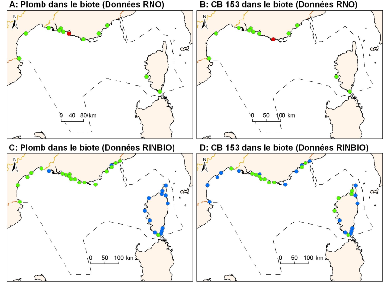
Concentrations of metals, organochlorines in mussels and oysters from the Mediterranean coast, from RNO RINBIO data.
-
The data is provided as a layer of points representing submersible dives in the French Mediterranean.
-
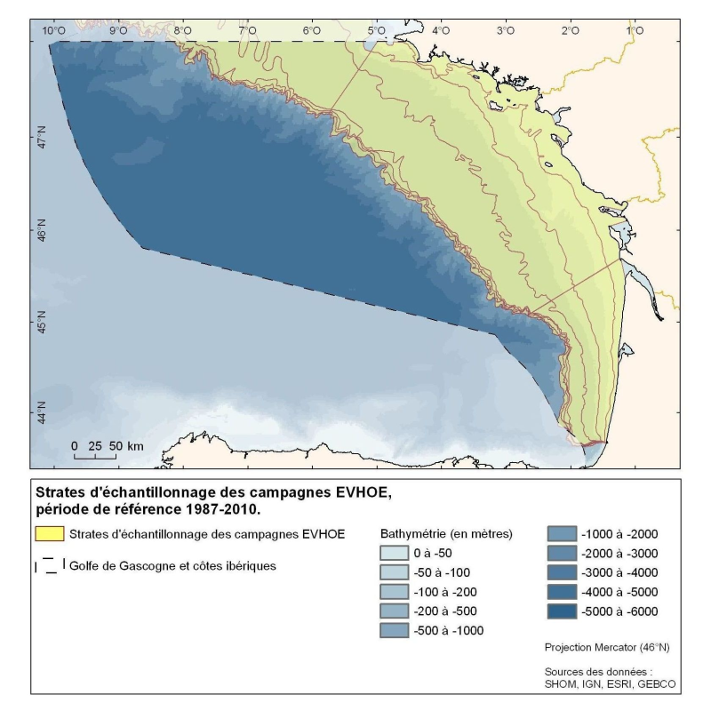
Polygons defined for the distribution of the sampling points of the EVHOE (Evaluation of Fish Stocks in Western Europe) campaigns in the Bay of Biscay and the Celtic Sea.
-
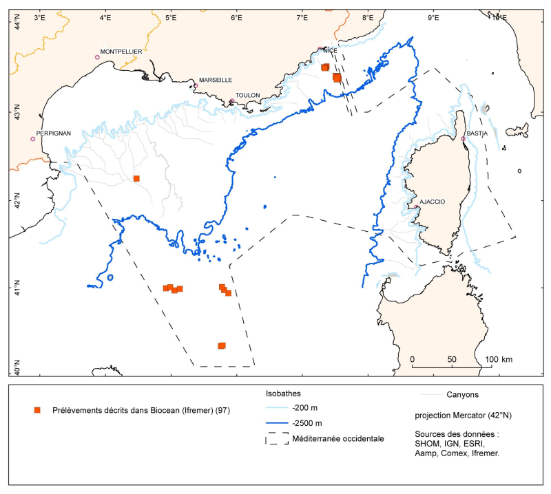
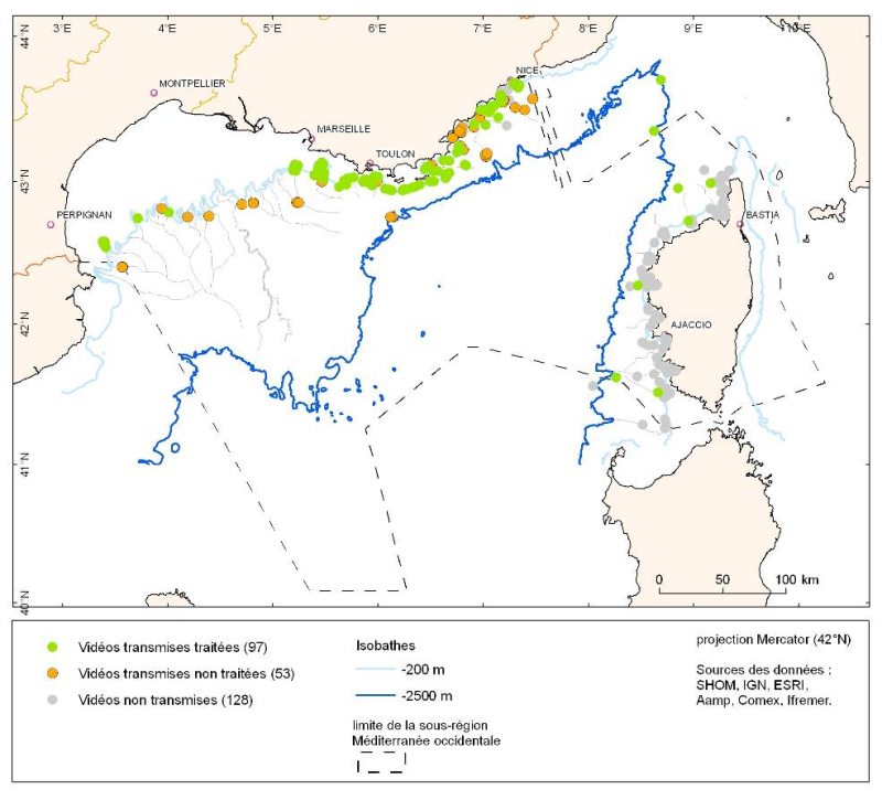
The data is provided as a layer of points representing the samples taken (operations) in the French Mediterranean. The lists of species identified corresponding to these sample points are in the Biocean database.
-
Species distribution is provided as a layer of points representing in situ observations of organisms observed during dives submersible into the canyons in the Mediterranean mainland.
-
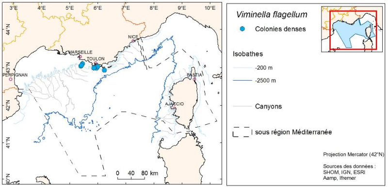
Layer of points representing the abundance weighted per canyon of observed organisms during submersible dives in the Mediterranean continental canyons.
-
Division of French metropolitan territories to define the zones contributing to the pollutant flow carried by rivers to the sea.
-
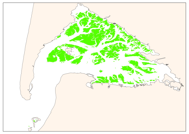
Map of the maximum extent of the seagrass Zostera noltti of Arcachon acquired in 2007-2008, under the supervisory control of the WFD (EU Water Framework Directive). Funded by the AEAG (Agence de l'Eau Adour Garonne) and Ifremer.
-
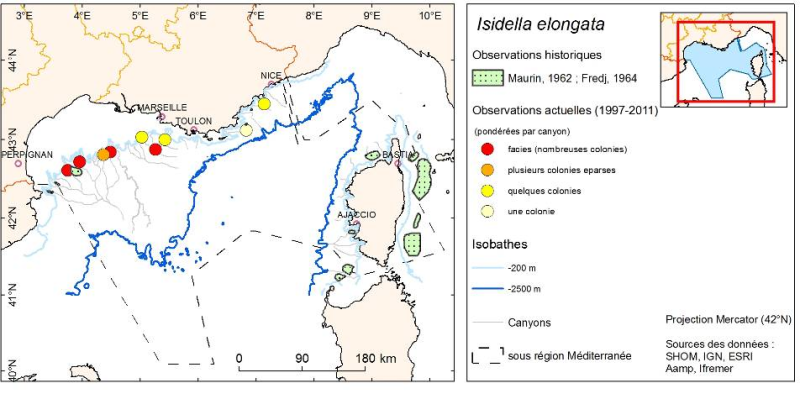
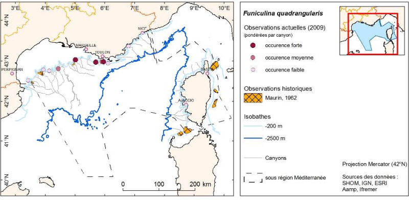
Layer of points representing the abundance weighted per canyon of observed organisms during submersible dives in the Mediterranean continental canyons.
-
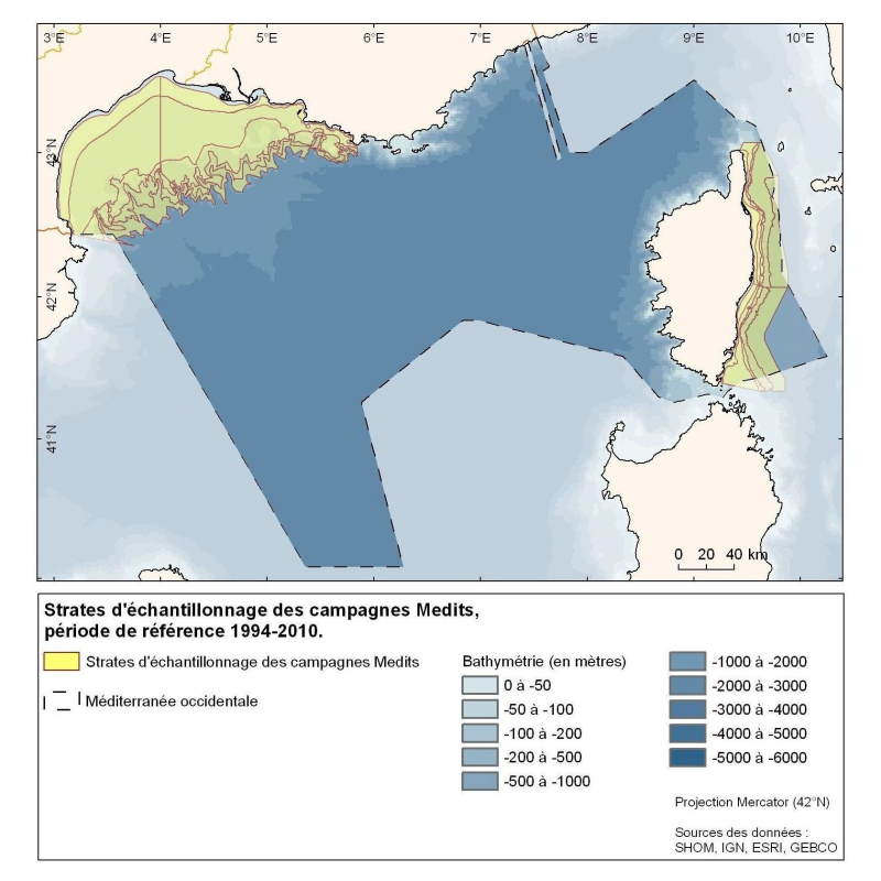
Polygons defined for the sampling points distribution in the Medits campaigns. MEDITS, 2007. International bottom trawl survey in the Mediterranean (Medits). Instruction manual. Version 5. Ifremer, Nantes. http://archimer.ifremer.fr/doc/00002/11321/. 60 p.