 Mon GéoSource
RECOPESCA - Network for measuring fishing activity and spatialized physical data
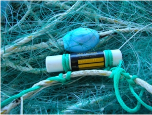
The national multidisciplinary RECOPESCA programme is a collaboration between volunteer fishermen and scientists for the automated collection of geolocated physical and fisheries environmental data from the coastal domain. The principle consists of installing sensors on gear to measure environmental parameters, from the surface to the bottom, and to record detailed data on fishing activity and effort.
The data acquired feeds the operational coastal oceanography database (coastal component of Coriolis) and the fisheries database of the SIH (Harmonie). The programme thus responds to research issues (physical and fisheries), the implementation of the ecosystem approach to fisheries, support for public policies (DCSMM, DCF, CMEMS) and Ifremer's innovation in the coastal field.
Simple
- Date ( Creation )
- 2004-01-01T00:00:00
- Date ( Publication )
- 2022-01-10
- Identifier
- FR-DCSMM-PDS-RECOPESCA
- Presentation form
- Digital profile
- Credit
- IFREMER
- Status
- On going
- Maintenance and update frequency
- Continual
- Keywords ( Theme )
-
- Network
- Fishing vessel
- Sensors
- Temperature
- Salinity
- Turbidity
- Physical environment
- Fishery
- Fishing effort
- Catch
- Activity
- Positions
- Global positioning
- Fishing trips
- Fishing operations
- Spatial distribution
- GEMET - INSPIRE themes, version 1.0 GEMET - INSPIRE themes, version 1.0 ( Theme )
-
- Environmental monitoring facilities
- Sous-regions marines Sous-regions marines ( Place )
-
- /Metropolitan France/Bay of Biscay
- /Metropolitan France
- /Metropolitan France/Channel-North Sea
- /Metropolitan France/Celtic Seas
- /Metropolitan France/Western Mediterranean
- DCSMM : Type d'espace concerné DCSMM : Type d'espace concerné ( Theme )
-
- Pas d'espace particulier concerné
- DCSMM : Descripteurs DCSMM : Descripteurs ( Theme )
-
- D3: Commercially Exploited Species
- DCSMM : Méthodes de recueil des données DCSMM : Méthodes de recueil des données ( Theme )
-
- Observation directe
- Thèmes Sextant Thèmes Sextant ( Theme )
-
- /Human Activities/Industrial Fishing
- SIH - Types de jeu de données SIH - Types de jeu de données ( Theme )
-
- /Observed Data/RECOPESCA
- SIH - Façade maritime SIH - Façade maritime ( Theme )
-
- Guadeloupe
- Martinique
- La Réunion
- Manche - Mer du Nord
- Méditerranée
- Atlantique
- Thématiques - SIMM Thématiques - SIMM ( Theme )
-
- Research
- /Environmental Status/Hydrodynamics
- /Uses and Human Activities/Fisheries and aquaculture
- Type de jeux de donnée ODATIS Type de jeux de donnée ODATIS ( Theme )
-
- /in-situ observations/Networks
- Access constraints
- Other restrictions
- Other constraints
-
Physical data : open access via the Coriolis database.
Fisheries data : restricted access (confidential individual data)
- Metadata language
- fr
- Character set
- UTF8
- Topic category
-
- Oceans
- Begin date
- 2006-10-11
))
))
))
))
))
))
- Supplemental Information
-
Project leader :
Ifremer
Prime contractor :
Ifremer
Backer :
Ifremer
Contribution of the Management of Maritime fishing and Aquaculture (MMFA)
- OnLine resource
- RECOPESCA project website ( WWW:LINK )
- Hierarchy level
- Dataset
Conformance result
- Date ( Creation )
- 2012-01-16
- Explanation
- Not rated
- Pass
- No
- Statement
-
The data collected by the RECOPESCA instruments are
- environmental parameters (pressure, temperature, salinity and possibly turbidity) over the entire water column, via a probe equipped with sensors,
- geolocation data, via a GPS.
The various sensors record the data and then communicate them by radio waves to a central data acquisition unit, also installed on board and known as a "concentrator". This compact box (which houses the GPS) then transmits the data on land to a data centre based at Ifremer Brest for storage. The automatic transmission is done by GPRS, as soon as the vessel is within range of the telephone network, without any intervention from the crew.
The RECOPESCA system is designed to feed Ifremer's oceanographic and fisheries information systems. It is therefore based on the existing thematic data centres:
- Coriolis, for coastal and offshore operational oceanography,
- The SIH (Système d'Informations Halieutiques) and its Harmonie database for fisheries.
This data management by the Topic Centres guarantees the quality control of the information and its dissemination to end users.
• Sampling plan(s) :
There is no sampling plan.
The programme is based on volunteer professional fishing vessels equipped according to scientific needs for physical data and/or vessel activity.
It therefore has a spatial and temporal variability.
• Precision on the type of data :
- Physical data: profiles up to 1,200m with acquisition every second and then every 10 minutes on the bottom.
- Geolocation data: acquisition from 1 to 15 minutes.
• Parameter(s) observed or measured :
- Pressure, temperature, salinity and possibly turbidity.
- GPS position of the vessel.
• Resolution of parameter(s) :
Data are banked by vessel and by year, day, minute, tide, fishing operation.
• Format(s):
The available data exist in the following formats: csv, pdf.
- File identifier
- 14430933-5103-4c32-b812-c3df3d7d579a XML
- Metadata language
- fr
- Character set
- UTF8
- Hierarchy level
- Dataset
- Date stamp
- 2022-02-15T14:52:28.077Z
- Metadata standard name
- ISO 19115:2003/19139 - SEXTANT
- Metadata standard version
- 1.0
Overviews
Spatial extent
Provided by
