 Mon GéoSource
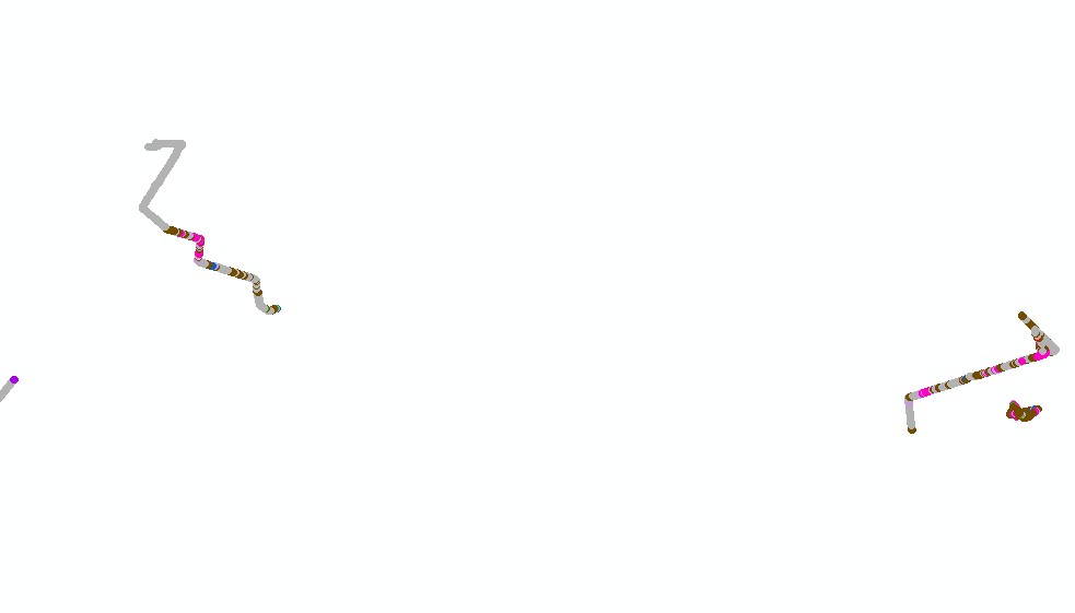
Cartographie des habitats de coraux d'eau froide du golfe de Gascogne. Campagne BOBECO.
La carte des habitats de coraux d'eau froide du golfe de Gascogne de la campagne BOBECO a été réalisée par le laboratoire Environnement Profond de l'Ifremer dans le cadre du projet CoralFish et d'une convention entre l'Ifremer et l'Agence des Aires Marines Protégées.
La méthode employée pour la cartographie des habitats repose sur le dépouillement préalable des vidéos et des images acquises grâce au ROV Victor 6000 dans le cadre de la campagne BOBECO (du 9/09/2011 au 11/10/2011, chefs de mission : Sophie Arnaud-Haond et Anthony Grehan).
Les habitats observés ont été définis selon la typologie CoralFish (J.S. Davies, B. Guillaumont, F. Tempera, A. Vertino, L. Beuck, S.H. Ólafsdóttir, C.J. Smith, J.H. Fosså, I.M.J. van den Beld, A. Savini, A. Rengstorf, C. Bayle, J.-F. Bourillet, S. Arnaud-Haond, A. Grehan, A new classification scheme of European cold-water coral habitats: Implications for ecosystem-based management of the deep sea, In Deep Sea Research Part II: Topical Studies in Oceanography, Volume 145, 2017, Pages 102-109, ISSN 0967-0645, https://doi.org/10.1016/j.dsr2.2017.04.014 ).
Les habitats ont ensuite été délimités en fonction des observations faites sur les profils vidéos.
Simple
- Date ( Publication )
- 2013-05-15T09:30:00
- Identificateur
- FR-330-715-368-00032-IFR_Compil_BOBECO_Habitats_Bathy
- Identificateur
- DOI:10.12770/84f977d5-861d-4790-b97f-3843da21a162
- But
- L'objectif de ce travail est la cartographie des habitats coralliens profonds du golfe de Gascogne selon la typologie CoralFish. L'intérêt est d'avoir une meilleure connaissance des habitats vulnérables profonds, de pouvoir en suivre l'évolution, et ainsi de prendre d'éventuelles mesures de gestion adaptées au maintien de leur intégrité.
- Reconnaissance
- IFREMER, BOBECO
- Reconnaissance
- Financement : Ce projet a été financé par le programme de fond européen pour la recherche et l'innovation FP7 sous l'agrément n°213144 (CoralFISH) et par le programme européen pour la recherche et l'innovation Horizon 2020 sous l'agrément n°678760 (ATLAS). L'Agence des Aires Marines Protégées (désormais Agence Française pour la Biodiversité) a apporté un soutien financier pour l'annotation des images. La thèse d'Inge van den Beld a été co-financée par la région Bretagne et l'Ifremer.
- Etat
- Mise à jour continue
- Fréquence de mise à jour
- Non planifiée
- GEMET - INSPIRE themes, version 1.0 GEMET - INSPIRE themes, version 1.0 ( Thème )
-
- Habitats et biotopes
- Thèmes Sextant Thèmes Sextant ( Thème )
-
- /Milieu biologique/Habitats
- DCSMM : Descripteurs DCSMM : Descripteurs ( Thème )
-
- D1: Biodiversité - Habitats benthiques
- D6: Intégrité des fonds marins
- Sous-regions marines Sous-regions marines ( Localisation )
-
- /Métropole/Golfe de Gascogne
- Mots clés ( Thème )
-
- Coraux d'eau froide, Récifs
- Cadre Réglementaire - SIMM Cadre Réglementaire - SIMM ( Thème )
-
- Directive Cadre Stratégie pour le Milieu Marin (DCSMM)
- Directive Cadre pour la Planification de l'Espace Maritime (DCPEM)
- Type de jeux de donnée ODATIS Type de jeux de donnée ODATIS ( Thème )
-
- /Données dérivées/Produits composites
- Thématiques - SIMM Thématiques - SIMM ( Thème )
-
- /Etat du Milieu/Habitats
- Recherche
- Limitation d'utilisation
- Données sous Licence Creative Commons - Attribution + Pas d’Utilisation Commerciale + Partage dans les mêmes conditions (BY-NC-SA) : http://creativecommons.fr/licences/
- Contraintes d'accès
- Autres restrictions
- Contraintes d'utilisation
- Droit d’auteur / Droit moral (copyright)
- Autres contraintes
- Obligation de citation dans la bibliographie : "VAN DEN BELD I., GUILLAUMONT B., DAVIES J., TOUROLLE J., MENOT L., 2013. Cartographie des habitats de coraux d'eau froide du golfe de Gascogne : campagne BOBECO. Convention REF/IFREMER : 12/2 212 725.
- Limitation d'utilisation
- Ces fichiers sont destinés à un usage personnel. Toute utilisation commerciale de ces données est strictement interdite. Pour tout usage autre que personnel, veuillez prendre contact avec l'administrateur du serveur Sextant (sextant@ifremer ).
- Type de représentation spatiale
- Vecteur
- Distance de résolution
- 5 m
- Distance de résolution
- 5 m
- Langue
- fr
- Jeu de caractères
- Utf8
- Catégorie ISO
-
- Biote
- Description de l'environnement de travail
- ArcGis 10.0, Adelie 3.0
))
- Date de début
- 2011-09-09T06:00:00
- Date de fin
- 2011-10-11T19:30:00
- Nom du système de référence
- EPSG / WGS 84 (EPSG:4326) / 7.4
- Niveau topologie
- Géométrie seulement
- Type de géométries des objets
- Complexe
- Nombre d'objets géométriques
- 423
- Format (encodage)
-
-
ESRI Shapefile
(
ArcGis 10.0
)
-
ESRI Shapefile
(
ArcGis 10.0
)
- Ressource en ligne
- IFR_EEP_BOBECO_Habitats_Bathy_A ( OGC:WMS )
- Protocole
- FILE
- Nom
- IFR_EEP_BOBECO_Habitats_Bathy_A
- Ressource en ligne
-
Campagne à la mer : BOBECO LEG1
(
WWW:LINK
)
Campagne à la mer : BOBECO LEG1
- Ressource en ligne
-
Campagne à la mer : BOBECO LEG2
(
WWW:LINK
)
Campagne à la mer : BOBECO LEG2
- Ressource en ligne
-
DOI du jeu de données
(
WWW:LINK-1.0-http--metadata-URL
)
DOI du jeu de données
- Ressource en ligne
-
SEANOE
(
WWW:LINK
)
Données en libre accès
- Niveau
- Jeu de données
Résultat de conformité
- Date ( Création )
- 2012-01-16
- Explication
- Non évalué
- Degré de conformité
- Non
- Généralités sur la provenance
- La carte a été réalisée en 2013 dans le cadre du projet CoralFish et d'une convention entre l'Ifremer et l'Agence des Aires Marines Protégées. L'approche retenue pour la réalisation de cette cartographie s'appuie sur le traitement et l'interprétation des vidéos et des images acquises à l'aide du ROV Victor 6000 lors de la campagne BOBECO.
- Description
- 1/ SUPPORTS : les vidéos et images utilisées pour réaliser cette cartographie proviennent de la campagne BOBECO.
- Description
- 2/ CAMPAGNE EN MER : la campagne BOBECO s'est déroulée du 9/09/2011 au 11/10/2011 dans le golfe de Gascogne à bord du Pourquoi Pas ?. Les chefs de mission pour cette campagne étaient Sophie Arnaud-Haond (LEP, Ifremer Brest) et Anthony Grehan (Université de Galway, Irlande).
- Description
- 3/ TRAITEMENT DES VIDÉOS ET DES IMAGES : Les vidéos et les images sont géoréférencées et ont été annotées par Inge Van den Beld, Brigitte Guillaumont et Jamie Davies sous les logiciels Adelie ou Cover. Les habitats de coraux d'eau froide observés ont été décrits suivant le niveau 1 de la classification publiée par Davies et al., 2017 (J.S. Davies, B. Guillaumont, F. Tempera, A. Vertino, L. Beuck, S.H. Ólafsdóttir, C.J. Smith, J.H. Fosså, I.M.J. van den Beld, A. Savini, A. Rengstorf, C. Bayle, J.-F. Bourillet, S. Arnaud-Haond, A. Grehan, A new classification scheme of European cold-water coral habitats: Implications for ecosystem-based management of the deep sea, In Deep Sea Research Part II: Topical Studies in Oceanography, Volume 145, 2017, Pages 102-109, ISSN 0967-0645, https://doi.org/10.1016/j.dsr2.2017.04.014 ).
- Description
- 4/ TRAITEMENT DES DONNÉES : Les observations faites à partir des vidéos et des images ont été exportées sous ArcGis puis mises en relation avec la navigation de chaque plongée ROV. Il en résulte une cartographie des habitats sous forme de polylignes qui correspondent à la navigation de la caméra, et qui sont segmentées selon les habitats observés.
- Description
- 5/ VALORISATION : Ces travaux ont fait l'objet d'une thèse de doctorat (Van Den Beld Inge, 2017. Habitats coralliens dans les canyons sous-marins du Golfe de Gascogne : distribution, écologie et vulnérabilité / Coral habitats in submarine canyons of the Bay of Biscay : distribution, ecology and vulnerability . PhD Thesis , Université de Bretagne occidentale). Une publication a également été acceptée : Van Den Beld Inge, Bourillet Jean-Francois, Arnaud-Haond Sophie, De Chambure Laurent, Davies Jaime S, Guillaumont Brigitte, Olu Karine, Menot Lenaick (2017). Cold-water coral habitats in submarine canyons of the Bay of Biscay . Frontiers in Marine Science , 4(118), 1-30 . Publisher's official version : http://doi.org/10.3389/fmars.2017.00118 , Open Access version : http://archimer.ifremer.fr/doc/00382/49343/.
- Identifiant de la fiche
- 84f977d5-861d-4790-b97f-3843da21a162 XML
- Langue
- fr
- Jeu de caractères
- Utf8
- Type de ressource
- Jeu de données
- Date des métadonnées
- 2020-06-04T00:42:41
- Nom du standard de métadonnées
- ISO 19115:2003/19139 - SEXTANT
- Version du standard de métadonnées
- 1.0
Aperçus
Étendue spatiale
Fourni par
