 Mon GéoSource
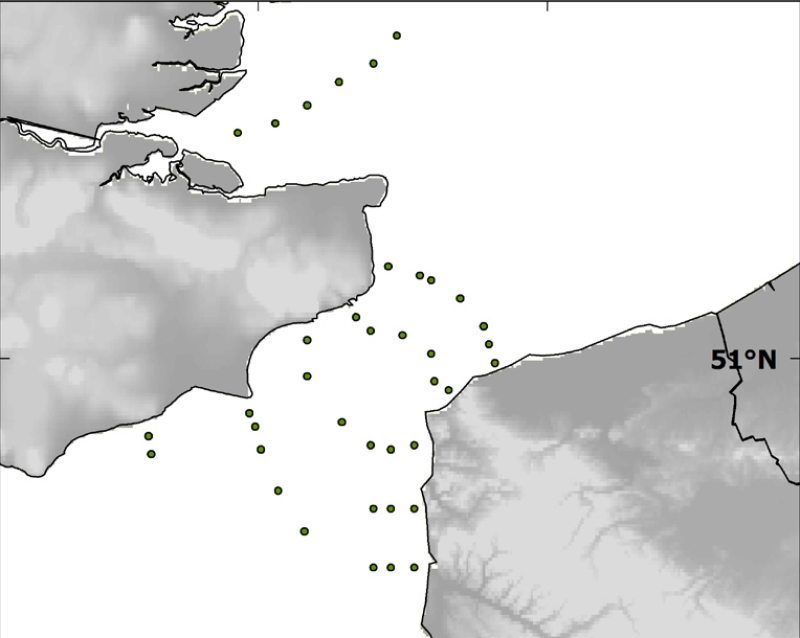
Species and habitats - Location of survey sampling stations of the BCD survey (april 1999)
Localisation of the 39 sampled sites done during the BCD survey in April 1999.
Simple
- Alternate title
- BCD_general_ponctuel
- Alternate title
- CHARM_STATION_BCD_PT
- Date ( Publication )
- 2009-12-31T00:00:00
- Identifier
- CHARM_STATION_BCD_PT
- Presentation form
- Digital map
- Other citation details
- Source CHARM Consortium
- Credit
- Université du Littoral Côte d'Opale
- Credit
- CHARM Consortium
- Status
- Completed
Originator
Ifremer
-
Philippe Koubbi
UPMC Univ Paris 06, UMR 7093, Laboratoire d'Océanographie de Villefranche
,
Villefranche-sur-Mer
,
06230
,
France
- Maintenance and update frequency
- As needed
- Thèmes Sextant ( Theme )
-
- /Biological Environment/Species/Fish Species of Commercial Interest
- Keywords ( Theme )
-
- Geographic localisation
- CHARM
- external.theme.gemet ( Theme )
-
- échantillonnage
- GEMET - INSPIRE themes, version 1.0 ( Theme )
-
- Habitats et biotopes
- Use limitation
- research-only
- Access constraints
- License
- Other constraints
- Has to be cited this way in maps : "Source CHARM Consortium"
- Other constraints
- Has to be cited this way in bibliography : "Carpentier A, Martin CS, Vaz S (Eds.), 2009. Channel Habitat Atlas for marine Resource Management, final report / Atlas des habitats des ressources marines de la Manche orientale, rapport final (CHARM phase II). INTERREG 3a Programme, IFREMER, Boulogne-sur-mer, France. 626 pp. & CD-rom"
- Spatial representation type
- Vector
- Denominator
- 10000
- Metadata language
- fr
- Metadata language
- en
- Character set
- UTF8
- Topic category
-
- Imagery base maps earth cover
- Boundaries
- Environment description
- Microsoft Windows XP ; ESRI ArcGIS 9.x
- Geographic identifier
- Dover Strait and river Thames mouth
N
S
E
W
))
- Begin date
- 1999-04-01
- End date
- 1999-04-30
- Reference system identifier
- 4326
- Topology level
- Geometry only
- Geometric object type
- Point
- Geometric object count
- 39
Distributor
- OnLine resource
- CHARM_STATION_BCD_PT ( OGC:WMS )
- Protocol
- FILE
- Name
- CHARM_STATION_BCD_PT
- OnLine resource
-
CHARM web site
(
WWW:LINK
)
CHARM web site
- Hierarchy level
- Dataset
- Statement
- The BCD survey (¿Biodiversity and cartography throughout the Dover Straits¿) was held at the end of April 1999, with sampling from 39 stations. The BCD survey was financed by the European INTERREG II programme (1995-2001) and produced maps of larvae stages and plankton. The aims of the BCD survey was to compare planktonic assemblages on the French and English coasts. Ichthyoplankton was collected with a double-framed bongo net (plankton nets with 500 ¿m mesh). Oblique tows were carried out at 2 knots from the surface to the proximity of the seabed.
- Description
- BCD survey, scientific survey of ULCO
- File identifier
- 00319470-01e6-11e0-9e8f-005056987263 XML
- Metadata language
- en
- Character set
- UTF8
- Hierarchy level
- Dataset
- Date stamp
- 2020-06-04T00:29:56
- Metadata standard name
- ISO 19115:2003/19139 - SEXTANT
- Metadata standard version
- 1.0
Overviews
Spatial extent
N
S
E
W
Provided by

Associated resources
Not available