 Mon GéoSource
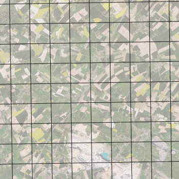
Orthophotographie des Hauts-de-France (2018) - index
Index de l'orthophotographie numérique couleur du territoire de la Région Hauts-de-France en 2017 et 2018.
Simple
- Date ( Creation )
- 2018-06-01
- Identifier
- https://www.geo2france.fr/ortho/2018/index
- GEMET - INSPIRE themes, version 1.0 ( Theme )
-
- Ortho-imagerie
- Région ( Place )
-
- HAUTS-DE-FRANCE
- Départements ( Place )
-
- PAS-DE-CALAIS
- SOMME
- NORD
- AISNE
- OISE
- Keywords ( Theme )
-
- DONNEES OUVERTES
- ORTHO
- ORTHOPHOTO
- INDEX
- Distance
- 20 cm
- Denominator
- 1000
- Metadata language
- fre
- Character set
- UTF8
- Topic category
-
- Imagery base maps earth cover
- Description
- France
- Description
- HAUTS-DE-FRANCE
N
S
E
W
))
- OnLine resource
-
index_L93_20cm_RVB
(
OGC:WMS
)
Index des dalles de l'orthophoto 2018 (Lambert 93 - 20cm - RVB)
- OnLine resource
- Téléchargement des dalles et des mosaïques ( WWW:DOWNLOAD-1.0-http--download )
- OnLine resource
-
geo2france:index_L93_20cm_RVB
(
OGC:WFS
)
Index des dalles de l'orthophoto 2018 (Lambert 93 - 20cm - RVB)
- Hierarchy level
- Dataset
Conformance result
- Date ( Publication )
- 2000-01-01
- Explanation
- -- Information sur l'évaluation de la conformité (non INSPIRE) --
- Pass
- Statement
- L'indexation en dalle de 1x1 km a été réalisé par le prestataire Topogeodis, contrôlé et validé par l'IGN et Géo2France.
- File identifier
- 620ee489-0ccf-4766-b92d-bf3f91089d4c XML
- Metadata language
- fr
- Character set
- UTF8
- Hierarchy level
- Dataset
- Hierarchy level name
- Précision sur le niveau de hiérarchie (non INSPIRE)
- Date stamp
- 2021-01-12T14:22:37
- Metadata standard name
- ISO 19115:2003/19139
- Metadata standard version
- 1.0
Overviews
Spatial extent
N
S
E
W
Provided by

Associated resources
Not available