 Mon GéoSource
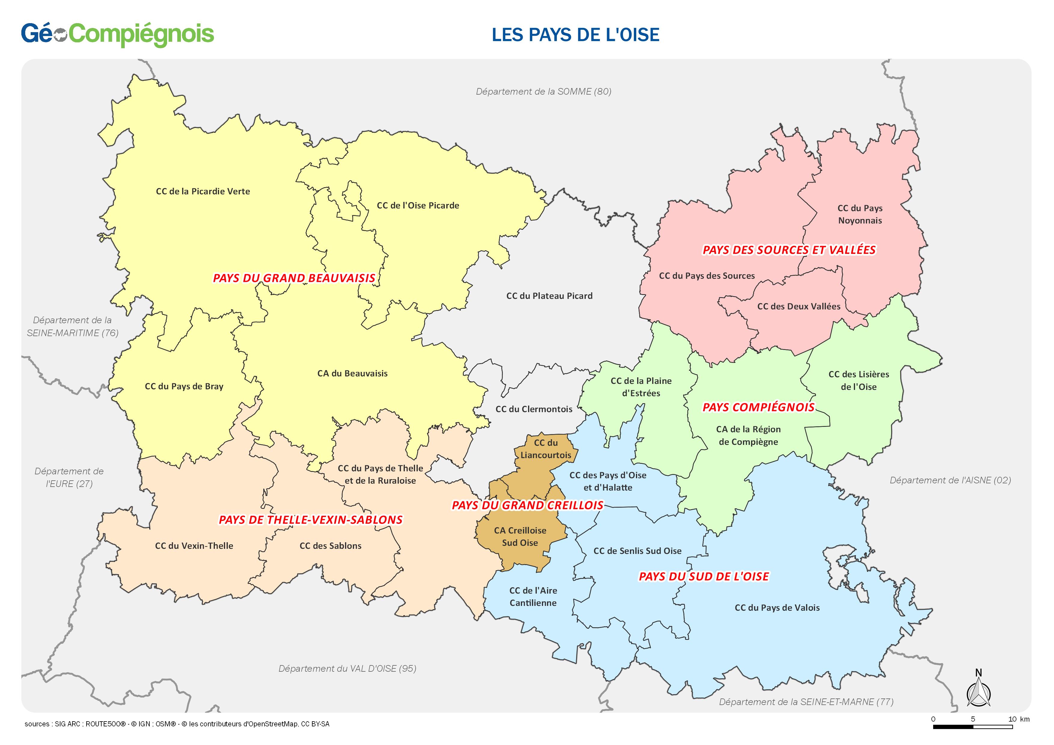
Les Pays du département de l'Oise
Carte administrative des pays sur le territoire du département de l'Oise au 1er janvier 2018.
Simple
- Date ( Publication )
- 2018-01-09T09:00:00
- Forme de la présentation
- Carte numérique
-
Service Information Géographique
Place de l'Hôtel de Ville
,
Compiègne
,
60200
,
FRANCE
03 44 40 76 18
- GEMET - INSPIRE themes, version 1.0 ( Thème )
-
- Unités administratives
- Mots clés ( Thème )
-
- Administratif
- Limite
- Périmètre
- GEMET - Concepts, version 2.4 ( Thème )
-
- carte
- Contraintes d'utilisation
- Droit d’auteur / Droit moral (copyright)
- Limitation d'utilisation
- Utilisation libre sous réserve de mentionner la source (a minima le nom du producteur) et la date de sa dernière mise à jour
- Dénominateur de l'échelle
- 500000
- Langue
- fr
- Catégorie ISO
-
- Limites
- Description
- OISE
N
S
E
W
))
- Espace de nommage
- EPSG
- Version
- 7.9
- Format (encodage)
-
-
(
)
-
(
)
- Ressource en ligne
- OISE_pays.jpg ( WWW:DOWNLOAD-1.0-http--download )
Résultat de conformité
- Date ( Publication )
- Identifiant de la fiche
- 0c2ef78c-6c30-43dc-bbc7-a5819d7d7633 XML
- Langue
- fr
- Jeu de caractères
- Utf8
- Type de ressource
- Jeu de données
- Date des métadonnées
- 2018-01-09T12:38:01
- Nom du standard de métadonnées
- ISO 19115:2003/19139
- Version du standard de métadonnées
- 1.0
-
Service Information Géographique
Place de l'Hôtel de Ville
,
Compiègne
,
60200
,
FRANCE
03 44 40 76 18
Aperçus
large_thumbnail
Étendue spatiale
N
S
E
W
Fourni par

Ressources associées
Not available