 Mon GéoSource
Keyword
Indian Ocean
Type of resources
Available actions
Topics
INSPIRE themes
Keywords
Provided by
Representation types
Update frequencies
status
Scale
From
1
-
1
/
1
-
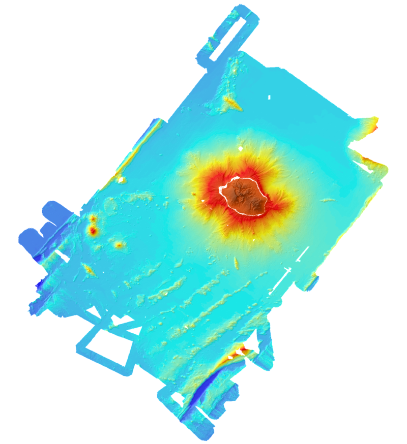
Bathymetric and topographic model of the island of La Réunion. Topography is from IGN data. Bathymetry is derived from the multibeam data acquired during the campaigns Forever (2006, EM12D sounder) Eroder1 (2006, EM120 sounder) and Eroder2 (2007, EM120 sounder). The grid spacing is 300m.