 Mon GéoSource
geophysics
Type of resources
Available actions
Topics
INSPIRE themes
Keywords
Provided by
Representation types
Update frequencies
status
Scale
-
Map of surficial sediments in the English Channel area known as "Larsonneur."
-
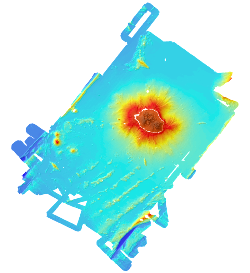
Bathymetric and topographic model of the island of La Réunion. Topography is from IGN data. Bathymetry is derived from the multibeam data acquired during the campaigns Forever (2006, EM12D sounder) Eroder1 (2006, EM120 sounder) and Eroder2 (2007, EM120 sounder). The grid spacing is 300m.
-
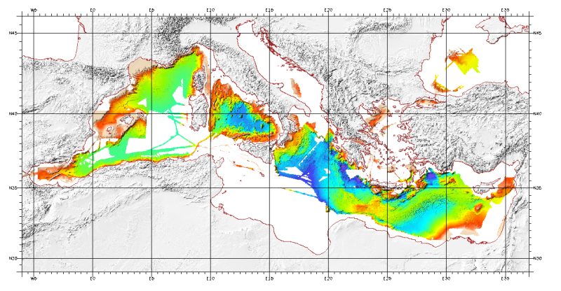
Bathymetric model (DTM) of the Mediterranean. MediMap group. Bathymetry data acquired by multibeam sounders during campaigns Almofront.leg1 and Almofront.leg2, Almofront, Bretane, Seamewe2, Heralis, Medee, Anaxiprobe, Almofront2 - leg1 and leg2, Prismed2, Marmara, Fanil, Tvic5 et 6, Progres, Maradja, Blac, Nautinil, Medor-Simed1 / 2 / 3 / 4 / 5, Maradja2, Sardinia, Prisme, Assemblage and Thertou. Integration of partner organizations DTM. This DTM is available at two cell sizes : 500 m and 1000 m.
-
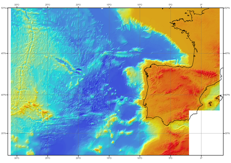
Bathymetric model (DTM) of the North-East Atlantic, generated from conventional multibeam bathymetry data, prior to the year 2000. The grid spacing is 1000 meters. Bibliographic reference : Sibuet J.C. & al., (2004) - Carte bathymétrique de l'Atlantique nord-est et du golfe de Gascogne : implications cinématiques. Bull. Soc. géol. Fr.T. 175, n°5, pp. 429-442
-

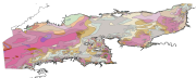
Map of surficial sediments of the northern continental shelf of the Bay of Biscay at 1:500000 by Bouysse P. (coord.), Lesueur P. and Klingebiel A., 1986, conducted jointly by the BRGM and Ifremer.
-
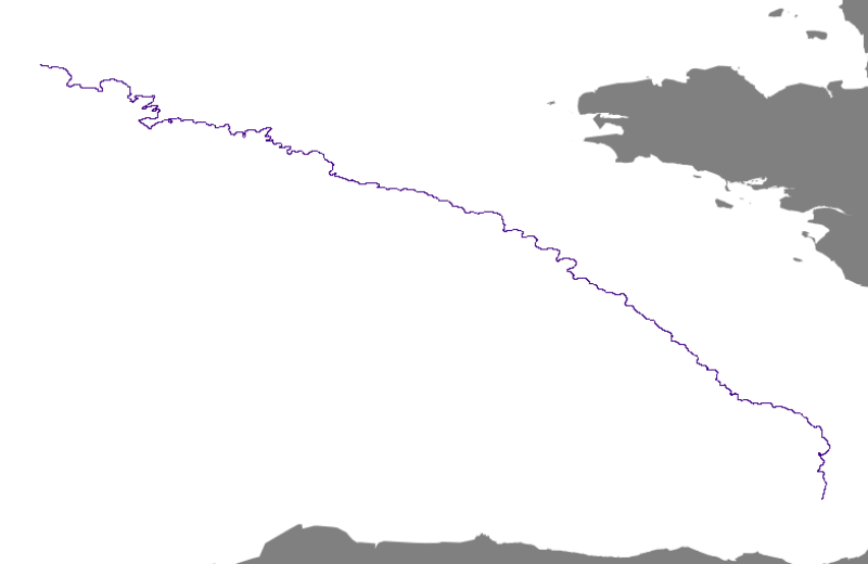
This is the path of the continental shelf break of the Bay of Biscay’s northwestern border.