 Mon GéoSource
Esri shapes
Type of resources
INSPIRE themes
Provided by
Years
Formats
Representation types
Resolution
-
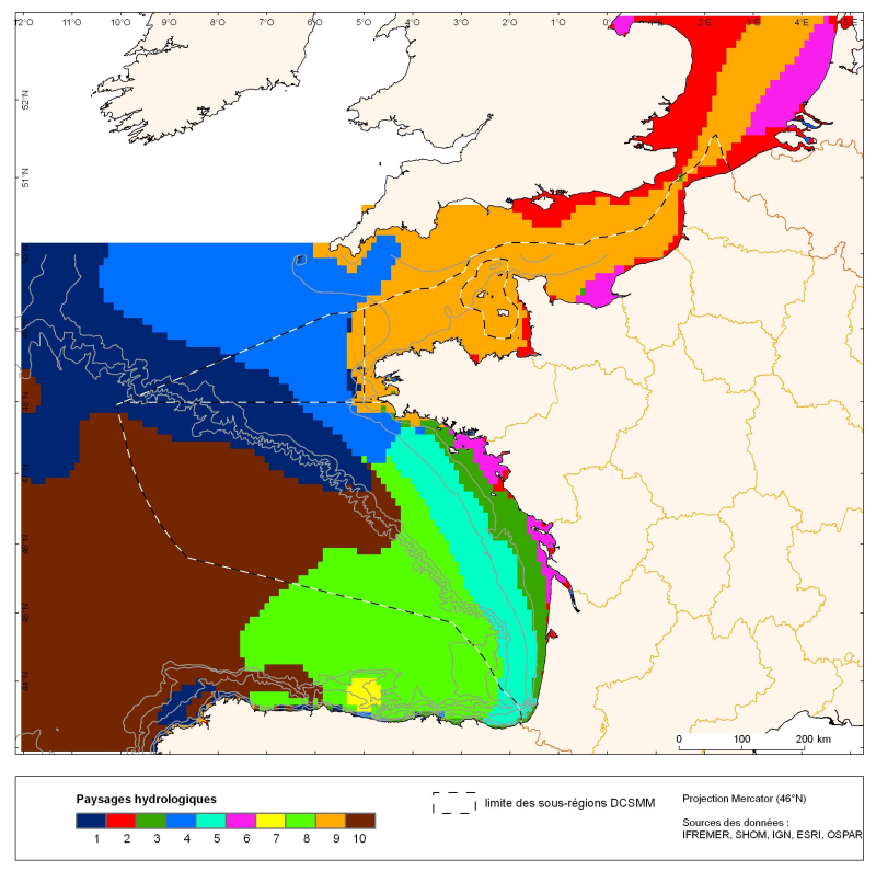
The distribution of hydrological landscapes is determined by a method of comparing multi-tables, to identify groups of individuals with similar variability of hydrological conditions during the year. The data used provides monthly tables showing the selected parameters, calculated over the entire geographic area with a resolution of 0.1 °. The variable chlorophyll-a is extra: it does not contribute to the discrimination of groups. This method identifies 10 hydrological landscapes with a similar annual variability of hydrological conditions.
-
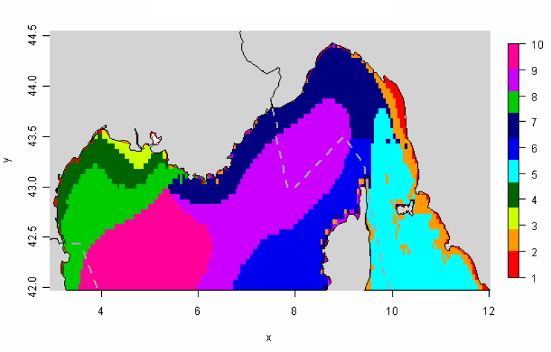
The distribution of hydrological landscapes is determined by a method of comparing multi-tables, to identify groups of individuals with similar variability of hydrological conditions during the year. The data used provides monthly tables showing the five selected physical parameters (SS, Phi, SST, MES et CHLA), calculated over the entire geographical area, a common resolution of 0.05°. This method identifies 10 hydrological landscapes showing a similar annual variability of hydrological conditions.