 Mon GéoSource
2011
Type of resources
Available actions
INSPIRE themes
Provided by
Years
Formats
Representation types
Update frequencies
status
Scale
Resolution
-
-- Court résumé explicatif du contenu de la ressource --
-
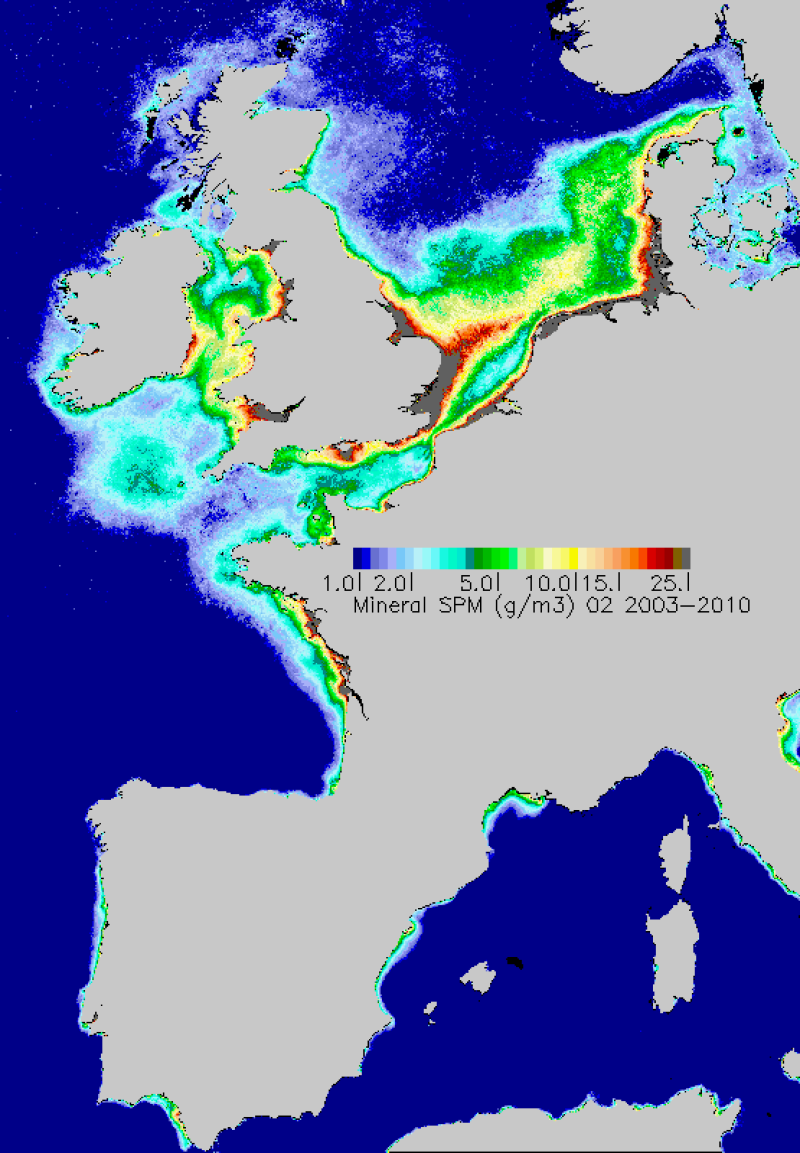
Map of average monthly non-algal suspended matter carried out in the period 2003-2010. TSS are estimated from the water reflectance using a specific algorithm developed at Ifremer.
-
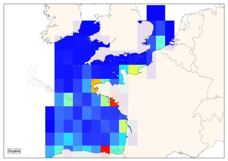
Spatial distribution of all oxygen data in degrees integrated vertically and horizontally for all sub-regions of the English Channel, the North Sea, the Celtic Seas and the Bay of Biscay.
-
Stocks of Crepidula fornicata Linnaeus, 1758 in the Pertuis Charentais. Environmental state for 2011
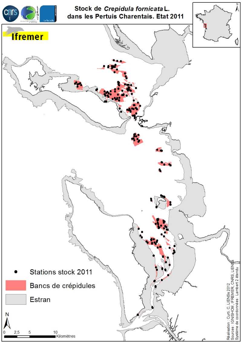
Stocks (abundance and biomass) of the slipper limpet Crepidula fornicata Linnaeus, 1758 in the Pertuis Charentais shallows were estimated in 2011 and mapped (Sauriau et al., 2011). The influence of the estimate includes the Pertuis Breton, the eastern part Pertuis Antioch Fouras peninsula and the Bay of Marennes-Oléron where the latter earlier estimates are available. Contours and surface areas of the crepidula were previously determined by acoustic imaging performed aboard the VO/Haliotis in 2008 and 2009, interpreted and validated by spot sampling in 2009 (Curti, 2009). Sampling stocks of 2011 is based on a stratified random sample of 40 banks with a proportional distribution of sampling of 200 stations between banks. The listing for each crepidula bank stocks (abundance in millions, biomass in tonnes) both living and dead, these shells may provide support to potential new colonization.
-
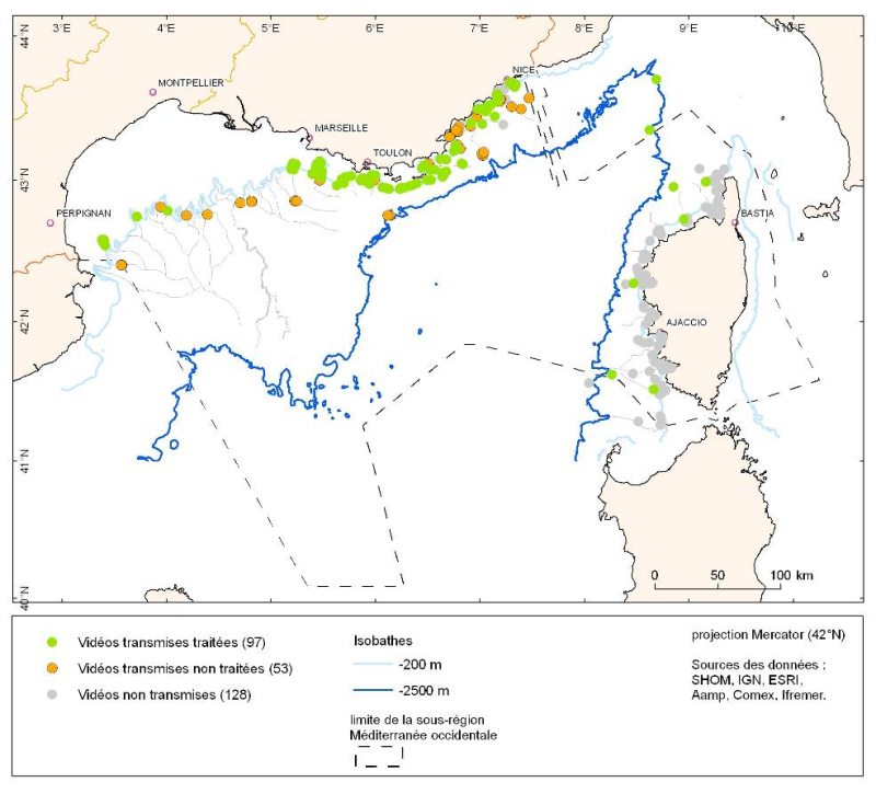
The data is provided as a layer of points representing submersible dives in the French Mediterranean.
-
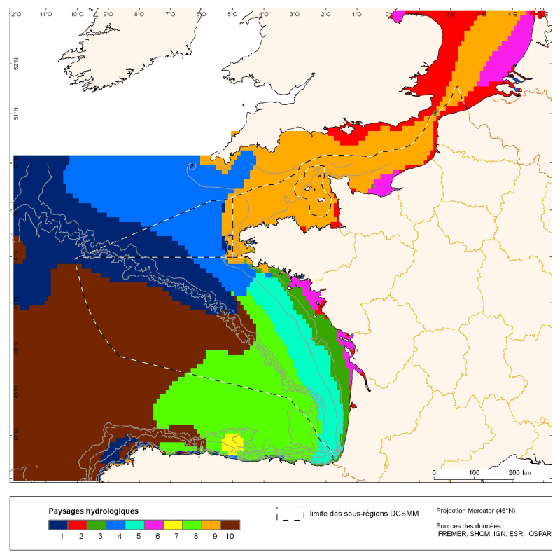
The distribution of hydrological landscapes is determined by a method of comparing multi-tables, to identify groups of individuals with similar variability of hydrological conditions during the year. The data used provides monthly tables showing the selected parameters, calculated over the entire geographic area with a resolution of 0.1 °. The variable chlorophyll-a is extra: it does not contribute to the discrimination of groups. This method identifies 10 hydrological landscapes with a similar annual variability of hydrological conditions.
-
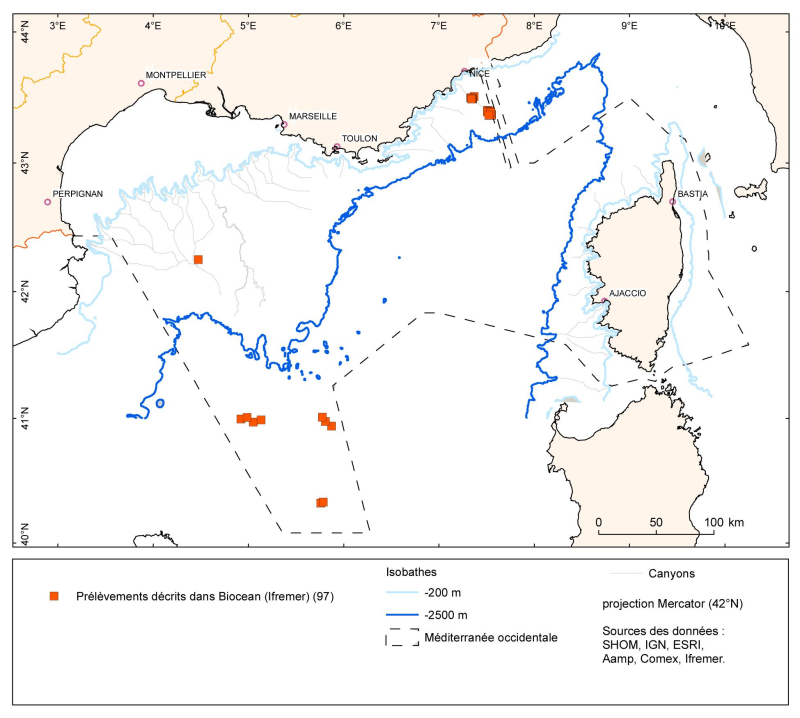
The data is provided as a layer of points representing the samples taken (operations) in the French Mediterranean. The lists of species identified corresponding to these sample points are in the Biocean database.
-
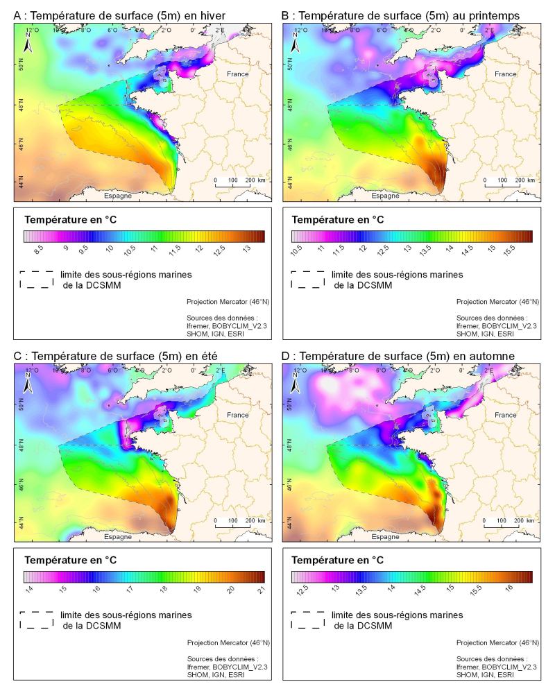
3D seasonal temperature range (in ° C) obtained by objective analysis (interpolation) of the raw data in situ, at a depth of 5m. Within the Bay of Biscay Challenge and the programme of the Operational Coastal Oceanographic Centre Prévimer, the services of SISMER DYNECO-PHYSED of IFREMER have built a joint hydrological database of the Bay of Biscay, from CTD measurements, Bouteilles, XBT / MBT and Profileurs from multiple global data centres to achieve a climatological atlas of the region for temperature and salinity.
-
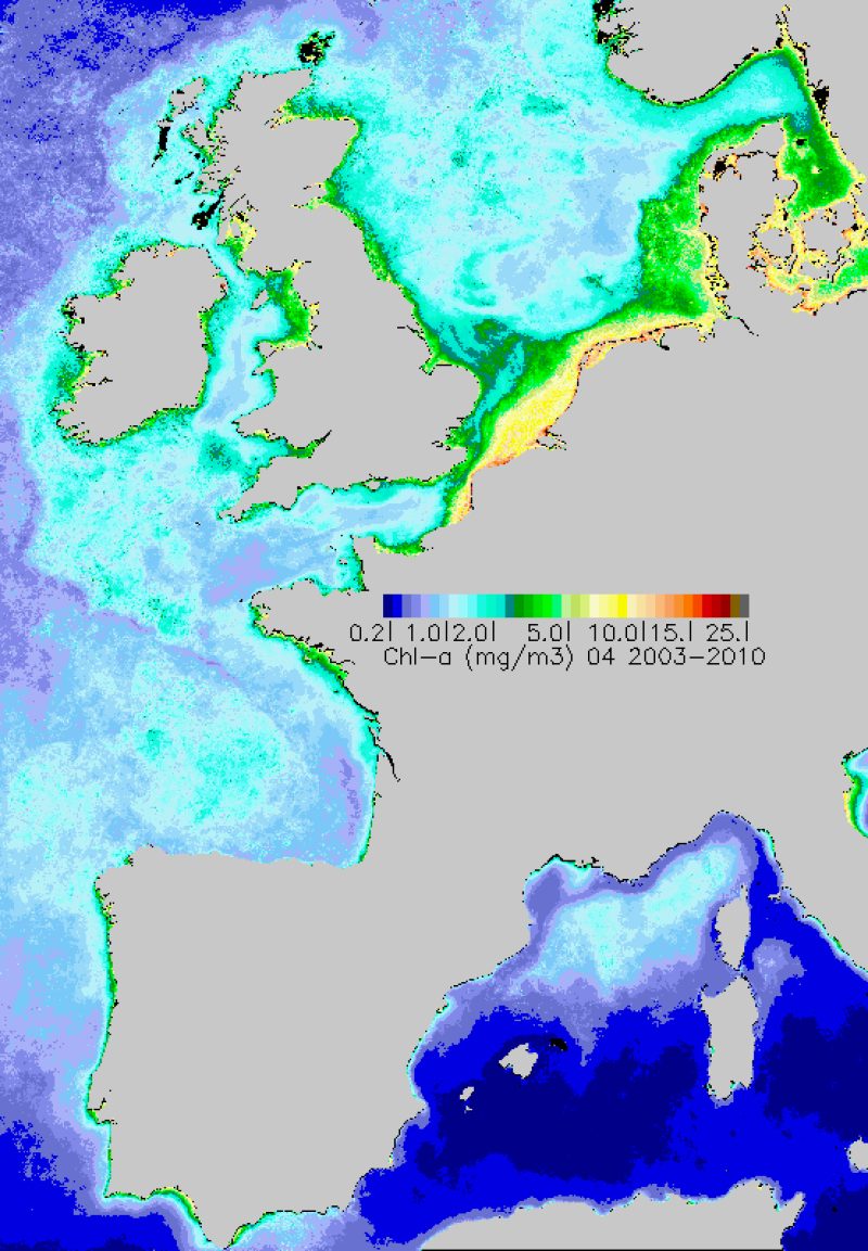
90th percentile calculated during the productive period of the WFD (March-October) from 2003 to 2009, from the MODIS Chl-a algorithm processed by Ifremer OC5.
-
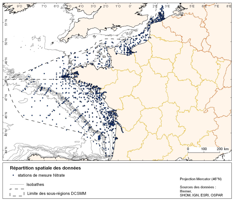
Spatial distribution for nutrients data (silicate, nitrate, nitrite, ammonium and phosphate) for all maritime regions in the English Channel and North Sea, the Celtic Seas and the Bay of Biscay. The temporal extent of the data is from 1930 to 2010, most being between 1974 and 2007 with a peak in 1999.