 Mon GéoSource
Abundance
Type of resources
Available actions
Topics
INSPIRE themes
Keywords
Contact for the resource
Provided by
Representation types
Update frequencies
status
Scale
-
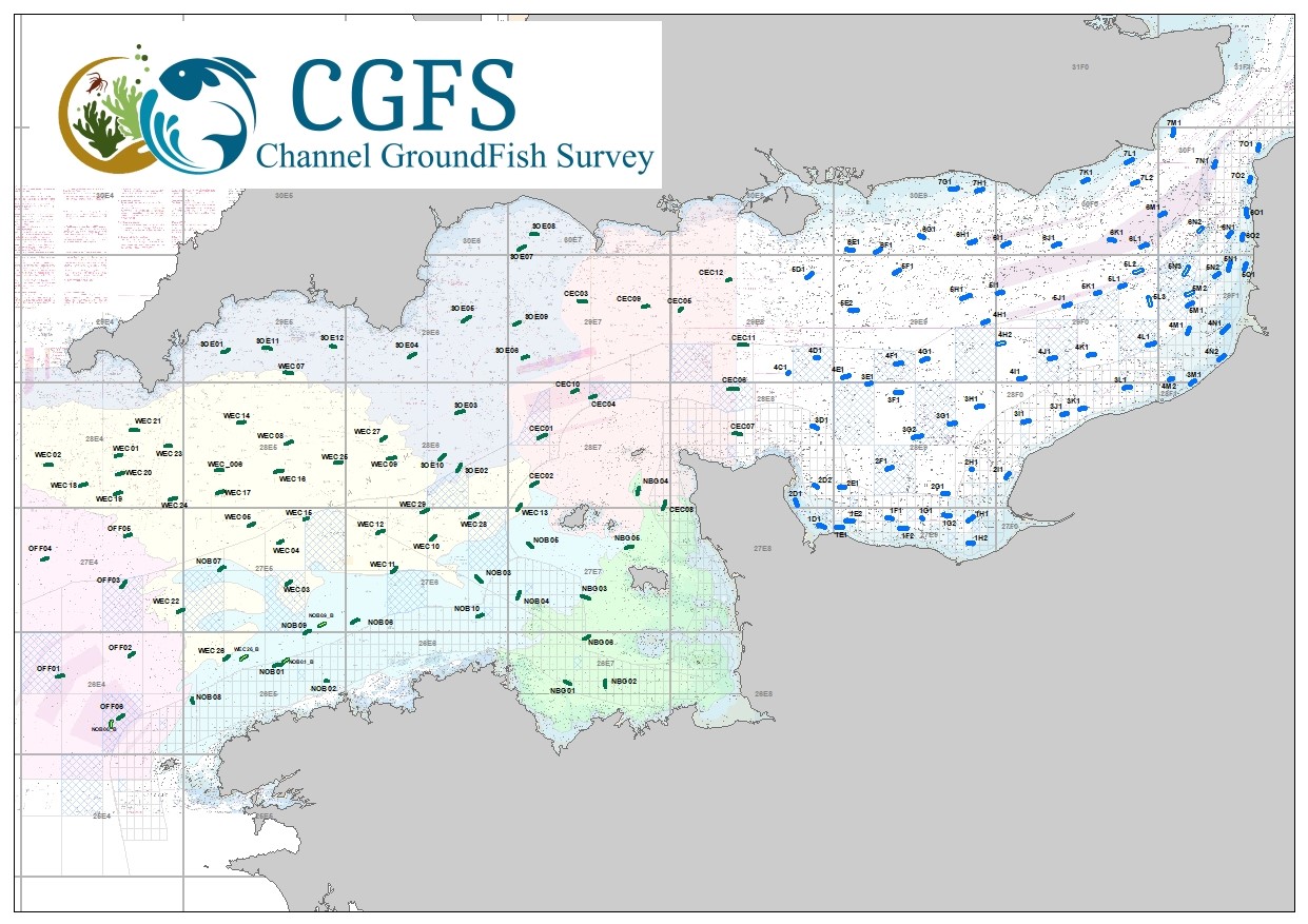
CGFS cruise aims to collect basic data to estimate the status of fisheries resources, by direct assessment of stock abundance and distribution, along with biological sampling of commercial catches. The CGFS campaign is carried out within the framework of this programme in the European project Contractualisation of Basic Fishery Data Collection (DCF). The abundance indices collected during this campaign are used by the ICES international working group "Demersal fisheries of the North Sea, Eastern Channel and Skagerrak" and complement the data from the English "Beam Trawl Survey" for the "Flatfish" working group.
-
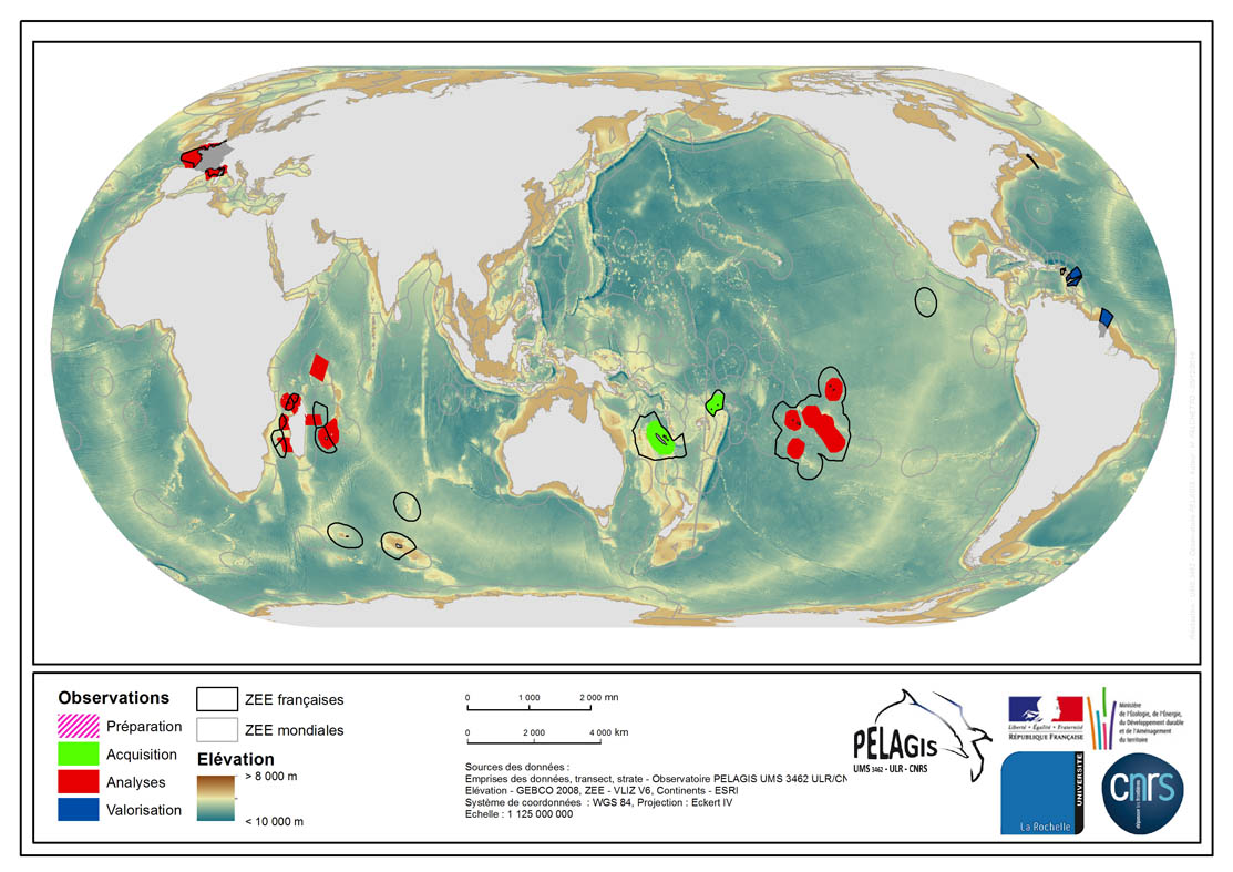
The associated data highlights the spatial influence of the dataset of the type “Visual Observations from an Aerial Platform” from the PELAGIS Observatory. These ranges represent the different areas of study on which the PELAGIS observatory conducted campaigns of visual observations from aerial platforms. Each area of study is associated with at least one campaign, with observers and geographical sectors linked to that campaign. Each sector is associated with bathymetric strips and transects related to each of the strips, with a few exceptions for the Indian Ocean region. Description of fields and values of the attribute tables : (- field name, meaning : value, description of values) - region, area of study specific to the PELAGIS observatory PELAGIS : OI/FRM/ AGFR/SOP/SP, region_lbl - programme, associated programme of which the campaign is a part: REMMOA/PACOMM, REcensement de la Mégafaune Marine par Observation Aérienne/Programme d'Acquisition sur les Oiseaux et Mammifères Marins - idCampagne, abbreviated name of the data collection campaign: OI/SAMM/ ANT/SOP/PF/GUY, Campagne Océan Indien/Suivi Aérien de la Mégafaune Marine/Sud Ouest Pacifique/Polynésie Française/ Guyane française - progress, current state of the campaigns, from collection to scientific optimisation : Preparation/Acquisition/ Analysis/Enhancement, campaign being prepared/under acquisition/being analysed/data enhanced within the context of a scientific publication.
-
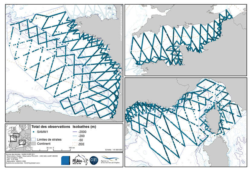
The associated data highlights the sampling programme for the data acquisition campaign of Observation on the Aerial Platform for the SAMM1campaign (Aerial Marine Megafauna Monitoring) conducted by the PELAGIS observatory.
-
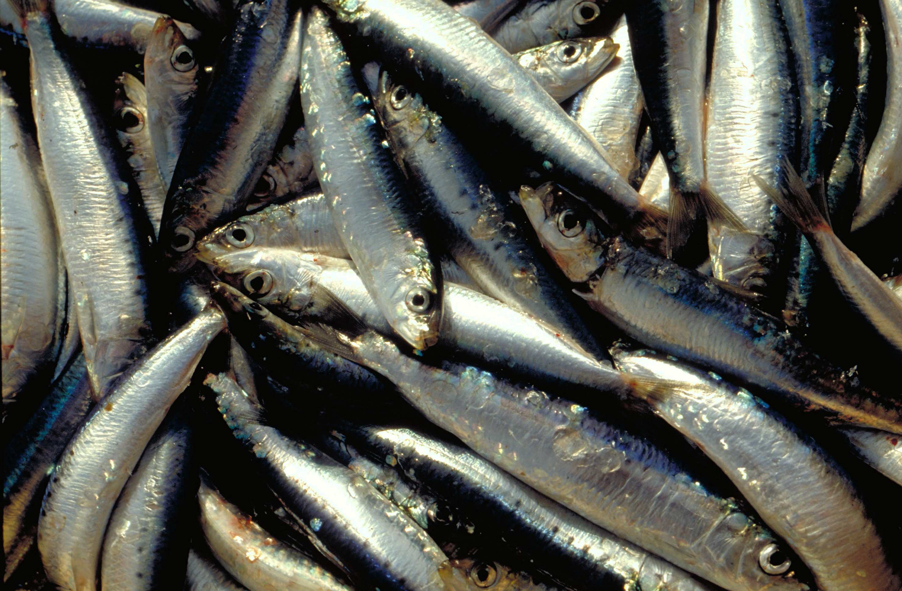
The annual PELMED (PELagiques MEDiterranée) fisheries resource assessment campaign is carried out by the Laboratoire Halieutique Méditerranée of the Ifremer station in Sète. The objectives of these cruises are : 1. Evaluate the biomass of small pelagic fish (anchovies, sardines) by direct method. For this, the campaign must alternate between acoustic prospecting and identification trawling. An acoustic signal is sent from a sounder fixed under the vessel and each time it encounters the bottom or schools of fish, it is reflected and retransmitted to the sounder. In this way, the shape and intensity of these echoes that materialize the schools of fish can be observed continuously. Species identification trawls are carried out in order to define the proportion of species present in the echoes detected. 2. Collecting as many biological parameters as possible on the target species of small pelagics (anchovies, sardines, sprats) to better understand the population dynamics of these species. For this purpose, morphometric measurements, as well as the determination of the sex and maturity stage of the fish are carried out. Finally, otoliths are taken in order to determine the age of the fish. These biological parameters are very important to complete the biomass assessment and have a better understanding of the processes underlying the variability of these populations. This allows for example to determine the age structure or size structure of the populations, to have an idea of their energy reserves, etc. 3. To better understand the pelagic ecosystem as a whole, from plankton to top predators. The primary goal of the PELMED cruise is to evaluate small pelagic stocks, but it also aims to accumulate as much data as possible on the different compartments of the pelagic ecosystem, from physical parameters (temperature, salinity) to top predators (marine mammals, birds), through the different lower trophic levels (phyto- and zooplankton, small pelagic fish). Thus, after each trawling, a hydrological station is carried out with the measurement of temperature and salinity along the water column via a CTD, water and phytoplankton samples with a Niskin bottle and zooplankton samples using a vertical line of WP2. Finally, throughout the campaign we carry out the observation and counting of birds and marine mammals. In addition to the understanding of the ecosystem, this should provide a number of indicators necessary for monitoring the marine environment under the MSFD (Marine Framework Directive).