 Mon GéoSource
Keyword
Climatology
Type of resources
Topics
INSPIRE themes
Keywords
Provided by
Representation types
From
1
-
1
/
1
-
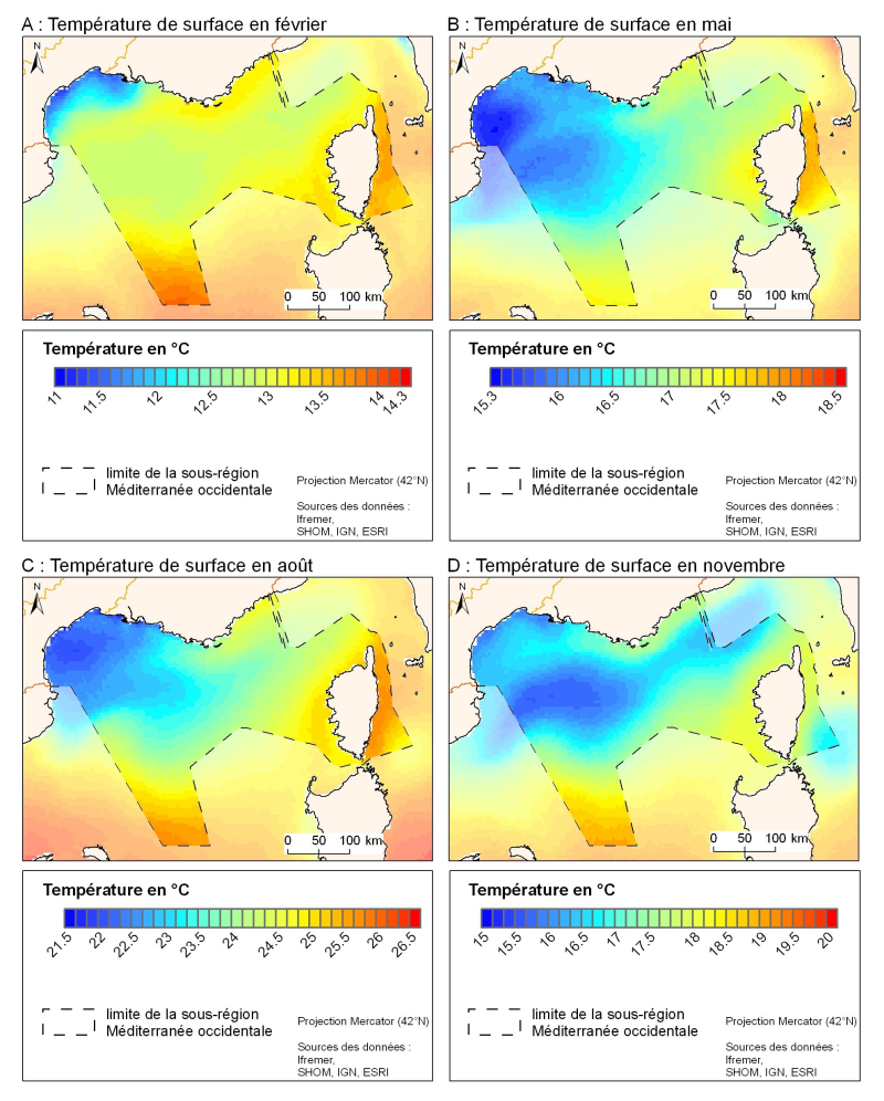
The spatial resolution from satellite climatology provides a more detailed description of spatio-temporal variations of surface temperature in the northern part of the western basin. Climatology exists for the surface temperature based on satellite infrared measurements which provides a spatial resolution on the order of kilometres.