 Mon GéoSource
D5: Eutrophication
Type of resources
Available actions
Topics
INSPIRE themes
Keywords
Contact for the resource
Provided by
Representation types
Update frequencies
status
Scale
-
-
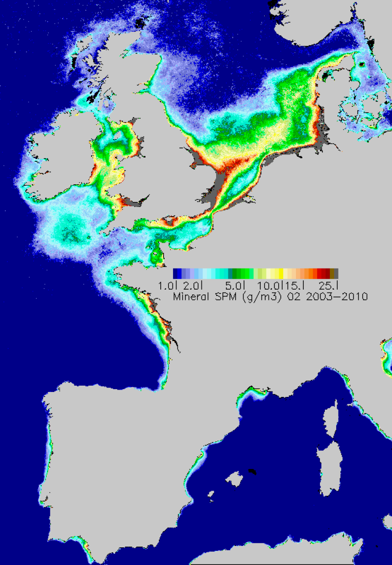
Map of average monthly non-algal suspended matter carried out in the period 2003-2010. TSS are estimated from the water reflectance using a specific algorithm developed at Ifremer.
-
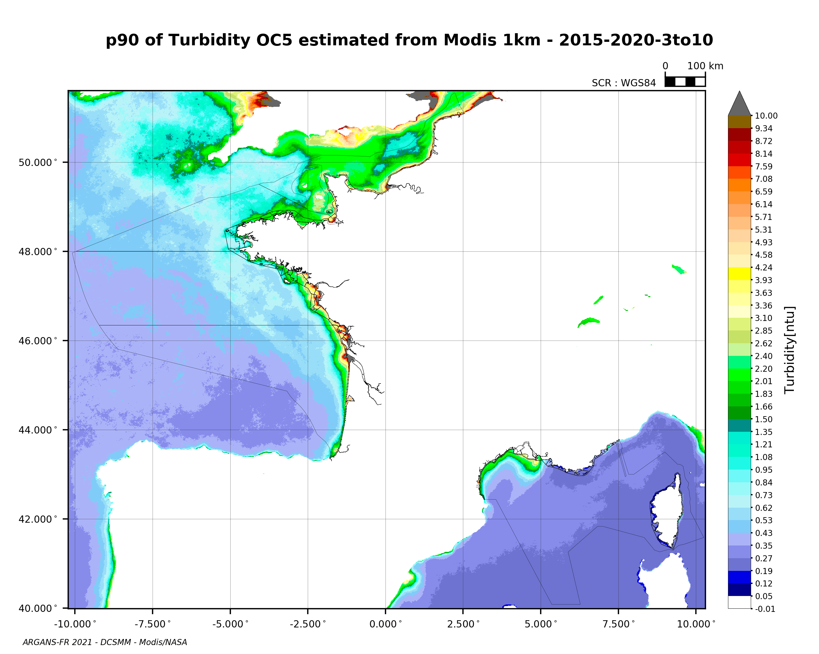
90th percentile of turbidity calculated during the productive period of the WFD (March-October) from 2015 to 2020, from the MODIS algorithm processed by OC5 IFREMER/ARGANS (Gohin et al 2002, Gohin 2011).
-
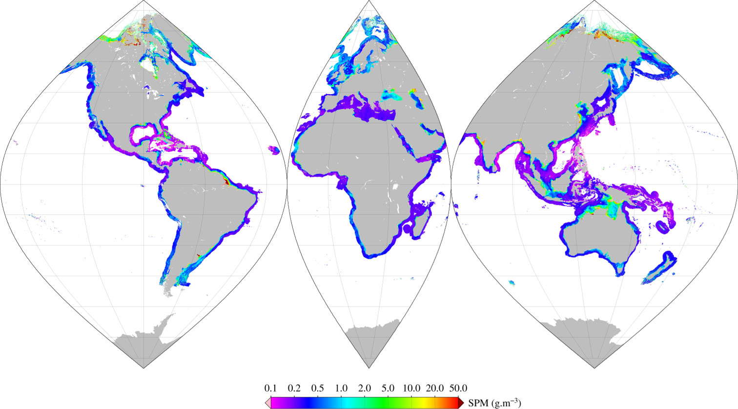
Monthly mean of Suspended Particulate Matter (2002-2012) using Han (2016) algorithm for coastal areas, at global scale, for MERIS sensor, with POLYMER atmospheric corrections. Ref: Bing Han, Hubert Loisel, Vincent Vantrepotte, Xavier Mériaux, Philippe Bryère,Sylvain Ouillon, David Dessailly, Qianguo Xing and Jianhua Zhu. Development of a Semi-Analytical Algorithm for the Retrieval of Suspended Particulate Matter rom Remote Sensing over Clear to Very Turbid Waters Remote Sens. 8, 211; doi:10.3390/rs8030211 2016
-
Monthly mean of chlorophyll-a (2002-2012) from Gohin (2002), for coastal areas, at global scale, for MERIS sensor, with POLYMER atmospheric corrections. Ref: F. Gohin , J. N. Druon & L. Lampert, A five channel chlorophyll concentration algorithm applied to SeaWiFS data processed by SeaDAS in coastal waters. IJRS Volume 23, 2002 - Issue 8 http://dx.doi.org/10.1080/01431160110071879 2002
-
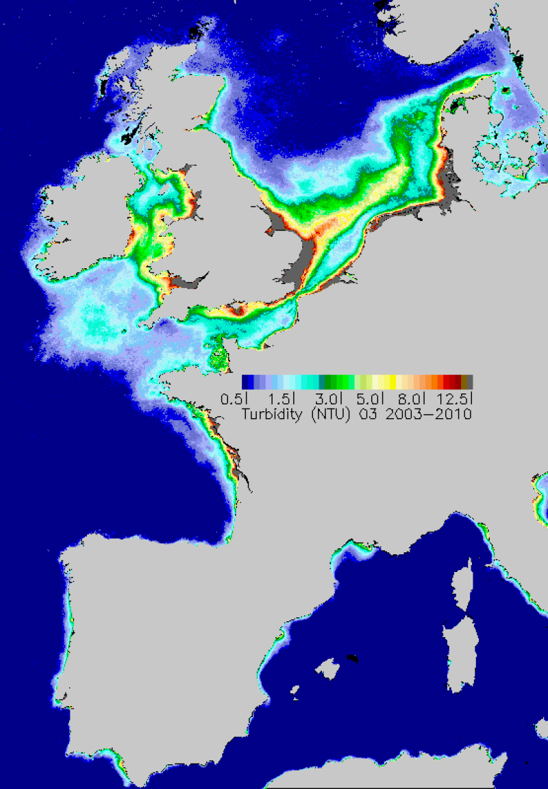
Average monthly turbidity maps made during the period 2003-2010. Turbidity is estimated from the concentrations of inorganic suspended materials and chlorophyll-a.
-
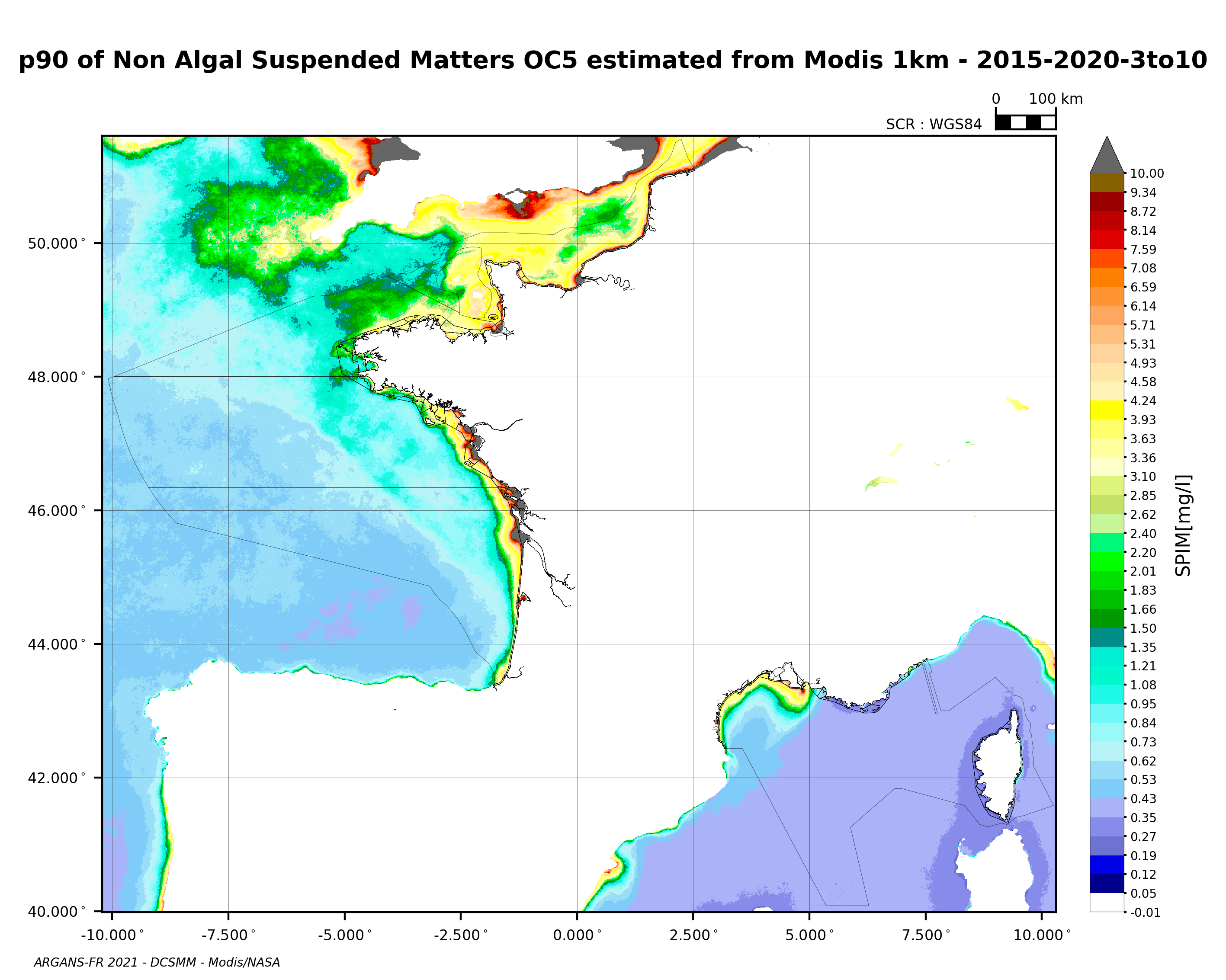
90th percentile of non-algal suspended matter calculated during the productive period of the WFD (March-October) from 2015 to 2020, from the MODIS algorithm processed by OC5 IFREMER/ARGANS (Gohin et al 2002, Gohin 2011).
-
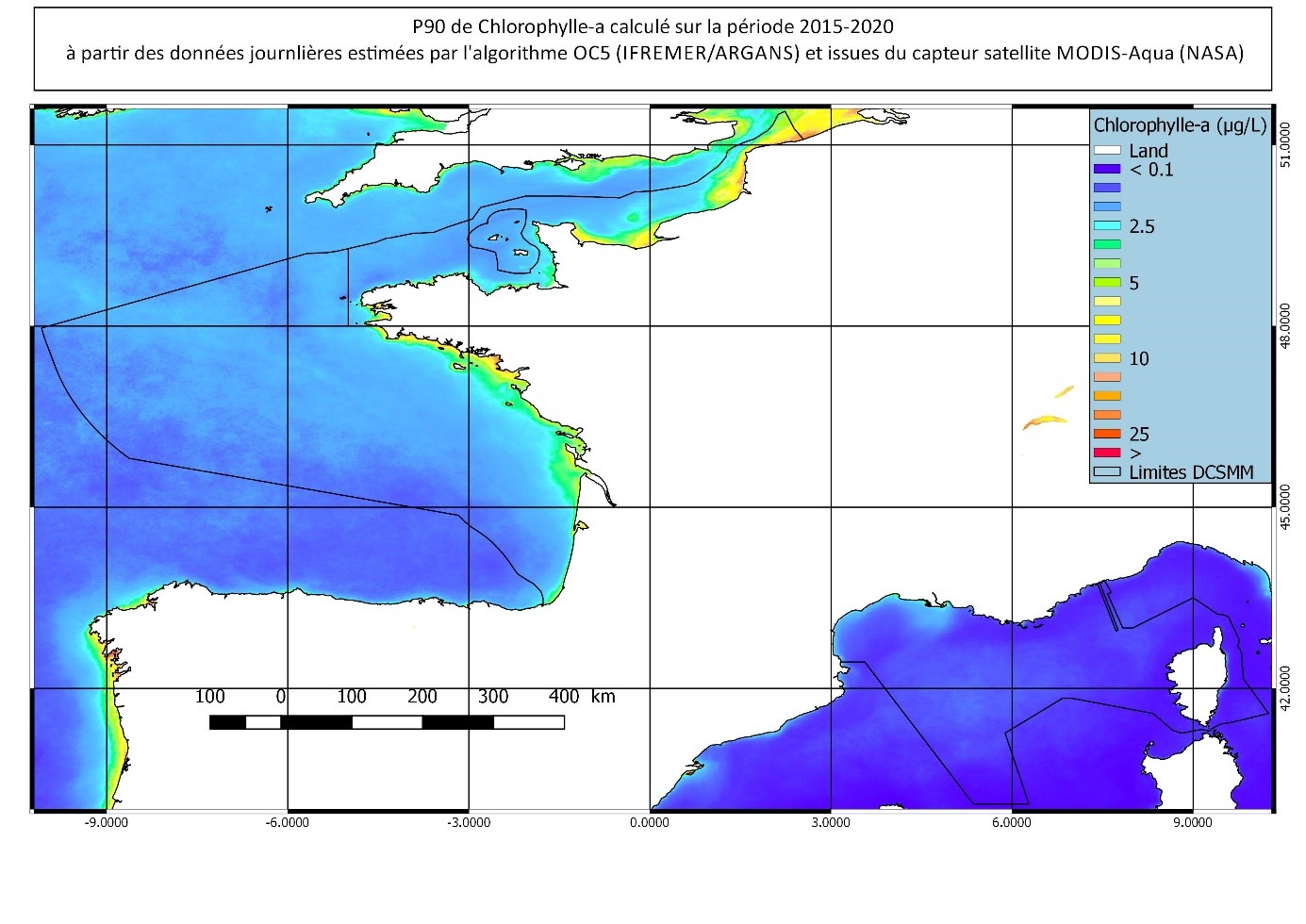
90th percentile calculated during the productive period of the WFD (March-October) from 2015 to 2020, from the MODIS Chl-a algorithm processed by OC5 IFREMER/ARGANS (Gohin et al 2002, Gohin 2011).
-
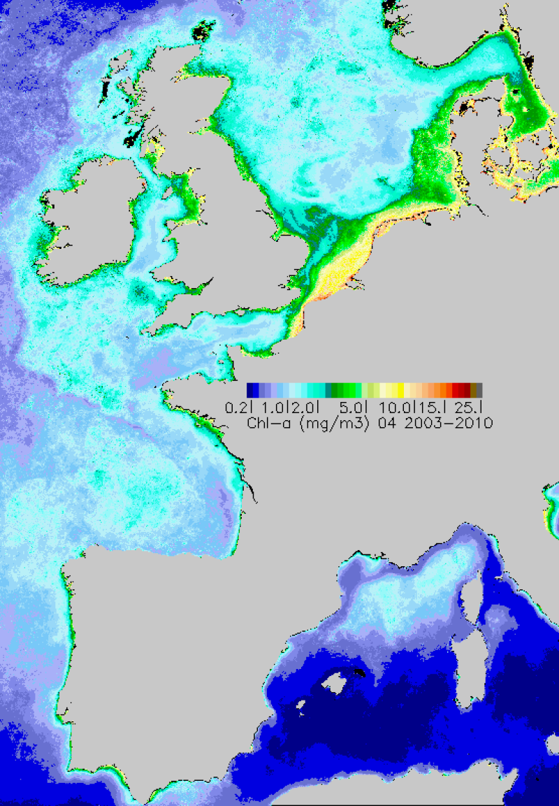
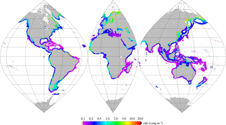
Monthly maps of mean chlorophyll-a achieved over the period 2003-2010. Chlorophyll-a is calculated using the OC5 algorithm developed by Ifremer.
-
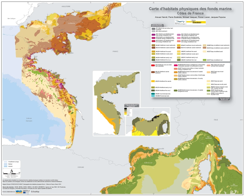
Eunis-classified physical habitats physiques resulting from the combination of three physical variables meshed at a resolution of 250 metres: nature of the substrates, biological area, shearing tension on the sea floor. Coasts of mainland France. Ifremer report "Hamdi Anouar, Vasquez Mickael, Populus Jacques (2010). Cartographie des habitats physiques Eunis - Côtes de France. Ifremer/AAMP agreement n° 09/12177764/FY. http://archimer.ifremer.fr/ doc/00026/13751/ "