 Mon GéoSource
/Milieu physique/Habitats physiques
Type of resources
Available actions
INSPIRE themes
Provided by
Years
Formats
Representation types
Update frequencies
status
Scale
-
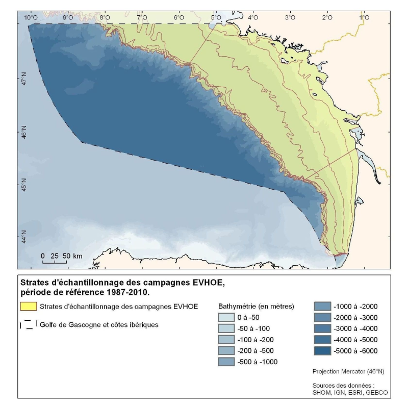
Polygons defined for the distribution of the sampling points of the EVHOE (Evaluation of Fish Stocks in Western Europe) campaigns in the Bay of Biscay and the Celtic Sea.
-
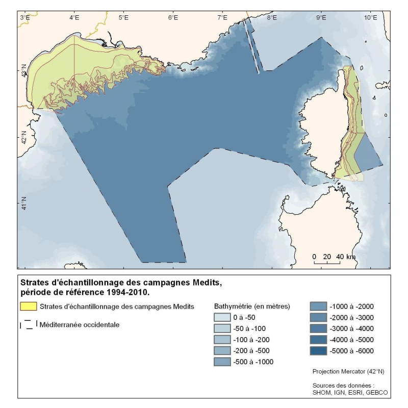
Polygons defined for the sampling points distribution in the Medits campaigns. MEDITS, 2007. International bottom trawl survey in the Mediterranean (Medits). Instruction manual. Version 5. Ifremer, Nantes. http://archimer.ifremer.fr/doc/00002/11321/. 60 p.
-
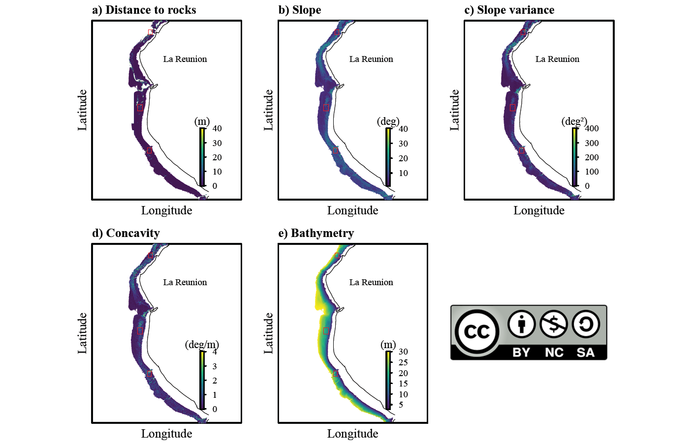
Ce produit regroupe cinq couches d’information descriptives de la topographie et la morphologie des pentes externes du récif de Saint-Gilles / l’Ermitage. Ces données ont été produites dans le cadre du travail de recherche mené sur les projets NExT, DYMATURE, HATOCAM et CHARC portés respectivement par l’Ifremer, le CEDTM, Keloniaet l’IRD visant à établir un lien entre la nature et l’utilisation des habitats physiographiques des tortues vertes immatures de l’Ouest réunionnais.
-
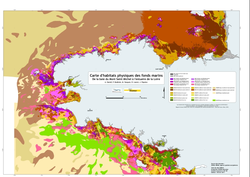
Eunis-classified physical habitats physiques resulting from the combination of three physical variables meshed at a resolution of 100 metres: nature of the substrates, biological area, shearing tension on the sea floor. Coasts of mainland France. Ifremer report "Hamdi Anouar, Vasquez Mickael, Populus Jacques (2010). Cartographie des habitats physiques Eunis - Côtes de France. Ifremer/AAMP agreement n° 09/12177764/FY. http://archimer.ifremer.fr/ doc/00026/13751/ "
-
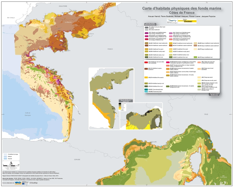
Eunis-classified physical habitats physiques resulting from the combination of three physical variables meshed at a resolution of 250 metres: nature of the substrates, biological area, shearing tension on the sea floor. Coasts of mainland France. Ifremer report "Hamdi Anouar, Vasquez Mickael, Populus Jacques (2010). Cartographie des habitats physiques Eunis - Côtes de France. Ifremer/AAMP agreement n° 09/12177764/FY. http://archimer.ifremer.fr/ doc/00026/13751/ "