 Mon GéoSource
Gascogne
Type of resources
Available actions
INSPIRE themes
Provided by
Years
Formats
Representation types
status
Resolution
-
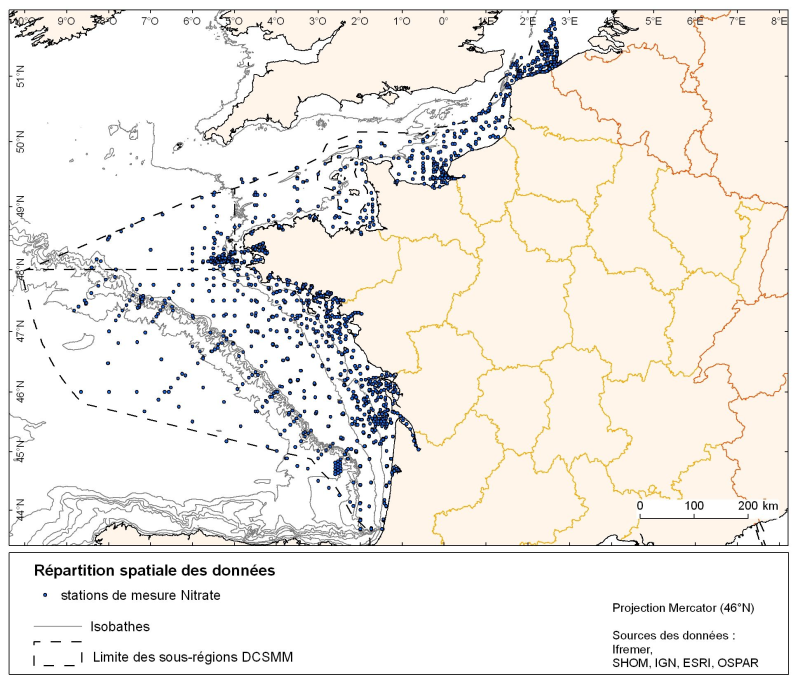
Spatial distribution for nutrients data (silicate, nitrate, nitrite, ammonium and phosphate) for all maritime regions in the English Channel and North Sea, the Celtic Seas and the Bay of Biscay. The temporal extent of the data is from 1930 to 2010, most being between 1974 and 2007 with a peak in 1999.
-
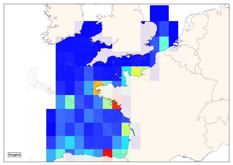
Spatial distribution of all oxygen data in degrees integrated vertically and horizontally for all sub-regions of the English Channel, the North Sea, the Celtic Seas and the Bay of Biscay.
-
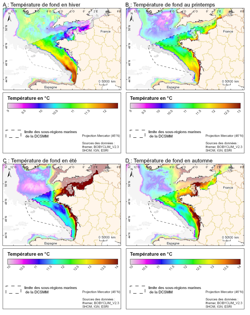
3D seasonal temperature range (in ° C) obtained by objective analysis (interpolation) of the raw data in situ, near the seafloor. Within the Bay of Biscay Challenge and the programme of the Operational Coastal Oceanographic Centre Prévimer, the services of SISMER DYNECO-PHYSED of IFREMER have built a joint hydrological database of the Bay of Biscay, from CTD measurements, Bouteilles, XBT / MBT and Profileurs from multiple global data centres to achieve a climatological atlas of the region for temperature and salinity.
-
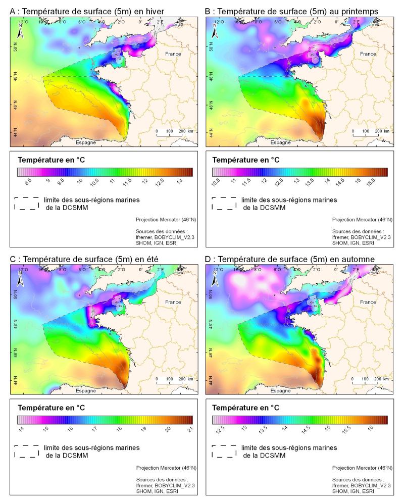
3D seasonal temperature range (in ° C) obtained by objective analysis (interpolation) of the raw data in situ, at a depth of 5m. Within the Bay of Biscay Challenge and the programme of the Operational Coastal Oceanographic Centre Prévimer, the services of SISMER DYNECO-PHYSED of IFREMER have built a joint hydrological database of the Bay of Biscay, from CTD measurements, Bouteilles, XBT / MBT and Profileurs from multiple global data centres to achieve a climatological atlas of the region for temperature and salinity.
-
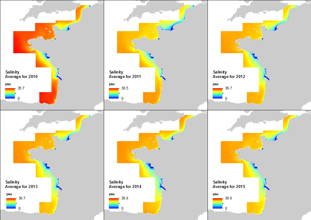
This annual statistics at 500m horizontal resolution was produced from the archived time series of MARS 3D physics model hindcast runs along French Atlantic Coast. The variable that is available here is Salinity. Values are expressed in psu. In each pixel the value is an average of the values of the 40 vertical levels that are considered in the model.
-
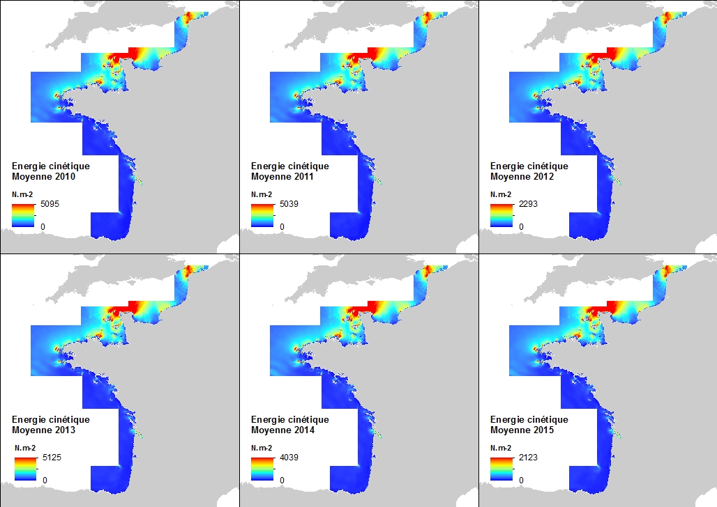
This annual statistics at 500m horizontal resolution was produced from the archived time series of MARS 3D physics model hindcast runs along French Atlantic Coast. The variable that is available here is the Kinetic Energy induced by currents caused by tide, water density gradients and action of winds. The formula used for the Kinetic Energy calculation is 0.5mv², where m is the density of seawater (1027 kg.m-3) and v is the current-induced velocity. Values are expressed in N.m-2 (Newton per square meter). The vertical level is the seabed.
-

This annual statistics at 500m horizontal resolution was produced from the archived time series of MARS 3D physics model hindcast runs along French Atlantic Coast. The variable that is available here is the Salinity. Values are expressed in psu. The vertical level is the seabed.
-
This annual statistics at 500m horizontal resolution was produced from the archived time series of MARS 3D physics model hindcast runs along French Atlantic Coast. The variable that is available here is the Kinetic Energy induced by currents caused by tide, water density gradients and action of winds. The formula used for the Kinetic Energy calculation is 0.5mv², where m is the density of seawater (1027 kg.m-3) and v is the current-induced velocity. Values are expressed in N.m-2 (Newton per square meter). The vertical level is the sea surface.
-

This annual statistics at 500m horizontal resolution was produced from the archived time series of MARS 3D physics model hindcast runs along French Atlantic Coast. The variable that is available here is the Salinity. Values are expressed in psu. The vertical level is the sea surface.
-
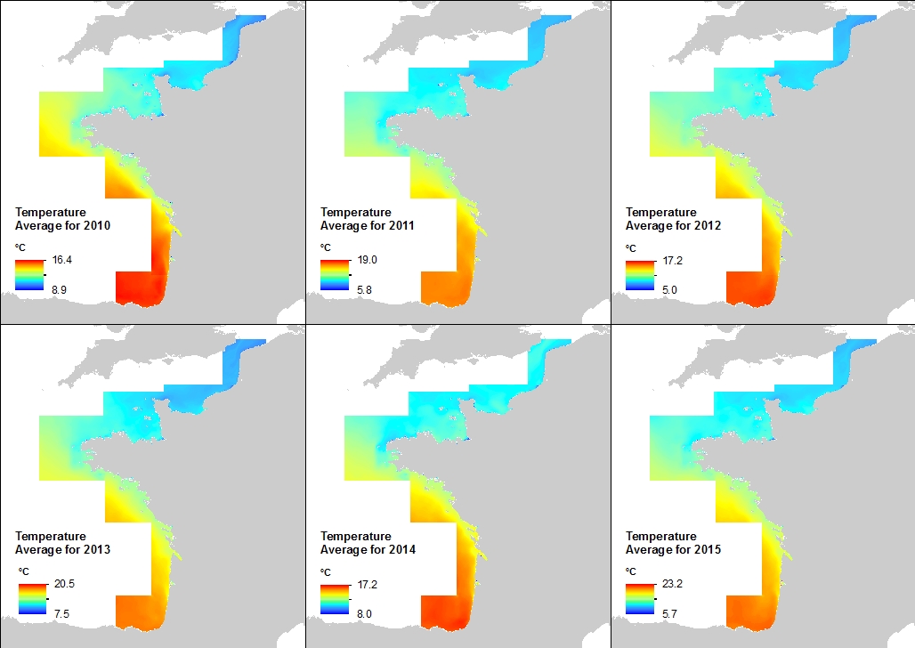
This annual statistics at 500m horizontal resolution was produced from the archived time series of MARS 3D physics model hindcast runs along French Atlantic Coast. The variable that is available here is Temperature. Values are expressed in Celsius degrees. In each pixel the value is an average of the values of the 40 vertical levels that are considered in the model.