 Mon GéoSource
Manche orientale
Type of resources
Available actions
INSPIRE themes
Provided by
Years
Representation types
Update frequencies
status
Scale
-
Cette carte des peuplements macrobenthiques en Manche orientale est reproduite d'après la carte, réalisée par Louis Cabioch, Franck Gentil, René Glaçon et Christian Rétière de l'Observatoire Océanologique de Roscoff, communiquée lors du colloque de l'UOF, les 26 et 27 janvier 1978 à Brest. La carte originale n'a jamais été publiée. C'est une communication directe des auteurs. Pour cette étude, des échantillonnages ont été réalisés entre 1971 et 1975. Cette carte a fait l'objet en 2006 d'une numérisation dans le cadre du Réseau de surveillance de la flore et de la faune benthique marine REBENT. Une harmonisation avec la typologie EUNIS a été réalisée en 2007, dans le cadre des projets REBENT et Interreg-MESH.
-
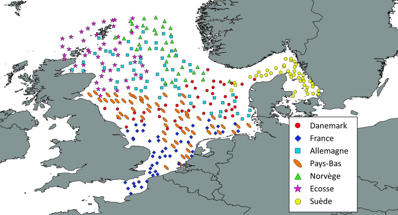
Like all EU Member States, France is obliged to collect and manage the data necessary to conduct the Common Fisheries Policy to assess the abundance and distribution of stocks. A "national multi-annual basic data collection programme" has therefore been set up in which scientific campaigns such as IBTS are integrated. This campaign is carried out in coordination with most of the countries bordering the North Sea, in the framework of the European Fisheries Data Collection Programme (DC-MAP). The research carried out over the last few decades has led to a shift away from fisheries issues stricto sensu (monospecific and geographically limited studies) towards a more integrated vision of the various components of marine ecosystems. This openness results from a desire to better understand the dynamics of exploited marine resources in order to improve diagnoses and management recommendations. The acquisition of data from these compartments at different stations makes it possible to establish a map of biotic and abiotic environmental parameters in the Channel and North Sea during the winter period, a period that is usually little studied, but which is crucial.