 Mon GéoSource
Open data
Type of resources
Available actions
Topics
INSPIRE themes
Keywords
Contact for the resource
Provided by
Years
Representation types
Scale
-
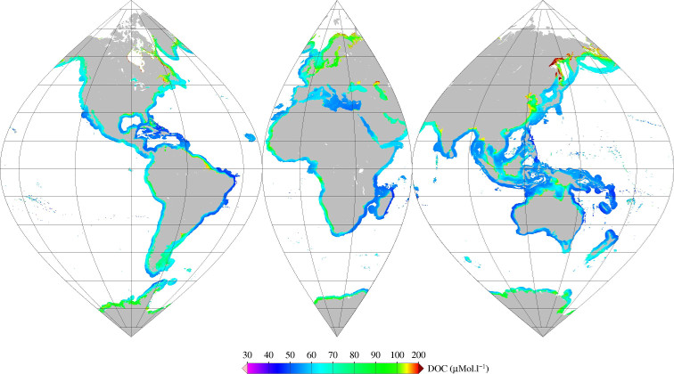
Monthly mean of Dissolved Organic Carbone (DOC) (2002-2012) for coastal areas, at global scale, for MERIS sensor, with POLYMER atmospheric corrections. Ref: V Vantrepotte, F Danhiez, H Loisel, S Ouillon, X Mériaux, A Cauvin and D Dessailly. CDOM-DOC relationship in contrasted coastalwaters: implication for DOC retrieval from ocean color remote sensing observation. OPTICS EXPRESS 33 Vol. 23, No. 1 DOI:10.1364/OE.23.000033 2015
-
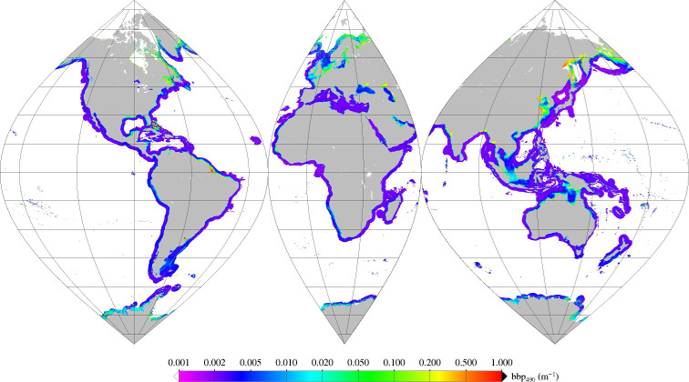
Monthly mean of backscattering coefficient (bbp) at 490nm (2002-2012) for coastal areas, at global scale, for MERIS sensor, with POLYMER atmospheric corrections. Ref: Loisel in prep.
-
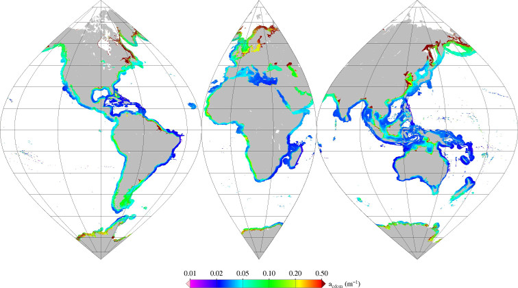
Monthly mean of colored dissolved organic matter absorption (acdom) at 412 nm (2002-2012) for coastal areas, at global scale, for MERIS sensor, with POLYMER atmospheric corrections. Ref: V Vantrepotte, F Danhiez, H Loisel, S Ouillon, X Mériaux, A Cauvin and D Dessailly. CDOM-DOC relationship in contrasted coastalwaters: implication for DOC retrieval from ocean color remote sensing observation. OPTICS EXPRESS 33 Vol. 23, No. 1 DOI:10.1364/OE.23.000033 2015
-
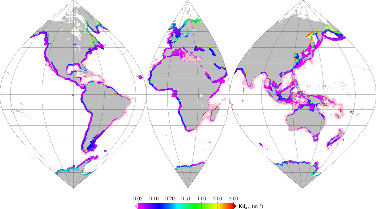
Monthly mean of diffuse attenuation coefficient (Kd) at 490nm (2002-2012), from Jamet et al (2012), for coastal areas, at global scale, for MERIS sensor, with POLYMER atmospheric corrections. Ref: Jamet et al, Retrieval of the spectral diffuse attenuation coefficient Kd(l) in open and coastal ocean waters using a neural network inversion, J. Geophys. Res., 117, C10023, doi:10.1029/2012JC008076.
-
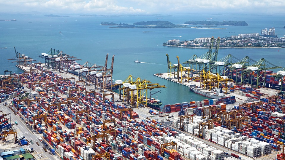
World list of seaports. In its 2021 version, the repository includes 13709 ports for 187 countries. The list of seaports has been drawn up on the basis of the information available in the European reference system of places used in the framework of the Common Fisheries Policy and, more particularly, by the Electronic Recording and Reporting System (ERS), the list of ports identified by the UNECE (2021-1). An assessment of the infrastructures present along the coastline made it possible to identify other ports that were not listed. Each geographical position has been verified with Google Earth in WGS84. Each port is associated with information relating to the country (ISO 3 coding), the UNECE or ERS 5-character coding, the name, the geographical position in WGS84 (latitude and longitude), the status of the port indicating whether it is referenced by Unece (UNECE), by the EU/ERS (ERS) or by both (UNECE/ERS) In case the port is not referenced by UNECE or ERS, the status is N/A. For French ports, the reference system integrates the ports of the French overseas departments and territories with the national codification. Inland ports have also been integrated in 2021.
-
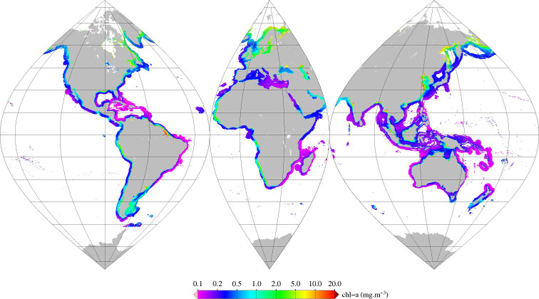
Monthly mean of chlorophyll-a (2002-2012) from Gohin (2002), for coastal areas, at global scale, for MERIS sensor, with POLYMER atmospheric corrections. Ref: F. Gohin , J. N. Druon & L. Lampert, A five channel chlorophyll concentration algorithm applied to SeaWiFS data processed by SeaDAS in coastal waters. IJRS Volume 23, 2002 - Issue 8 http://dx.doi.org/10.1080/01431160110071879 2002