 Mon GéoSource
hydrologie
Type of resources
Available actions
INSPIRE themes
Provided by
Years
Formats
Representation types
Scale
-
Base de données précise au 1/500 reprenant de nombreux éléments visibles du paysage : routes, enceintes, zones boisées et engazonnées, canaux, bâtiments. Ce référentiel couvre l'ensemble du territoire de la CU Dunkerque et est utilisé comme fond de plan topographique pour la gestion des avants-projets sommaires ou comme étude topographique par défaut. Il sert également à l'analyse à l'évolution du territoire. Il est constitué de 39 couches d'informations : Cette couche comprend la ligne matérialisant les quais.
-
Base de données précise au 1/500 reprenant de nombreux éléments visibles du paysage : routes, enceintes, zones boisées et engazonnées, canaux, bâtiments. Ce référentiel couvre l'ensemble du territoire de la CU Dunkerque et est utilisé comme fond de plan topographique pour la gestion des avants-projets sommaires ou comme étude topographique par défaut. Il sert également à l'analyse à l'évolution du territoire. Il est constitué de 39 couches d'informations : Cette couche comprend la ligne axiale des fossés ou des canaux.
-
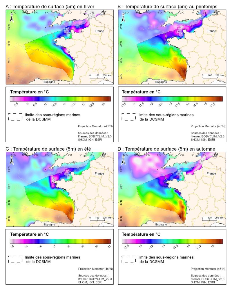
3D seasonal temperature range (in ° C) obtained by objective analysis (interpolation) of the raw data in situ, at a depth of 5m. Within the Bay of Biscay Challenge and the programme of the Operational Coastal Oceanographic Centre Prévimer, the services of SISMER DYNECO-PHYSED of IFREMER have built a joint hydrological database of the Bay of Biscay, from CTD measurements, Bouteilles, XBT / MBT and Profileurs from multiple global data centres to achieve a climatological atlas of the region for temperature and salinity.
-
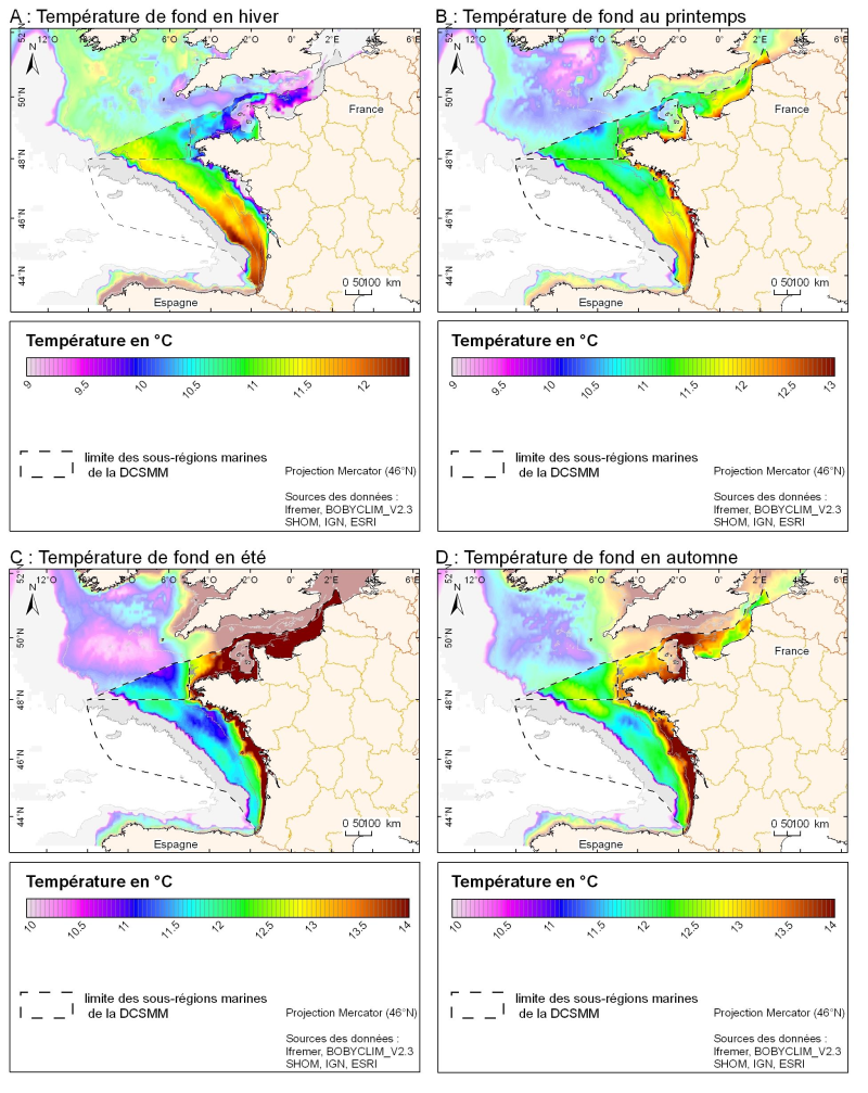
3D seasonal temperature range (in ° C) obtained by objective analysis (interpolation) of the raw data in situ, near the seafloor. Within the Bay of Biscay Challenge and the programme of the Operational Coastal Oceanographic Centre Prévimer, the services of SISMER DYNECO-PHYSED of IFREMER have built a joint hydrological database of the Bay of Biscay, from CTD measurements, Bouteilles, XBT / MBT and Profileurs from multiple global data centres to achieve a climatological atlas of the region for temperature and salinity.