 Mon GéoSource
Contact for the resource
Geological Survey of Canada
Type of resources
Available actions
INSPIRE themes
Provided by
Years
Representation types
Update frequencies
status
Scale
From
1
-
1
/
1
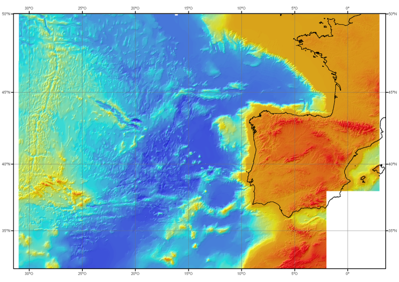
-
Bathymetric model (DTM) of the North-East Atlantic, generated from conventional multibeam bathymetry data, prior to the year 2000. The grid spacing is 1000 meters. Bibliographic reference : Sibuet J.C. & al., (2004) - Carte bathymétrique de l'Atlantique nord-est et du golfe de Gascogne : implications cinématiques. Bull. Soc. géol. Fr.T. 175, n°5, pp. 429-442