 Mon GéoSource
2002
Type of resources
Available actions
INSPIRE themes
Provided by
Years
Formats
Representation types
Update frequencies
status
Scale
Resolution
-
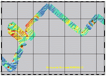
Geophysical and geochemical study of the Pacific-Antarctic ridge between S65/W175 and S60/W150. The first objective was to contribute to the understanding and modelling of the mechanisms of ocean ridge functioning on the scale of the basic accretion unit (< 100 km). The second was to study the zoning of the upper mantle on various scales, through investigating the geochemical signature of rocks from the axial valley. This cruise falls under the framework of the Inter-Ridge programme and is the result of cooperation between IFREMER/DRO/GM, INSU (CNRS,IPG, GRGS), Washington State University, Scripps (University of California) and the University of Chiba (Japan).
-
Suivi qualitatif et quantitatif standardisé des biocénoses benthiques (ensemble des organismes vivant à proximité du fond : anémones, étoiles de mer, crustacés, coquillages etc.) des stations de référence du cantonnement de pêche de Guéthary (département 64).
-

Comme tous les milieux côtiers soumis à des pressions anthropiques, le Bassin d'Arcachon subit des contaminations liées aux activités qui s'exercent dans la Baie ou sur son bassin versant. Les activités urbaines, agricoles, industrielles, domestiques et touristiques engendrent des apports de contaminants chimiques multiples et variés qui ont des conséquences sur l’environnement marin et sur l’homme. En particulier, les polluants métalliques peuvent se retrouver dans les eaux et les sédiments du Bassin d’Arcachon, impactant potentiellement les organismes aquatiques qui s’y trouvent. Les bivalves filtreurs notamment présentent de fortes capacités de bioaccumulation des éléments traces métalliques à l’origine de leur utilisation dans les réseaux de biosurveillance (Réseau National d’Observation, RNO). Cependant, très peu d’études jusqu’à présent se sont réellement intéressées à l’état de contamination des bivalves filtreurs dans le Bassin d’Arcachon, hormis les analyses réalisées sur les huîtres sauvages par le RNO. Concernant les bivalves fouisseurs, encore moins de données sont disponibles dans la littérature concernant le Bassin d’Arcachon. Pourtant, la coque, par son mode de vie enfoui dans les sédiments et en tant qu’organisme filtreur peut représenter une espèce particulièrement sensible à la présence de contaminants métalliques
-
État initial (2002) et études d’impact (2005, 2006) des peuplements benthiques et de la granulométrie dans le cadre de travaux de creusement d’une souille.
-
Geophysical and geochemical study of the Pacific-Antarctic ridge between S65/W175 and S60/W150. The first objective was to contribute to the understanding and modelling of the mechanisms of ocean ridge functioning on the scale of the basic accretion unit (< 100 km). The second was to study the zoning of the upper mantle on various scales, through investigating the geochemical signature of rocks from the axial valley. This cruise falls under the framework of the Inter-Ridge programme and is the result of cooperation between IFREMER/DRO/GM, INSU (CNRS,IPG, GRGS), Washington State University, Scripps (University of California) and the University of Chiba (Japan).
-
Relevé des entailles d’érosion marine dans le pied du versant externe du cordon dunaire que l'on nomme parfois « coup de cuillère » marine. Ces données sont issues de levés GPS effectués par l'ONF sur le littoral sableux aquitain au cours de l'hiver 2002-2003.
-
A partir des relevés terrain effectués par les TFT ONF des entailles d'érosion marines (cuillères d'érosion) sur la côte sableuse, une donnée de synthèse est générée par maille de 1km de linéaire de littoral. A chaque maille est associé un pourcentage de linéaire côtier érodé.
-

État initial (2002) et études d’impact (2005, 2006, 2008) des peuplements benthiques et de la granulométrie dans le cadre du nettoyage du Banc de la Matelle (éradication des huîtres sauvages).