 Mon GéoSource
Location
Type of resources
Available actions
Topics
Keywords
Provided by
Representation types
Scale
-
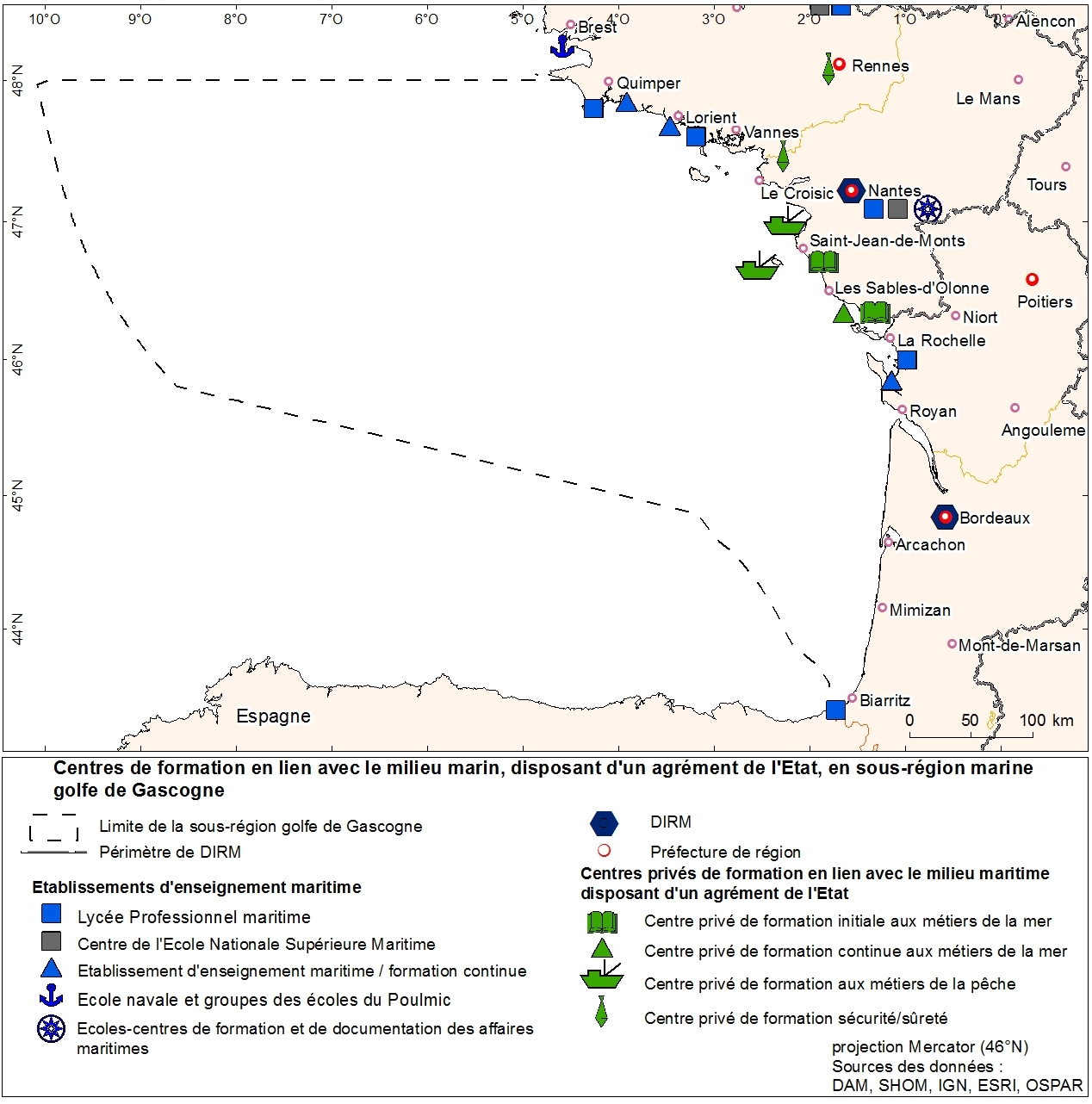
Agencies education in marine trades geolocalized to municipality. This information was produced as part of the initial assessment of the MSFD. Referent expert Sophie Devergie. WARNING: the spatial structure of the data must be improved because it contains superpositions of points (several training agencies per commune). Here the tool "Representation" of ArcGIS was used to facilitate the mapping of the data that does not meet basic standards of the topology. Ultimately, the quality of the data can be improved by refining the address geolocation.
-
Selection of flow gauging stations of the French rivers (accessible via the central bank administered by the HYDRO SCHAPI) on the basis of hydrological function and monitoring stations. The data bank HYDRO stores measurements of water depth (variable time step) from 3500 stations (including 2400 which are currently in service) located on French rivers and provides access to descriptive data stations (main purpose, precise location, measurement quality, history, data available ...)
-
Physico-chemical monitoring stations are part of a network under the responsibility of the water agencies. Regarding the scope of strict thematic contribution "Hydrology," the monitoring stations do not come into account because they only measure the physico-chemical quality of the rivers. These stations are used only for calculations under fluvial inputs of pollutants / nutrients.