 Mon GéoSource
Mediterranean
Type of resources
Available actions
Topics
INSPIRE themes
Keywords
Contact for the resource
Provided by
Years
Representation types
Update frequencies
status
Scale
-
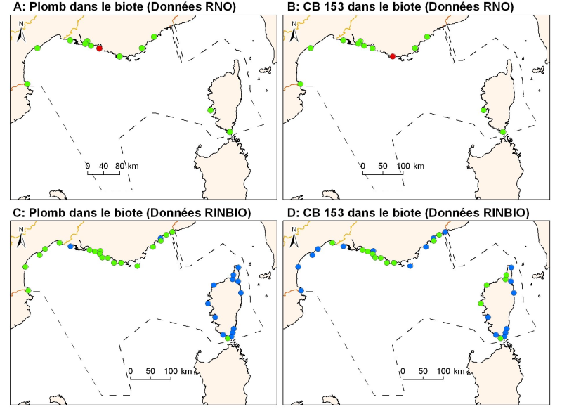
Concentrations of metals, organochlorines in mussels and oysters from the Mediterranean coast, from RNO RINBIO data.
-
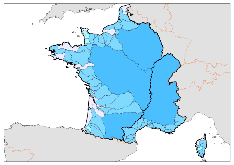
Division of French metropolitan territories to define the zones contributing to the pollutant flow carried by rivers to the sea.
-
This mapping includes contract for the Baie des Golfes de Lérins. The study area extends from the tip of the Notre Dame in the town of Théoule-sur-Mer to Cap up to Antibes (Ilette tip included) on the bathymetry up to the surface of the contour from 60 meters.
-
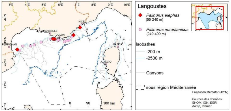
Species distribution is provided as a layer of points representing in situ observations of organisms observed during dives submersible into the canyons in the Mediterranean mainland.
-
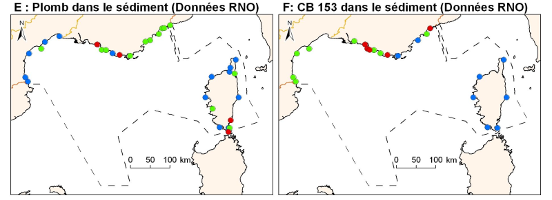
Concentrations of metals, organochlorines in surficial sediments (1st cm) in the Mediterranean coast, from RNO data.
-
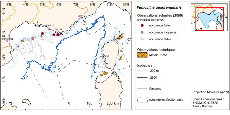
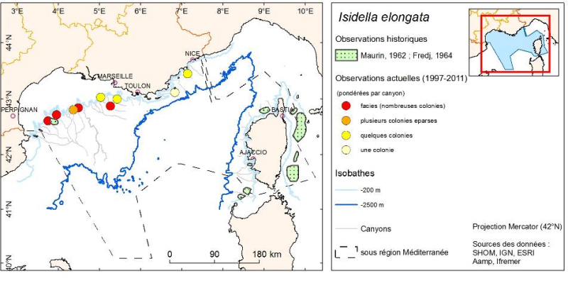
Layer of Polygons representing the distribution of organisms described in the bibliography by Maurin (1962) and obtained by trawling in the canyons of the French Mediterranean.
-
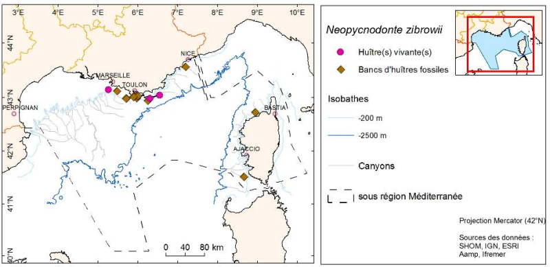
Species distribution is provided as a layer of points representing in situ observations of organisms during submersible dives into the canyons of the Mediterranean mainland.
-
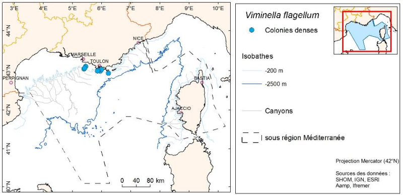
Antipathaires distribution observed by submersible between 1995 and 2011 in the French Mediterranean
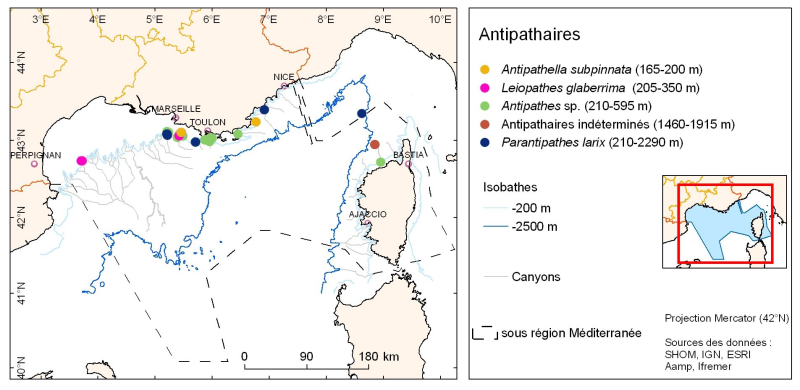
Species distribution is provided as a layer of points representing in situ observations of organisms during submersible dives into the canyons of the Mediterranean mainland.
-
Species distribution is provided as a layer of points representing in situ observations of organisms during submersible dives into the canyons of the Mediterranean mainland.
-
Layer of Polygons representing the distribution of organisms described in the bibliography and obtained by sampling in the canyons of the French Mediterranean.