 Mon GéoSource
D1: Biodiversité - Poissons
Type of resources
Available actions
INSPIRE themes
Provided by
Years
Representation types
Update frequencies
status
Scale
Resolution
-
Modelised abundances of several species in coastal nurseries or prediction uncertainty.
-
Modelised abundances of several species in coastal nurseries or prediction uncertainty.
-
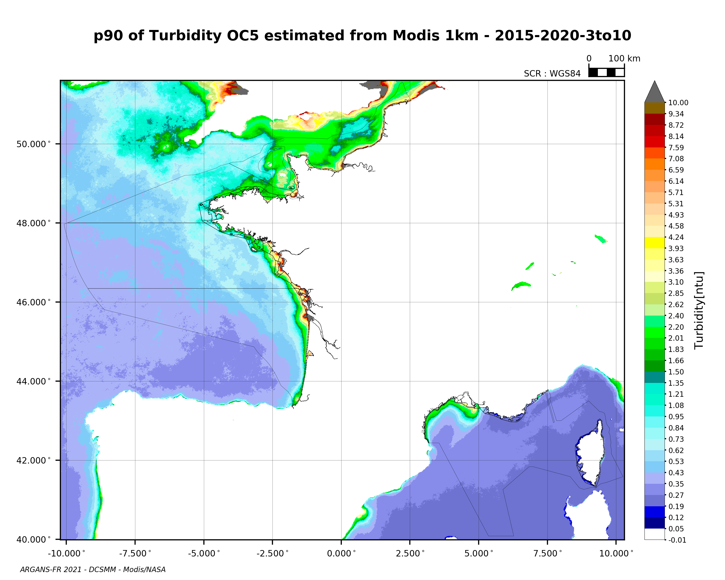
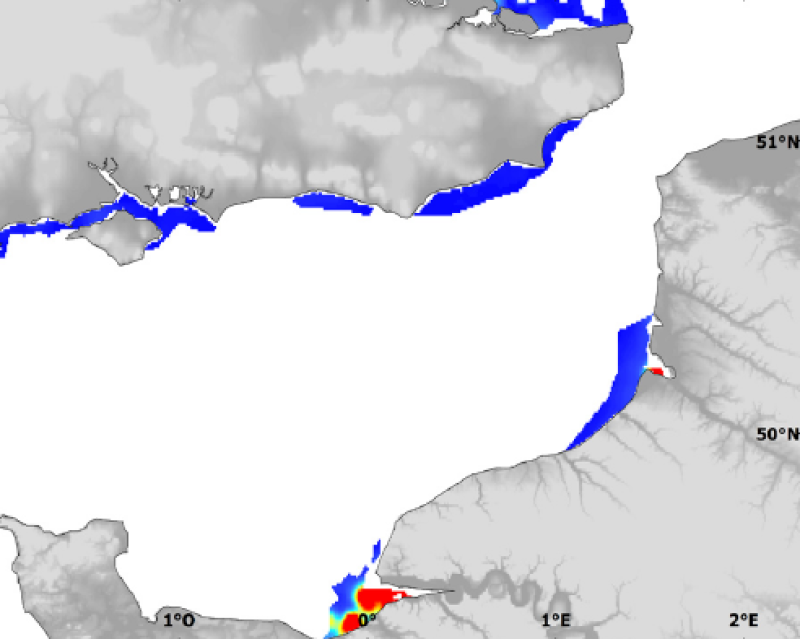
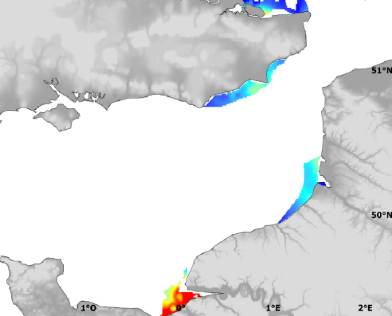
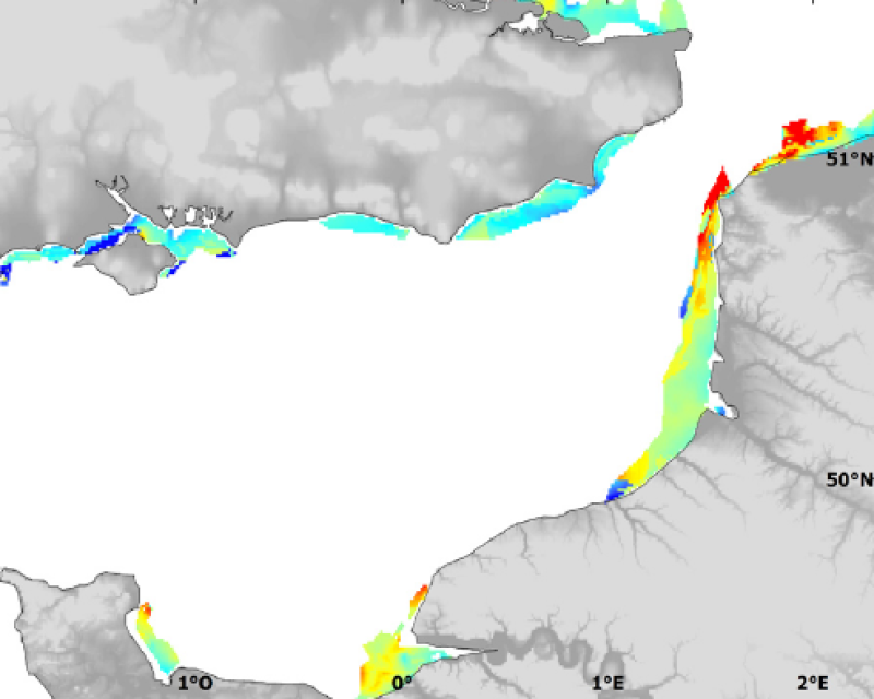
90th percentile of turbidity calculated during the productive period of the WFD (March-October) from 2015 to 2020, from the MODIS algorithm processed by OC5 IFREMER/ARGANS (Gohin et al 2002, Gohin 2011).
-
Modelised abundances of several species in coastal nurseries or prediction uncertainty.
-
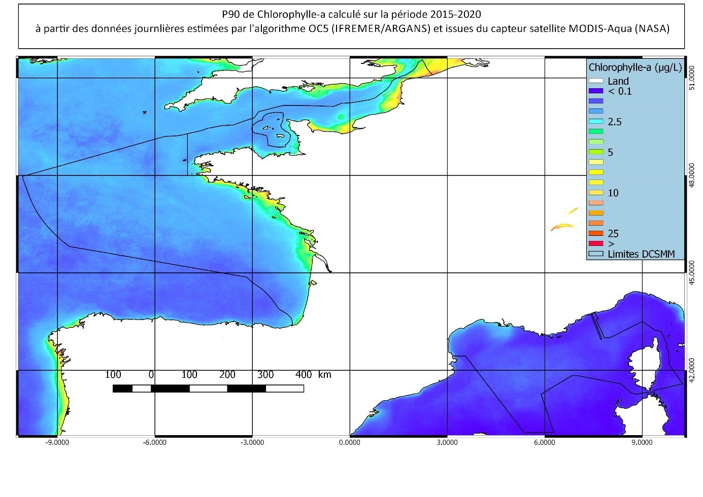
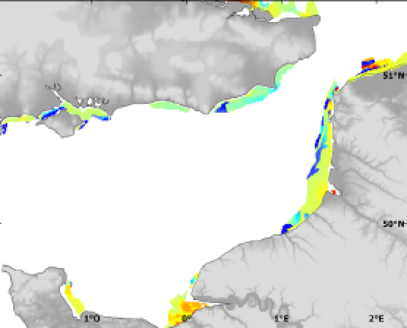
90th percentile calculated during the productive period of the WFD (March-October) from 2015 to 2020, from the MODIS Chl-a algorithm processed by OC5 IFREMER/ARGANS (Gohin et al 2002, Gohin 2011).
-
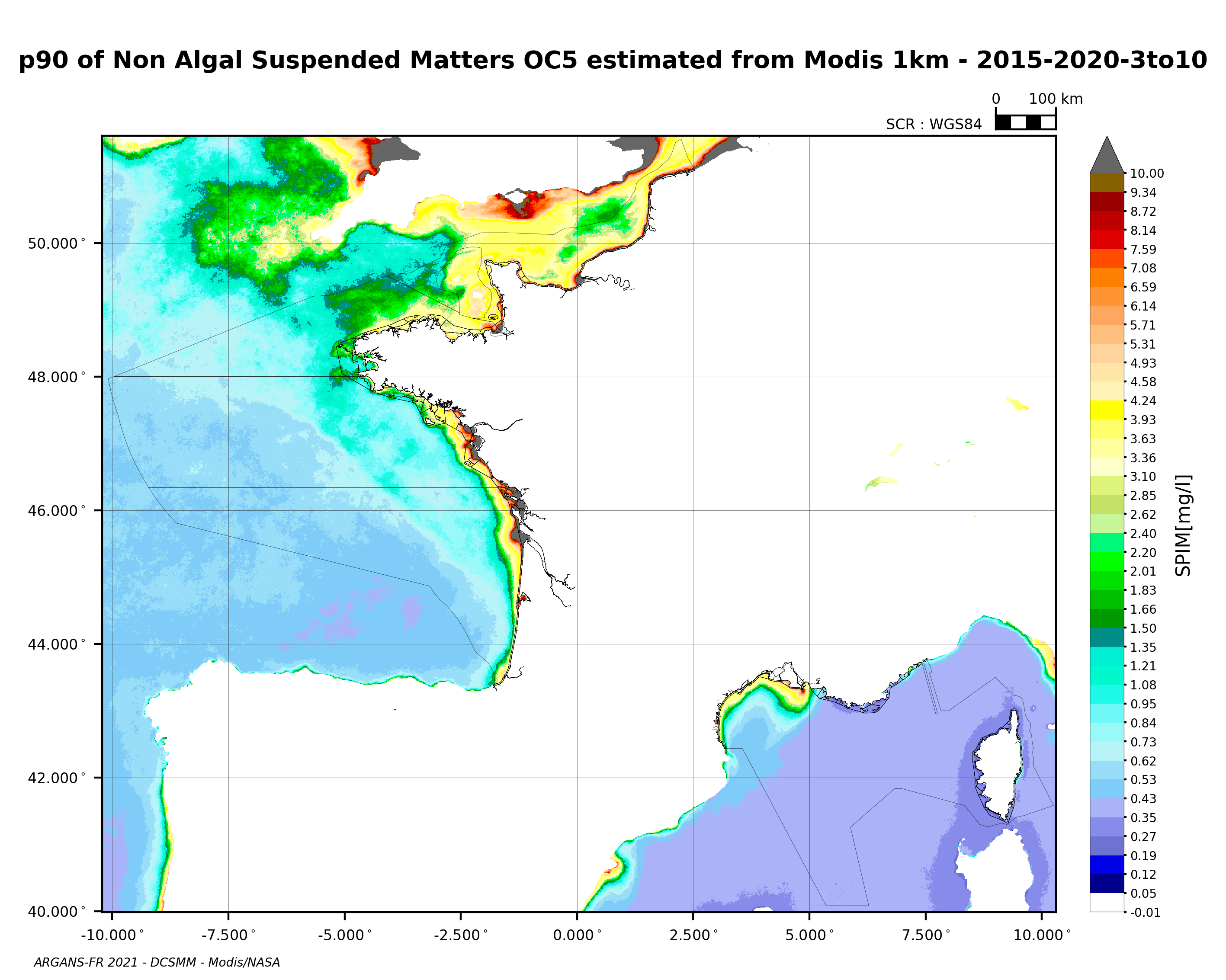
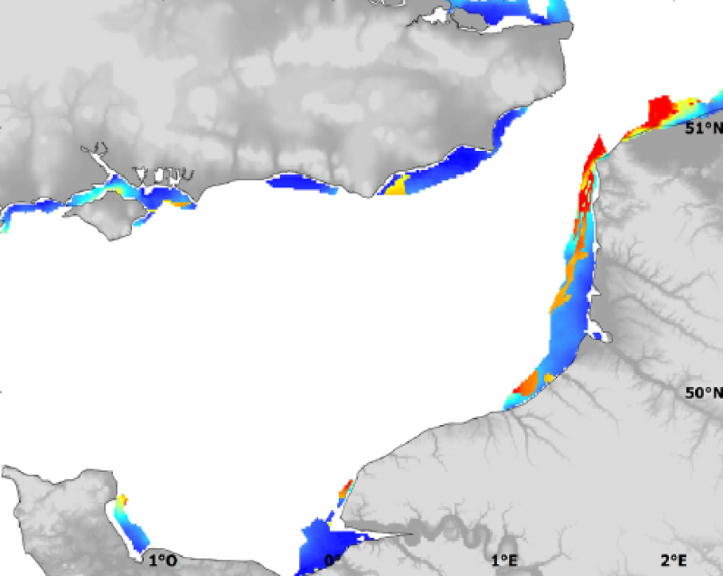
90th percentile of non-algal suspended matter calculated during the productive period of the WFD (March-October) from 2015 to 2020, from the MODIS algorithm processed by OC5 IFREMER/ARGANS (Gohin et al 2002, Gohin 2011).
-
Modelised abundances of several species in coastal nurseries or prediction uncertainty.
-
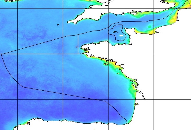
Données traitées issues du satellite MODIS. Les paramètres observés sont la matière en suspension, la chlorophyl-a, la turbidité et le rayonnement photosynthétiquement actif (KPAR) sur la zone de la France métropolitaine. Il s'agit des fichiers de données journalières sur la période 2015-2020 Les données ont été traitées à partir des données brutes, dans le cadre du chantier collecte de données de la DCSMM.
-
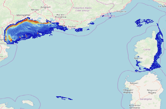
Data on physical impact intensity caused by trawling (bottom otter trawl, twin bottom otter trawl, dredges) estimated from VMS (Vessel Monitoring System) data cross-referenced with the Community Fishing Fleet Register and, for French vessels, with the landing data between 2008 and 2020. The data is constituted of 14 rasters in a resolution of 1’x1’ (13 annual abrasion rasters between 2008 and 2020 and 1 raster representing the 90th percentile of inter-annual abrasion). The abrasion is expressed in swept area ratio per year for each layer. This work enabled the study of the trawling impact on benthic communities in the Gulf of Lions and Corsica. The objective was to better describe the spatial and temporal repartition of trawling in this area and its potential impact on benthic habitats.
-
Modelised abundances of several species in coastal nurseries or prediction uncertainty.