 Mon GéoSource
Saint-Pierre-et-Miquelon
Type of resources
Available actions
INSPIRE themes
Provided by
Years
Representation types
Update frequencies
status
Scale
-
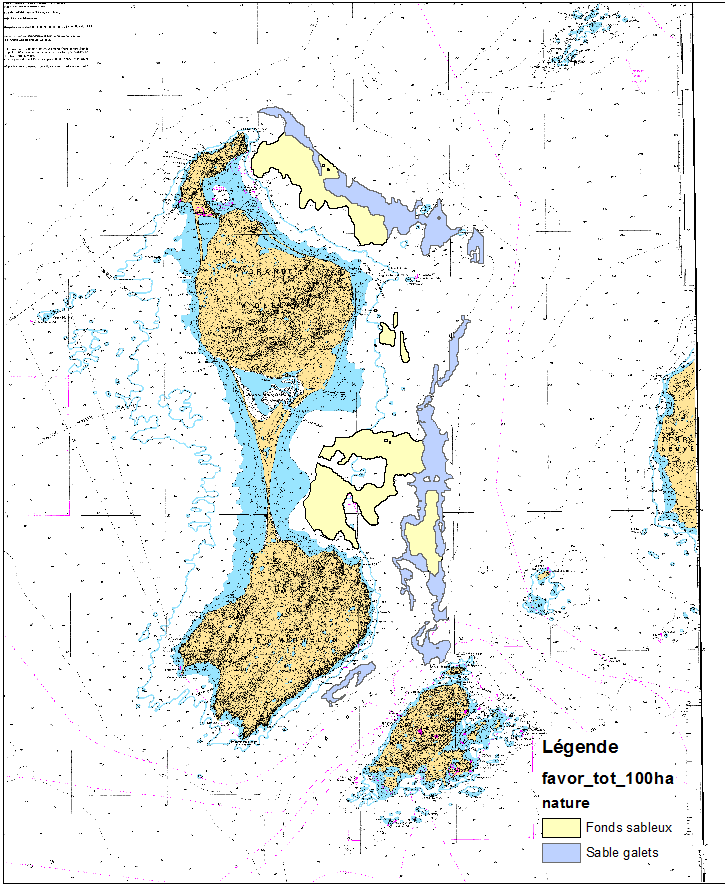
This data set was obtained during 2 ENVISION-IFREMER field campaigns carried out in 2007 and 2011 to sustain a Pectinid aquaculture project. This project was co-funded by ODEADOM and the public collectivity of Saint Pierre et Miquelon. Potential areas for further aquaculture exploitation and development on the Eastern coast of Saint Pierre et Miquelon.
-
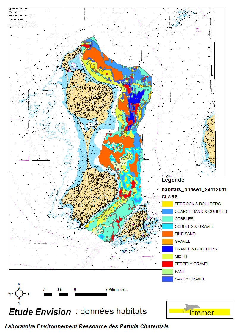
These data were collected during the 2007 and 2011 ENVISION-Ifremer campaigns to sustain a R & D project focusing on the Pectinid aquaculture development. This project was co-funded by the Saint Pierre et Miquelon public body and ODEADOM. This work aims to assess and select new potential rearing areas for the King scallop Placopecten magellanicus by using bottom type data resulting from 2 mapping campaigns carried out in 2007 and 2011 on the Eastern coast of Saint Pierre et Miquelon archipelago.
-
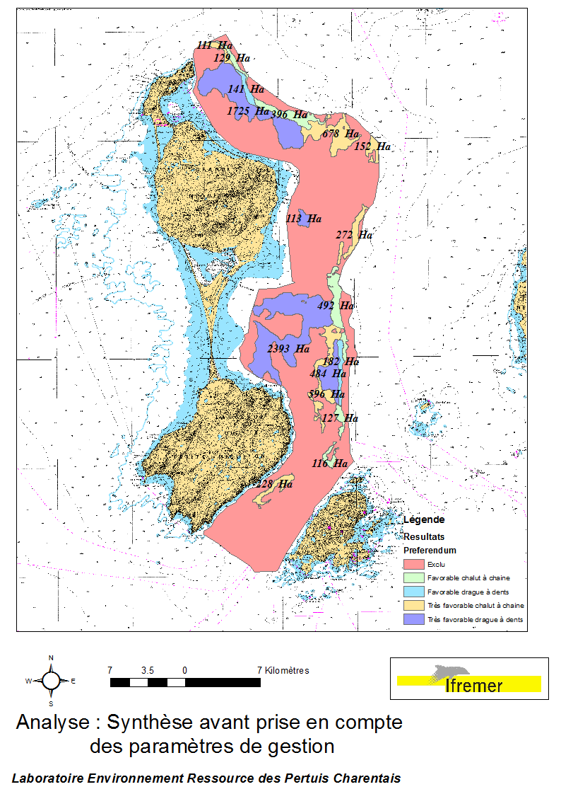
This data set was obtained during 2 ENVISION-IFREMER field campaigns carried out in 2007 and 2011, to sustain a R & D project aimed to develop pectinid aquaculture. This project was co-funded by the St Pierre et Miquelon public collectivity and ODEADOM. This represents a synthesis of spatial analysis based upon multi-criteria to assess future seeding and rearing areas for King scallop Placopecten magellanicus on the Eastern coast of Saint Pierre et Miquelon.
-
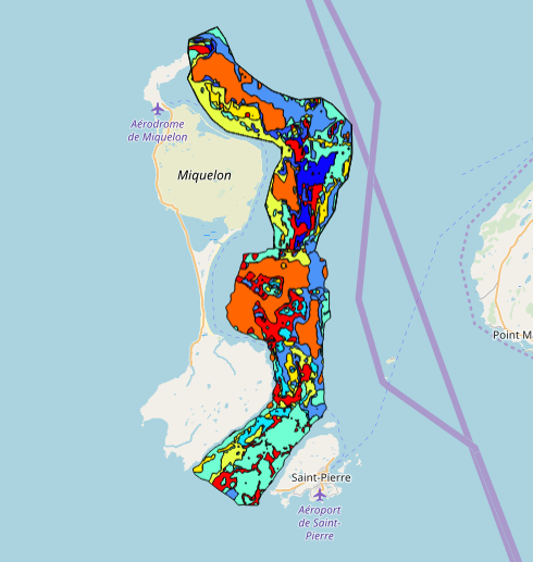
This data set was collected during 2 ENVISION-IFREMER field campaigns carried out in 2007 and 2011 to sustain a Pectinid aquaculture project. This was co-funded by ODEADOM and the public collectivity of Saint Pierre et Miquelon. This work aims to assess new seeding and rearing areas for the King scallop Placopecten magellanicus through a site selection process using the bottom type mapping data set obtained during the 2 ENVISION-IFREMER field campaigns. Furthermore, new estimates of potental scallop production is produced by this data treatment.
-
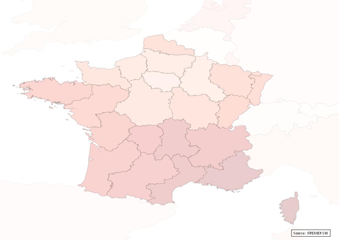
Avant le 1er janvier 2016, la France comptait 27 régions : - 22 régions en France métropolitaine (en comptant la Corse). - 5 régions d'outre mer : la Guadeloupe, la Martinique, la Guyane, la Réunion et Mayotte (depuis 2011). Bien qu'obsolète, ce référentiel est conservé dans le Système d'Informations Halieutiques pour les données historiques.
-

SACROIS is a data crossing algorithm that produces professional fishing activity data series (validated, consolidated and qualified production and effort data) for the vessels registered in the Community Fishing Fleet (CFP) file. SACROIS selects the best of the available information sources to produce the reference fishing activity data. SACROIS consists of an operational application for reconciliation, verification and consistency checks of different unitary data streams. The SACROIS algorithm does not correct the data, its objective is to : - provide the best possible estimate of the various elements making up a tide from the available data sources - to identify the incompleteness of the various data sources and to propose a synthesis completed by indicators of data qualification resulting from the crossings. Twice a month, the SACROIS algorithm produces a new data source, a synthesis of all the available data sources: the reconstructed SACROIS tides. The SACROIS data have been calculated since 2000 for all fleets for which data are available: - North Sea - Channel - Atlantic (excluding tropical seiners), - Mediterranean (excluding bluefin seiners), - DOM (Reunion, Mayotte, French Guiana and the West Indies).
-
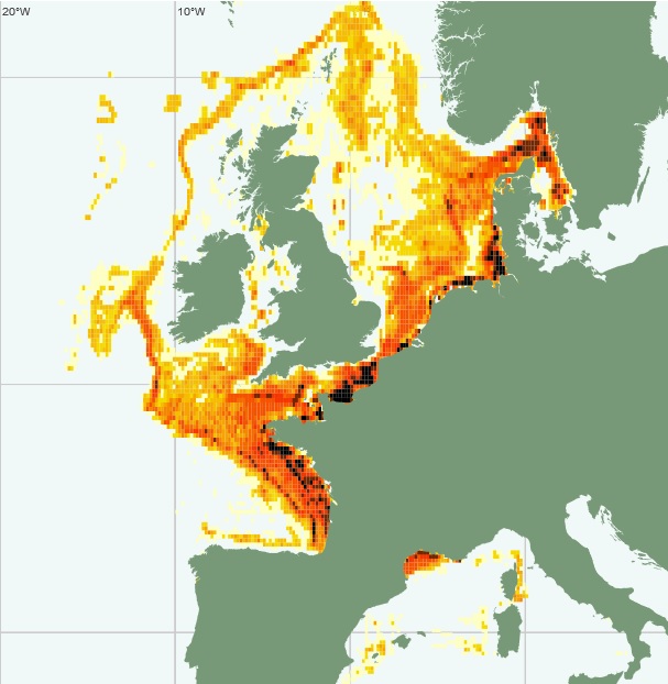
Vessel Monitoring System (VMS) data is the data from the Community's satellite-based fishing vessel monitoring system, which provides data on the position, course and speed of vessels to fisheries authorities at regular intervals.