 Mon GéoSource
Habitats
Type of resources
Available actions
Topics
INSPIRE themes
Keywords
Contact for the resource
Provided by
Years
Formats
Representation types
Update frequencies
status
Scale
-
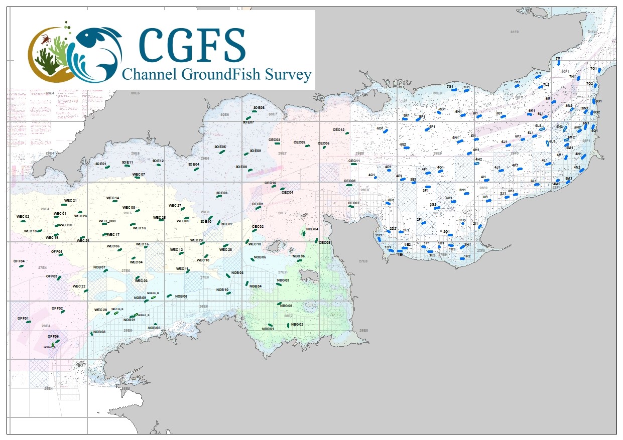
CGFS cruise aims to collect basic data to estimate the status of fisheries resources, by direct assessment of stock abundance and distribution, along with biological sampling of commercial catches. The CGFS campaign is carried out within the framework of this programme in the European project Contractualisation of Basic Fishery Data Collection (DCF). The abundance indices collected during this campaign are used by the ICES international working group "Demersal fisheries of the North Sea, Eastern Channel and Skagerrak" and complement the data from the English "Beam Trawl Survey" for the "Flatfish" working group.
-
The Bargip project : acquisition of scientific data and knowledge to produce advices on integrated management of European sea bass (Dicentrarchus labrax) in North-East Atlantic.
-

La typologie des milieux de l'EID Méditerranée a été définie à partir de deux critères fondamentaux caractérisant le fonctionnement des zones humides méditerranéennes, à savoir le degré de salinité et la fréquence de submersions.
-
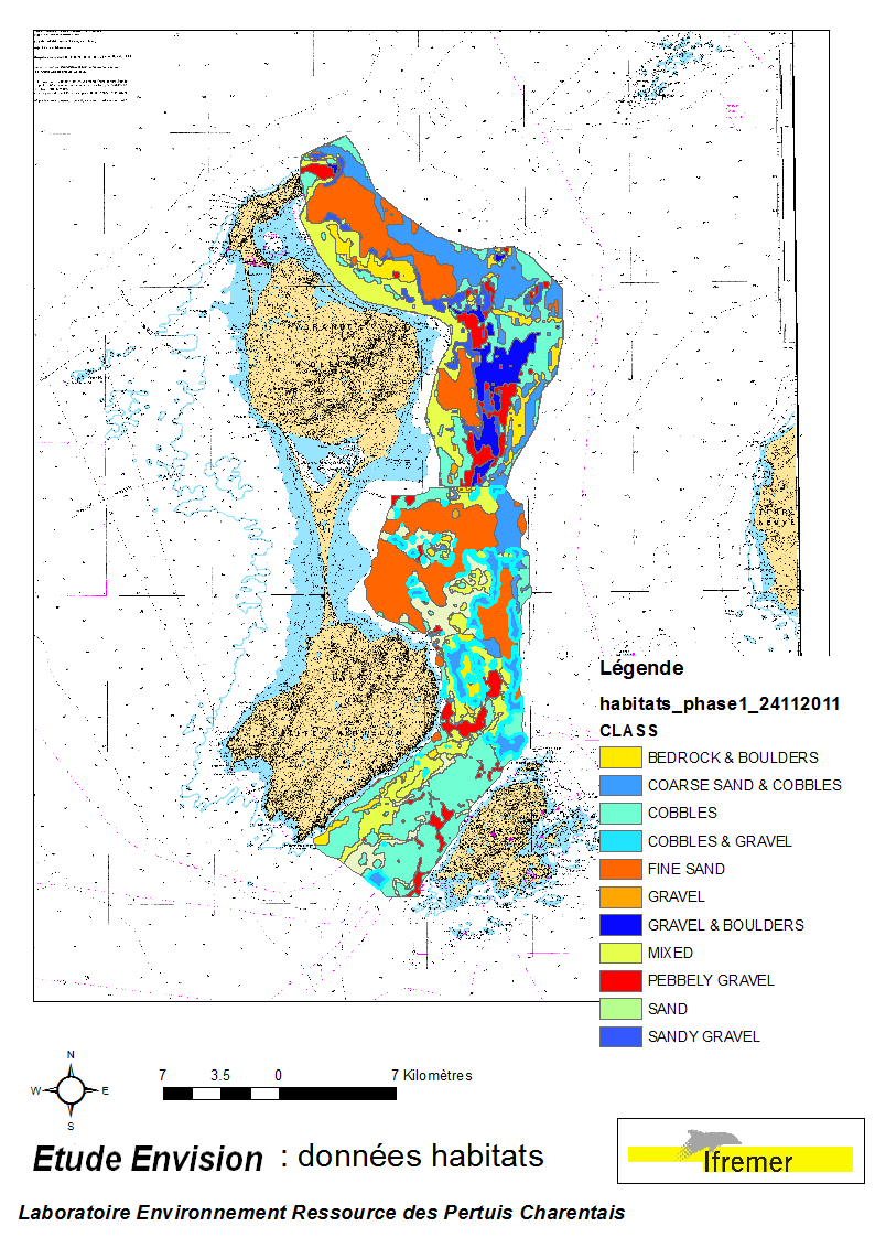
These data were collected during the 2007 and 2011 ENVISION-Ifremer campaigns to sustain a R & D project focusing on the Pectinid aquaculture development. This project was co-funded by the Saint Pierre et Miquelon public body and ODEADOM. This work aims to assess and select new potential rearing areas for the King scallop Placopecten magellanicus by using bottom type data resulting from 2 mapping campaigns carried out in 2007 and 2011 on the Eastern coast of Saint Pierre et Miquelon archipelago.
-
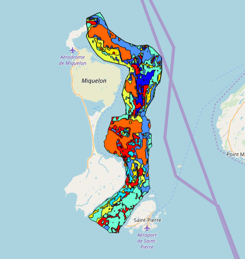
This data set was collected during 2 ENVISION-IFREMER field campaigns carried out in 2007 and 2011 to sustain a Pectinid aquaculture project. This was co-funded by ODEADOM and the public collectivity of Saint Pierre et Miquelon. This work aims to assess new seeding and rearing areas for the King scallop Placopecten magellanicus through a site selection process using the bottom type mapping data set obtained during the 2 ENVISION-IFREMER field campaigns. Furthermore, new estimates of potental scallop production is produced by this data treatment.
-
Cette carte des peuplements benthiques de la région de Roscoff a été réalisée d’après une carte extraite de la thèse de Louis Cabioch (1968, Station biologique de Roscoff) : "Contribution à la connaissance des peuplements benthiques de la Manche occidentale" publiée en 1968 dans les Cahiers de biologie marine, tome IX, cahier 5 suppl. Ces données ont été numérisées en 2003 et une harmonisation avec la typologie EUNIS a été effectuée en 2006 dans le cadre des projets REBENT et Interreg-MESH, avec l'expertise de Frank Gentil, de la Station Biologique de Roscoff.