 Mon GéoSource
irregular
Type of resources
Available actions
Topics
INSPIRE themes
Keywords
Provided by
Years
Formats
Representation types
Update frequencies
status
Scale
Resolution
-
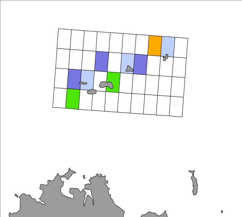
Quarterly spatial distribution of gray seals (Halichoerus grypus) identified by the LPO (Seven Islands Nature Reserve) on haul out sites in the Seven Islands archipelago, from 2007 to 2009 inclusive.
-
Total number of gray seals (Halichoerus grypus) neonates identified at various colonies along the French coast during the fourth quarters of 2007 to 2009.
-
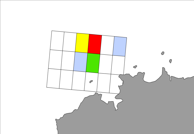
Seasonal spatial distribution of gray seals (Halichoerus grypus) on their haul out sites identified by the ONCFS on the rocks of Portsall in 2010.
-
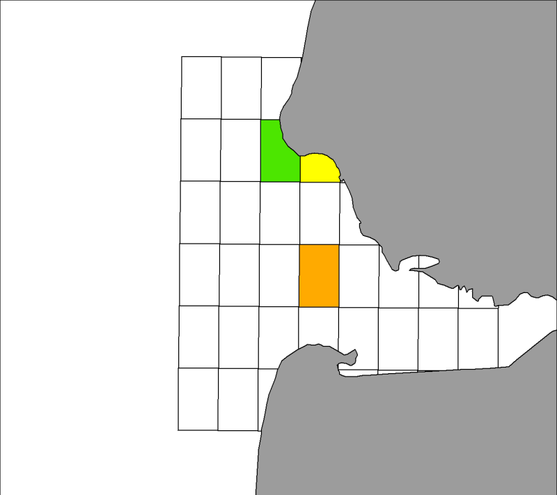
Seasonal spatial distribution of gray seals (Halichoerus grypus) on their haul out sites identified by the associations ADN and Picardy Nature in the Authie Bay from 2007 to 2009 inclusive.
-
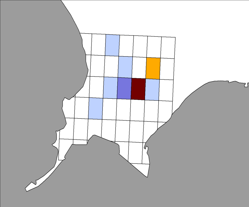
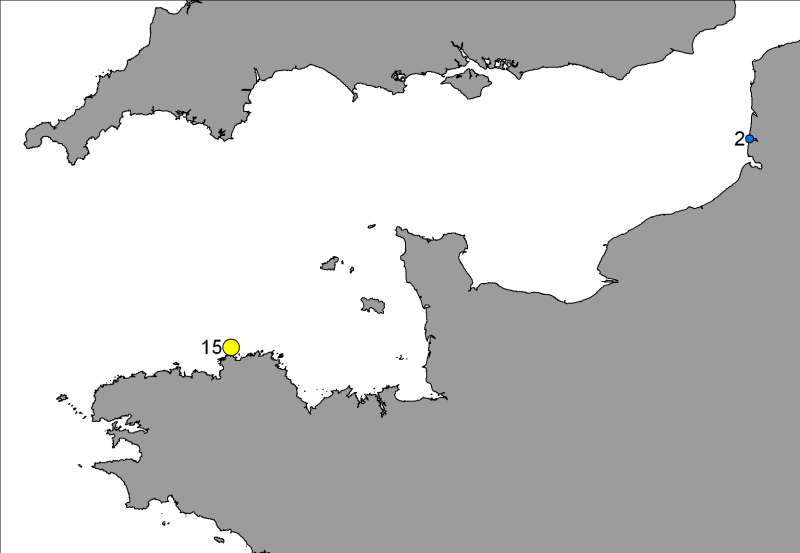
Spatial distribution of quarterly harbor seals (Phoca vitulina) identified by Aérobaie and the Réserve Naturelle du Domaine de Beauguillot (Nature Reserve of Beauguillot) on their haul out sites in the Bay of Somme from 2007 to 2009 inclusive.
-
-
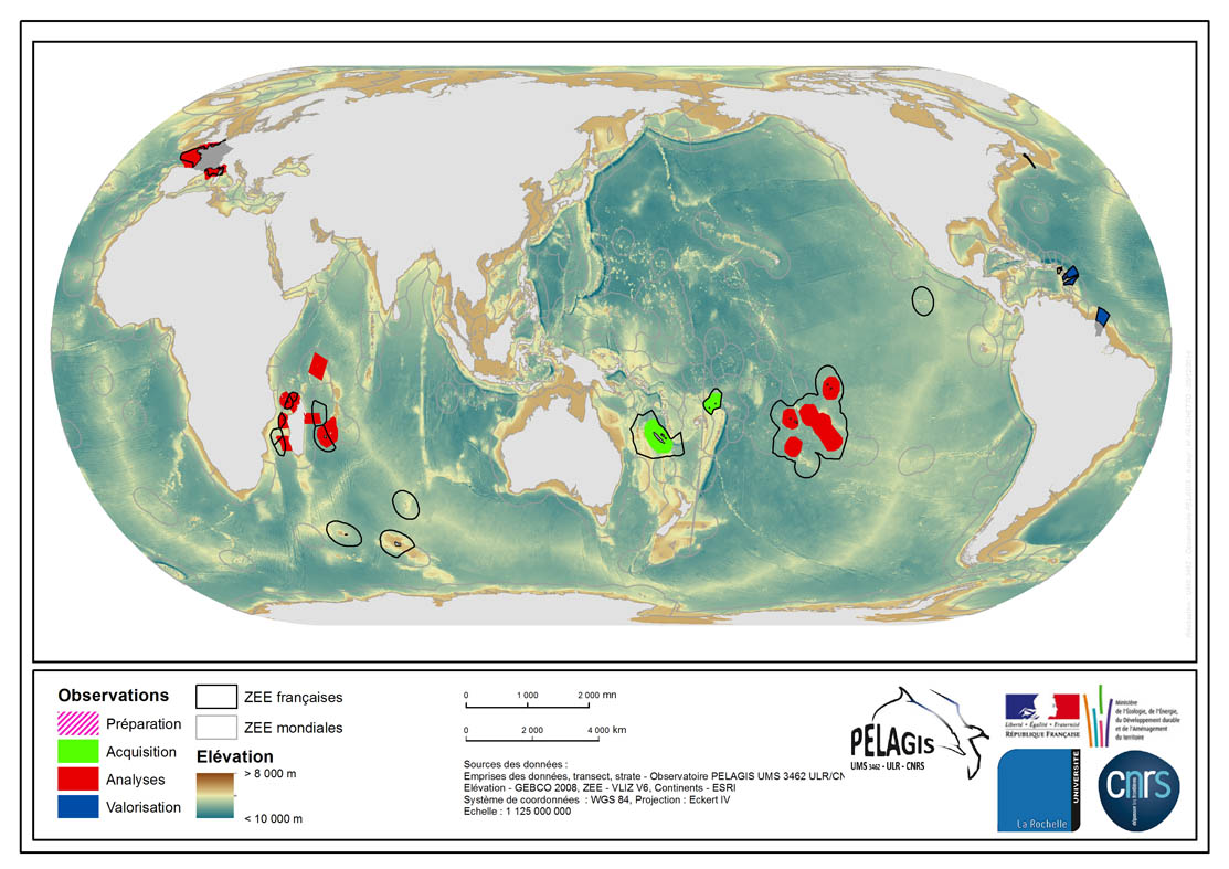
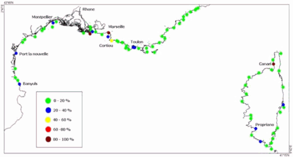
The associated data highlights the spatial influence of the dataset of the type “Visual Observations from an Aerial Platform” from the PELAGIS Observatory. These ranges represent the different areas of study on which the PELAGIS observatory conducted campaigns of visual observations from aerial platforms. Each area of study is associated with at least one campaign, with observers and geographical sectors linked to that campaign. Each sector is associated with bathymetric strips and transects related to each of the strips, with a few exceptions for the Indian Ocean region. Description of fields and values of the attribute tables : (- field name, meaning : value, description of values) - region, area of study specific to the PELAGIS observatory PELAGIS : OI/FRM/ AGFR/SOP/SP, region_lbl - programme, associated programme of which the campaign is a part: REMMOA/PACOMM, REcensement de la Mégafaune Marine par Observation Aérienne/Programme d'Acquisition sur les Oiseaux et Mammifères Marins - idCampagne, abbreviated name of the data collection campaign: OI/SAMM/ ANT/SOP/PF/GUY, Campagne Océan Indien/Suivi Aérien de la Mégafaune Marine/Sud Ouest Pacifique/Polynésie Française/ Guyane française - progress, current state of the campaigns, from collection to scientific optimisation : Preparation/Acquisition/ Analysis/Enhancement, campaign being prepared/under acquisition/being analysed/data enhanced within the context of a scientific publication.
-

Nos travaux ont pour objectif d’étudier la biogéochimie non stationnaire des sédiments intertidaux du Bassin d'Arcachon. Quatre stations caractéristiques des trois principaux types de sédiments intertidaux du bassin et favorables aux conditions transitoires sont échantillonnées depuis quelques années: 1) les sédiments sableux perméables dans le haut de plage (station 1/S); 2) les vases couvertes par Zostera noltii (station 3/VH), et 3) les vases nues (stations 2/VN et 4N marquées par des conditions redox différentes). Les questions fondamentales que nous souhaitons aborder dans ce travail concernent : i) l’influence des alternances émersion/immersion et jour/nuit sur les réactions biogéochimiques benthiques, et leurs influence sur les flux des composés biogéniques et de métaux traces ; ii) la dynamique biogéochimique et les processus spécifiques se déroulant dans les sédiments sableux perméables de la zone intertidal ; iii) la variabilité saisonnière de ces processus et le métabolisme net de ces environnements. Notre expertise repose sur l’utilisation d’outils in situ (voltammétrie, DET, profileur benthique) et ex situ (découpage et incubation de carottes).
-
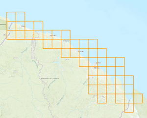
Depuis 2018, une nouvelle campagne de vol aérien sur une partie du littoral français est engagée en vue d'établir une couverture d'orthophotographies sur tout le littoral Atlantique et Manche - Mer du Nord en métropole ainsi que sur tout le linéaire de celui de la Guyane. La production de cette orthophotographie s'effectue au rythme des campagnes de vols. Ces dernières ne peuvent être réalisées que sous des conditions bien particulières : à marée basse en période de grande marée avec une hauteur d’eau inférieure à 1.50 mètre dans des conditions anticycloniques (> 1013hPa) établies depuis au moins 48 heures. Cette couverture orthophotographique est découpée en dalles 20*20km et ces dernières sont rendues disponibles en libre téléchargement sur le site Géolittoral dans le format JPEG2000 en RVB et Infrarouge couleur au fur et à mesure de leur production. Le téléchargement se fait par lot de dalles d'environ 600Mo chacun. Le système de projection associé est le RGF93 / Lambert93 (pour les dalles produites en métropole) et le RGFG 1995 / UTM Zone 22N (pour les dalles produites en Guyane). Cette couche détermine le plan d'assemblage des dalles 20*20km réalisées en IRC (Infrarouge Couleur). Elle concerne actuellement le linéaire du littoral de la Guyane. Elle sera actualisée au fur et à mesure de la production des dalles de l'ortho-littorales v3 et de leur diffusion.
-
Le produit BD ORTHO® V2 est une collection de mosaïques d'orthophotographies numériques en couleurs ou en Infra Rouge couleurs, rectifiées dans la projection adaptée au territoire couvert.