 Mon GéoSource
/Marine Biology/Benthic habitats
Type of resources
Available actions
Topics
INSPIRE themes
Keywords
Provided by
Representation types
Update frequencies
status
Scale
-
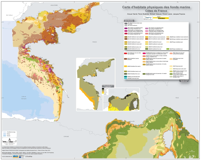
Eunis-classified physical habitats physiques resulting from the combination of three physical variables meshed at a resolution of 250 metres: nature of the substrates, biological area, shearing tension on the sea floor. Coasts of mainland France. Ifremer report "Hamdi Anouar, Vasquez Mickael, Populus Jacques (2010). Cartographie des habitats physiques Eunis - Côtes de France. Ifremer/AAMP agreement n° 09/12177764/FY. http://archimer.ifremer.fr/ doc/00026/13751/ "
-
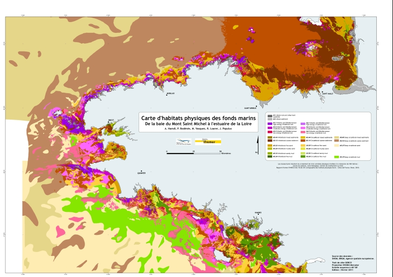
Eunis-classified physical habitats physiques resulting from the combination of three physical variables meshed at a resolution of 100 metres: nature of the substrates, biological area, shearing tension on the sea floor. Coasts of mainland France. Ifremer report "Hamdi Anouar, Vasquez Mickael, Populus Jacques (2010). Cartographie des habitats physiques Eunis - Côtes de France. Ifremer/AAMP agreement n° 09/12177764/FY. http://archimer.ifremer.fr/ doc/00026/13751/ "
-
The definitive coastal information system, Quadrige stores coastal observation and monitoring network data. In order to manage coastal monitoring data, Ifremer developed the Quadrige² information system. Quadrige is one element of the Water Information System (SIE) http:// www.eaufrance.fr, et à ce titre, contribue aux travaux du Secrétariat d'Administration National des Données Relatives à l'Eau (SANDRE) http://www.sandre.eaufrance.fr. Quadrige Marine Zones is a reference source unique to the Quadrige system. It is used to break down the coast of the French mainland and overseas territories into large areas and to connect each one with observation and monitoring locations.