 Mon GéoSource
Added-value products
Type of resources
Available actions
Topics
INSPIRE themes
Keywords
Contact for the resource
Provided by
Representation types
Update frequencies
status
Scale
-
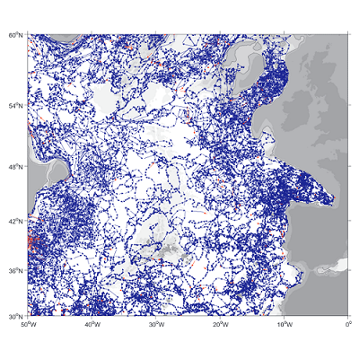
A world deep displacement dataset, named ANDRO, after a traditional dance of Brittany meaning a swirl, comprising more than 1300 000 deep displacements, has been produced from the Argo float trajectory data ('traj' files). ANDRO dataset was completed over the period 2000-2009, then was partially but yearly updated since 2010. For detailed information and status of the last released ANDRO product, please visit the dedicated Argo France web page: https://www.umr-lops.fr/SNO-Argo/Products/ANDRO-Argo-floats-displacements-Atlas One important feature of ANDRO is that the pressures measured during float drifts at depth, and suitably averaged are preserved in ANDRO. To reach this goal, it was necessary to reprocess most of the Argo raw data, because of the many different decoding versions (roughly 100) not always applied by the DACs to the displacement data because they were mainly interested in the p,t,S profiles. The result of our work was the production of comprehensive files, named DEP (for 'déplacement' in French), containing all the possibly retrievable float data.
-
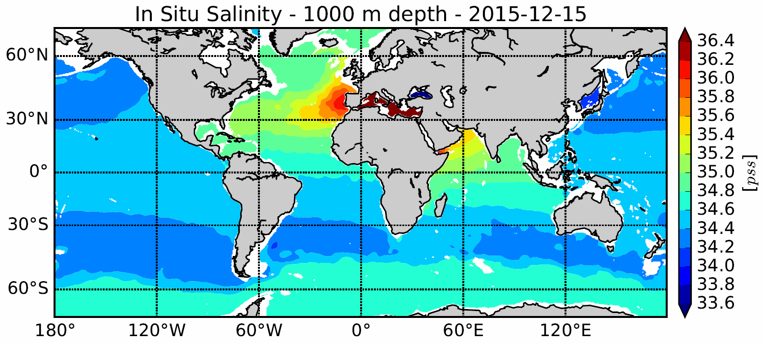
The In Situ Analysis System (ISAS) was developed to produce gridded fields of temperature and salinity that preserve as much as possible the time and space sampling capabilities of the Argo network of profiling floats. Since the first global re-analysis performed in 2009, the system has been extended to accommodate all types of vertical profile as well as time series. ISAS gridded fields are entirely based on in-situ measurements. The system aims at monitoring the time evolution of ocean properties for climatological studies and allowing easy computation of climate indices. A careful delayed mode processing of the 2002-2015 dataset has been carried out using version 7 of ISAS and updating the statistics to produce the ISAS-15 analysis.
-
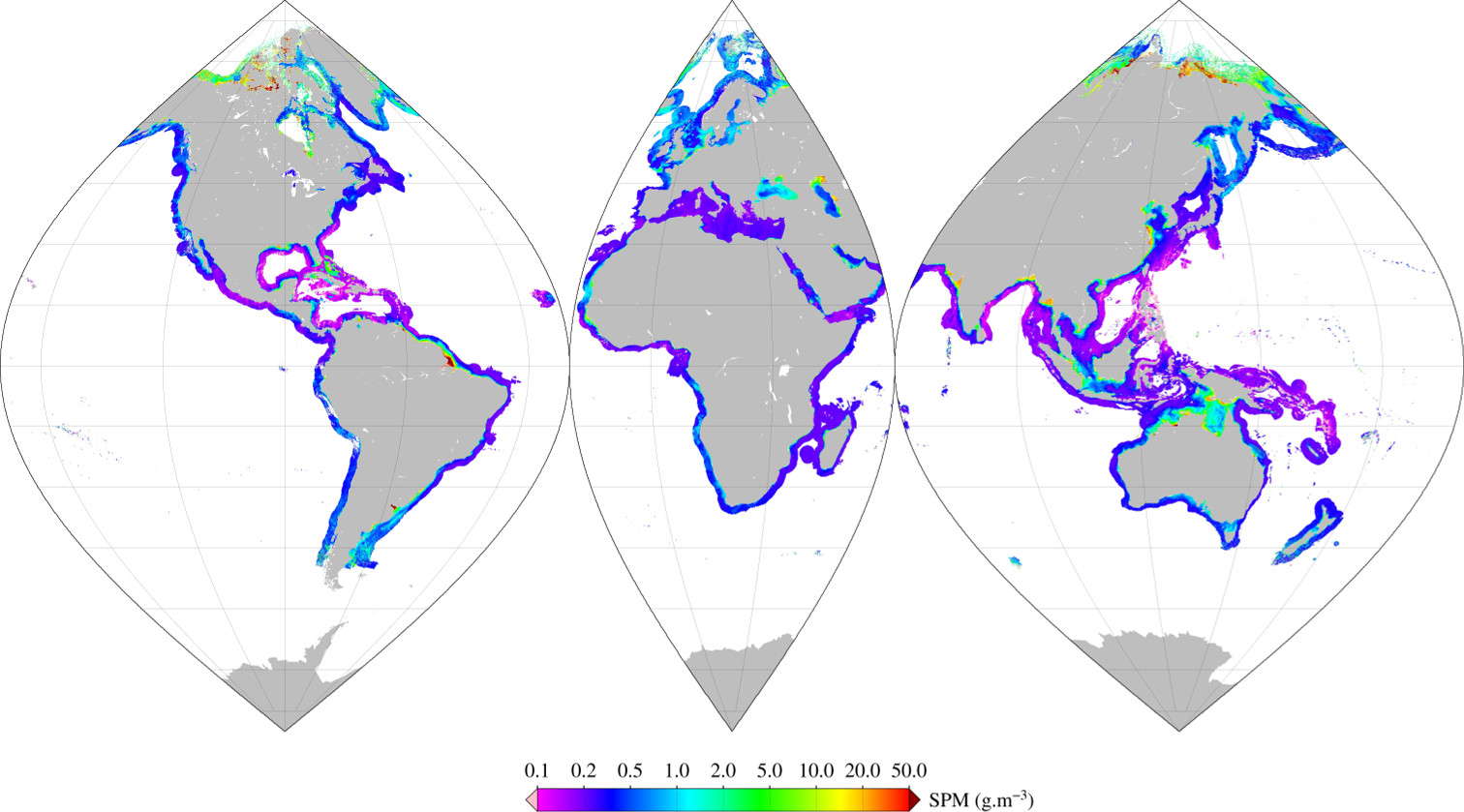
Monthly mean of Suspended Particulate Matter (2002-2012) using Han (2016) algorithm for coastal areas, at global scale, for MERIS sensor, with POLYMER atmospheric corrections. Ref: Bing Han, Hubert Loisel, Vincent Vantrepotte, Xavier Mériaux, Philippe Bryère,Sylvain Ouillon, David Dessailly, Qianguo Xing and Jianhua Zhu. Development of a Semi-Analytical Algorithm for the Retrieval of Suspended Particulate Matter rom Remote Sensing over Clear to Very Turbid Waters Remote Sens. 8, 211; doi:10.3390/rs8030211 2016
-
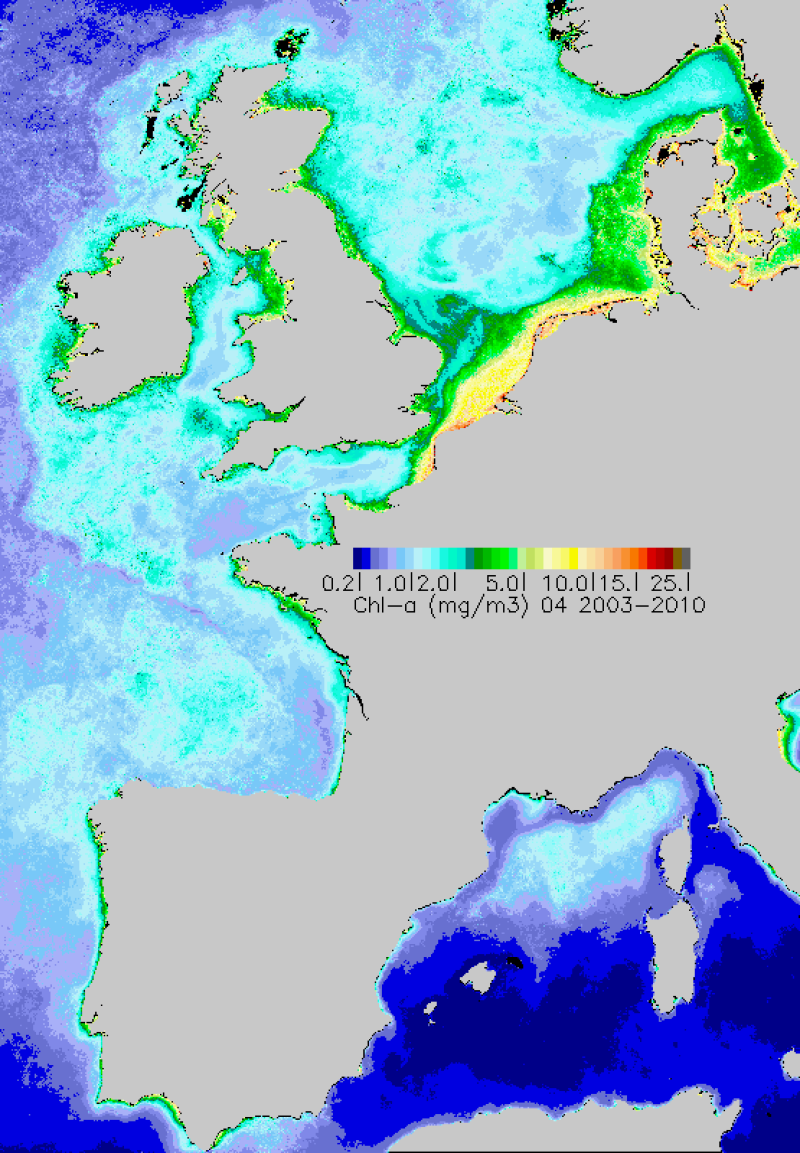
Monthly maps of mean chlorophyll-a achieved over the period 2003-2010. Chlorophyll-a is calculated using the OC5 algorithm developed by Ifremer.
-
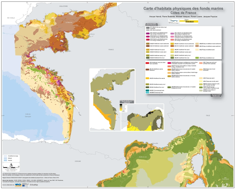
Eunis-classified physical habitats physiques resulting from the combination of three physical variables meshed at a resolution of 250 metres: nature of the substrates, biological area, shearing tension on the sea floor. Coasts of mainland France. Ifremer report "Hamdi Anouar, Vasquez Mickael, Populus Jacques (2010). Cartographie des habitats physiques Eunis - Côtes de France. Ifremer/AAMP agreement n° 09/12177764/FY. http://archimer.ifremer.fr/ doc/00026/13751/ "
-
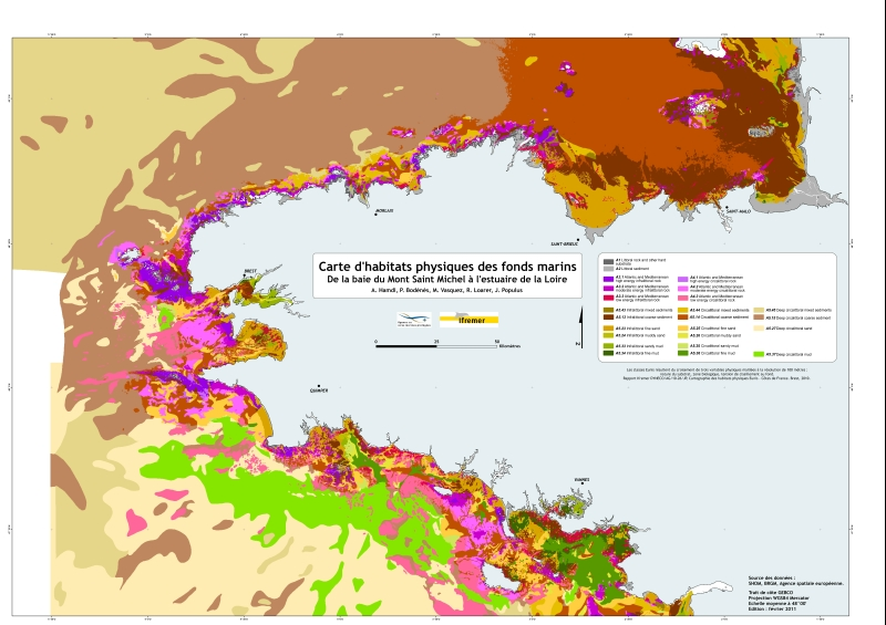
Eunis-classified physical habitats physiques resulting from the combination of three physical variables meshed at a resolution of 100 metres: nature of the substrates, biological area, shearing tension on the sea floor. Coasts of mainland France. Ifremer report "Hamdi Anouar, Vasquez Mickael, Populus Jacques (2010). Cartographie des habitats physiques Eunis - Côtes de France. Ifremer/AAMP agreement n° 09/12177764/FY. http://archimer.ifremer.fr/ doc/00026/13751/ "