 Mon GéoSource
Mediterranean Sea
Type of resources
Available actions
Topics
INSPIRE themes
Keywords
Provided by
Representation types
Update frequencies
status
Scale
-
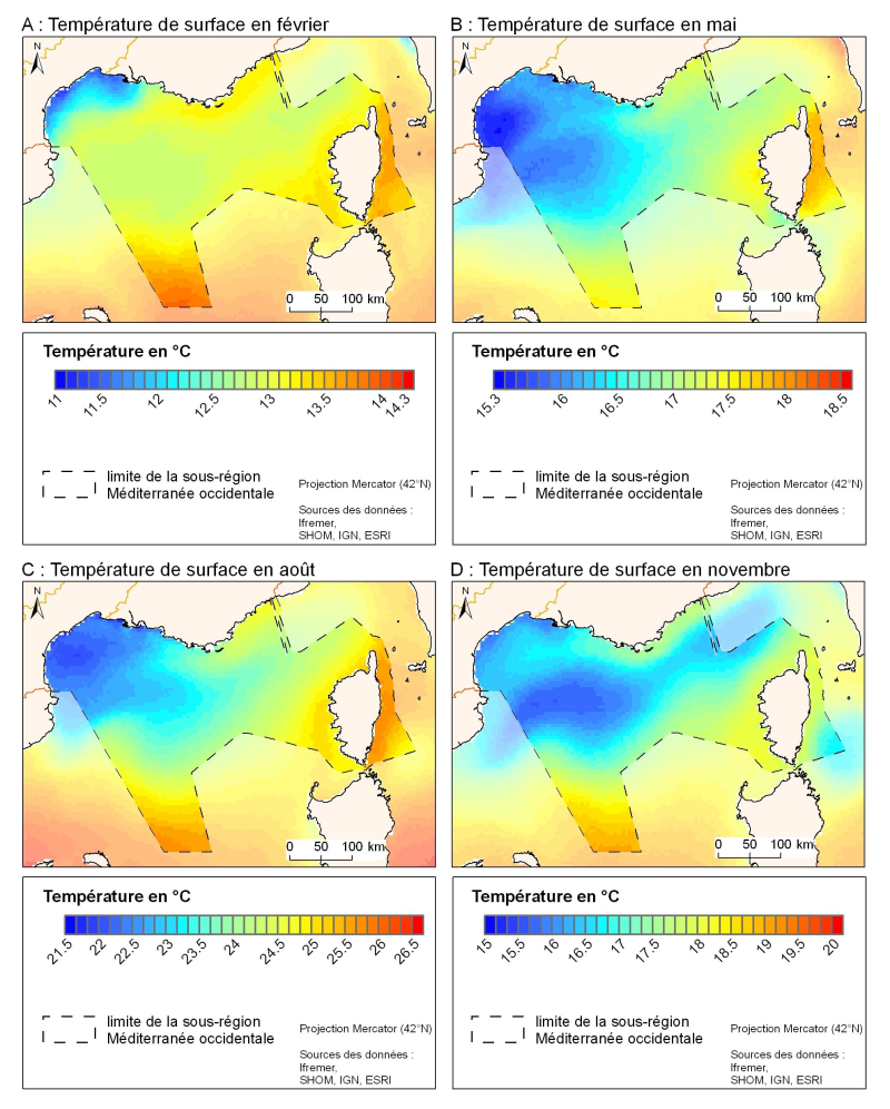
The spatial resolution from satellite climatology provides a more detailed description of spatio-temporal variations of surface temperature in the northern part of the western basin. Climatology exists for the surface temperature based on satellite infrared measurements which provides a spatial resolution on the order of kilometres.
-
Bathymetric model (DTM) of the Mediterranean. MediMap group. Bathymetry data acquired by multibeam sounders during campaigns Almofront.leg1 and Almofront.leg2, Almofront, Bretane, Seamewe2, Heralis, Medee, Anaxiprobe, Almofront2 - leg1 and leg2, Prismed2, Marmara, Fanil, Tvic5 et 6, Progres, Maradja, Blac, Nautinil, Medor-Simed1 / 2 / 3 / 4 / 5, Maradja2, Sardinia, Prisme, Assemblage and Thertou. Integration of partner organizations DTM. This DTM is available at two cell sizes : 500 m and 1000 m.