 Mon GéoSource
2002
Type of resources
Available actions
INSPIRE themes
Provided by
Years
Representation types
Update frequencies
status
Scale
Resolution
-
Geophysical and geochemical study of the Pacific-Antarctic ridge between S65/W175 and S60/W150. The first objective was to contribute to the understanding and modelling of the mechanisms of ocean ridge functioning on the scale of the basic accretion unit (< 100 km). The second was to study the zoning of the upper mantle on various scales, through investigating the geochemical signature of rocks from the axial valley. This cruise falls under the framework of the Inter-Ridge programme and is the result of cooperation between IFREMER/DRO/GM, INSU (CNRS,IPG, GRGS), Washington State University, Scripps (University of California) and the University of Chiba (Japan).
-
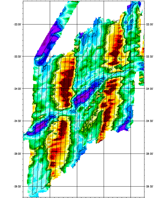
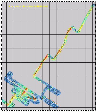
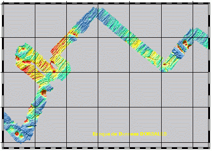
Geophysical survey of 2 sections of the South West Indian Ridge from the axis to a distance of about 100 km, corresponding to more than 10Ma. Profiles were 4 miles apart to ensure correct interpretation of gravimetry and magnetism data. The first zone studied was located around 38S and 50E, and was along a straight axis with shallow depths. The second zone was located around 34S and 56E, and was along a highly fragmented and very oblique axis.
-
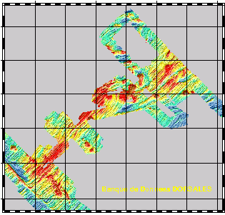
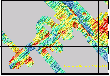
Geophysical (bathymetry, gravimetry, magnetism, seismics and multichannel reflection) and geological (dredging) studies of the northern part of the Kerguelen plateau (Indian Ocean). Survey of ODP drilling sites (leg 183). The Kerguelen underwater plateau is still puzzling today, when trying to understand its origin and explain the way it was formed. To try to answer these questions, new deep ocean drilling was to be done on the Kerguelen shelf in late 1998 and early 1999.
-

Mosaïque d'imagerie acoustique au nord de la Grande Vasière. La résolution de l'image est de 25 mètres. Les données ont été acquises lors de la campagne océanographique Trophal en 2002, par sonar à balayage latéral.
-
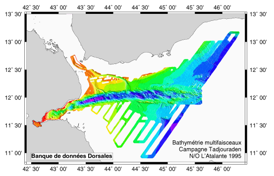
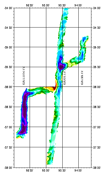
EM12 and EM 950 surveys + gravimetry, magnetism and rapid digital seismics to study the mechanism of the ocean ridge's propagation from the Gulf of Aden towards the west(gulf of Tadjoura and Ghoubbet).
-
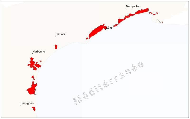
Etangs du Languedoc-Roussillon basés sur la Base de Données sur la CARtographie THématique des AGences de l'Eau et du ministère de l'Environnement qui est un référentiel national hydrographique: Languedoc-Roussillon, BD CARTHAGE
-
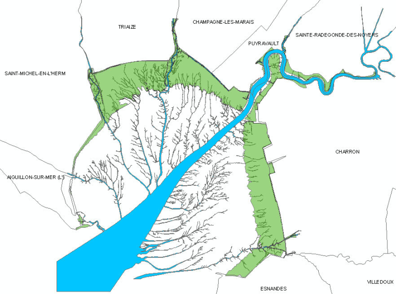
Cette carte du réseau hydrographique de la baie de l'Aiguillon et de l'embouchure de la Sèvre Niortaise a été réalisée dans le cadre de la numérisation des prés salé. Elle a été obtenu par la numérisation du réseau hydrographique visible sur l'orthophograhie 2000 de l'IGN au 1/5000. Il s'agit d'un unique polygone permettant de localiser le réseau hydrographique dans la baie, sur le pré salé et remontant le canal jusqu'à Marans.