 Mon GéoSource
Keyword
Remote sensing
Type of resources
Available actions
Topics
INSPIRE themes
Keywords
Provided by
Representation types
Update frequencies
status
From
1
-
1
/
1
-
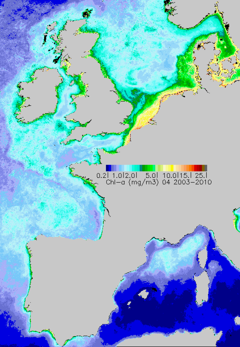
Monthly maps of mean chlorophyll-a achieved over the period 2003-2010. Chlorophyll-a is calculated using the OC5 algorithm developed by Ifremer.