 Mon GéoSource
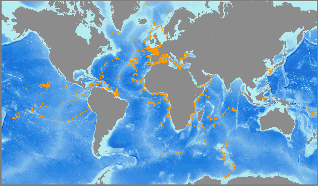
/Human Activities/Oceanographical Cruises
Type of resources
Available actions
INSPIRE themes
Provided by
Representation types
Update frequencies
status
Scale
-
La cartographie des habitats au large du Congo a été réalisée par le laboratoire Environnement Profond de l'Ifremer dans le cadre du projet ANR CONGOLOBE (2011-2015, responsable Christophe RABOUILLE). La méthode employée pour cette cartographie des habitats repose sur le dépouillement préalable des images acquises grâce au ROV Victor 6000 dans le cadre de deux campagnes océanographiques : WACS (du 26/01/2011 au 25/02/2011, chef de mission : Karine OLU) et CONGOLOBE (du 11/12/2011 au 12/01/2012, chef de mission : Christophe RABOUILLE). Les habitats ont été décrits au plus fin niveau d'analyse puis ont été classifiés selon la typologie EUNIS (https://www.eea.europa.eu/data-and-maps/data/eunis-habitat-classification-1). Données publiées dans: Sen, A., B. Dennielou, J. Tourolle, A. Arnaubec, C. Rabouille and K. Olu (2017). Fauna and habitat types driven by turbidity currents in the lobe complex of the Congo deep-sea fan. Deep-Sea Research Part Ii-Topical Studies in Oceanography 142: 167-179. http://dx.doi.org/10.1016/j.dsr2.2017.05.009
-
Données brutes de sismique réflexion archivées au SISMER, acquises par les navires océanographiques et les équipements nationaux gérés par l'IFREMER.
-
Données brutes de gravimétrie archivées au SISMER, acquises à bord de la flotte océanographique civile française.
-

Le projet NourDem vise à réaliser des campagnes annuelles de chalutage dans les trois estuaires de la Seine, de la Loire et de la Gironde.
-
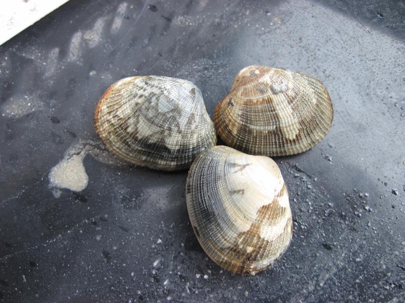
Depuis 2001, une évaluation annuelle des stocks de palourdes japonaise (Ruditapes philippinarum) et croisée d'Europe (Ruditapes decussatus) est réalisée en mars dans le golfe du Morbihan et la rivière Noyalo. Les objectifs de cette enquête sont : 1) l'estimation par évaluation directe, de la biomasse du stock et de sa répartition géographique; 2) estimer la biomasse exploitable et le potentiel d'exploitation des sites échantillonnés en particulier, dans les zones réservées à la pêche professionnelle; 3) établir un diagnostic, avec une vision à moyen terme, sur l'état du stock; 4) proposer la mise en œuvre de mesures de gestion appropriées. Deux campagnes ont également été réalisées en 1996 et 1997.
-
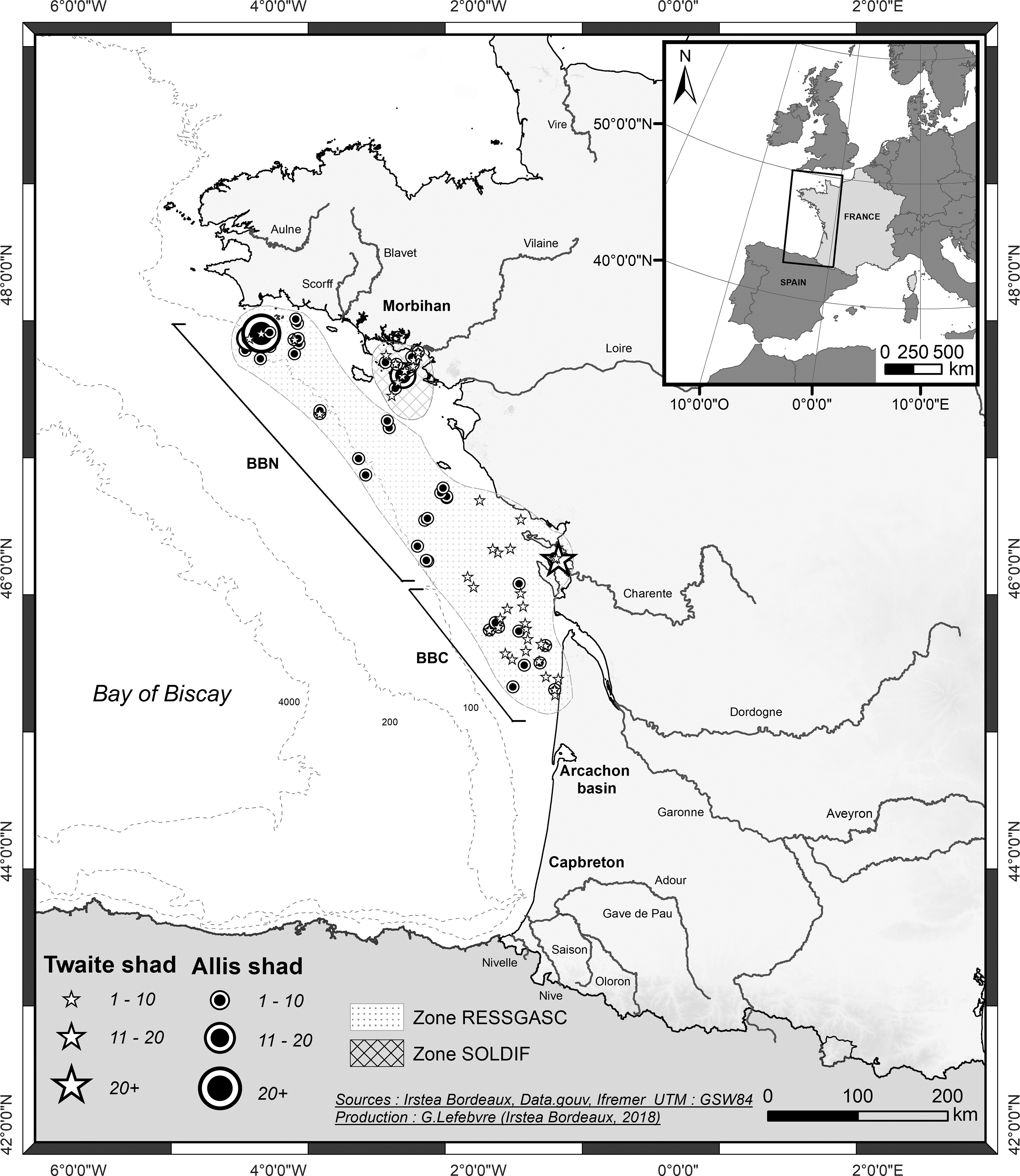
Les 62 campagnes RESSGASC permettent l'évaluation trimestrielle des quantités de diverses espèces (merlu, sole, langoustine, etc.) rejetées par les navires de pêche (individus n'ayant pas atteint la taille légale de débarquement). Ces informations, ainsi que les données collectées à partir de la structure démographique des débarquements (à l'aide d'échantillons provenant des criées), sont essentielles pour l'évolution des stocks de poissons commerciaux.
-
Données brutes de bathymétrie monofaisceau archivées au SISMER, acquises à bord de la flotte océanographique civile française.
-
Archives nationales (SISMER) de séries temporelles de courantomètres.
-
Données de courantométrie mesurées en continu par un ADCP de coque (Acoustic Doppler Current Profiler), validées et agrégées.
-
Le service SISMER de l'Ifremer, Centre français de Données Océanographiques, gère la base de données d'échantillons biologiques et géologiques (BIGOOD, BIology and GeOlogy Ocean Database). Cette base regroupe les descriptions d’échantillons biologiques et géologiques relatives aux prélèvements effectués par les équipes et/ou moyens Ifremer ou conservés à l’Ifremer : - campagnes de prélèvement en mer ; - stations d’observation et de prélèvement : position, type d’observation et de prélèvement (submersible, forage, dragage); - description et lieu de stockage des échantillons. Cette base de données est alimentée par les équipes scientifiques du département REM à l'aide des logiciels Sealog et Archimède.