 Mon GéoSource
series
Type of resources
Available actions
Topics
INSPIRE themes
Keywords
Contact for the resource
Provided by
Years
Formats
Representation types
Update frequencies
status
Scale
Resolution
-
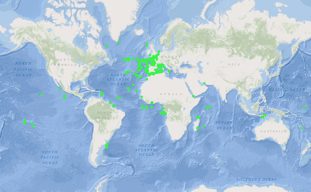
French national archive (SISMER) of time series data, particularly current meter and thermistor data.
-
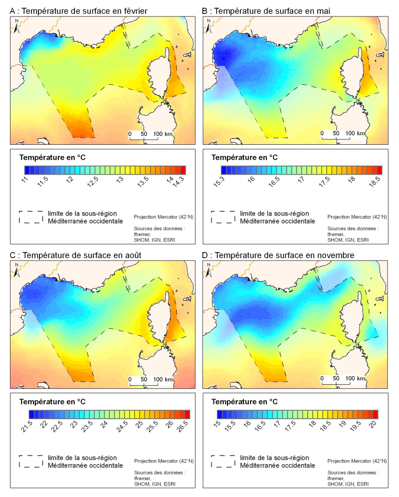
The spatial resolution from satellite climatology provides a more detailed description of spatio-temporal variations of surface temperature in the northern part of the western basin. Climatology exists for the surface temperature based on satellite infrared measurements which provides a spatial resolution on the order of kilometres.
-
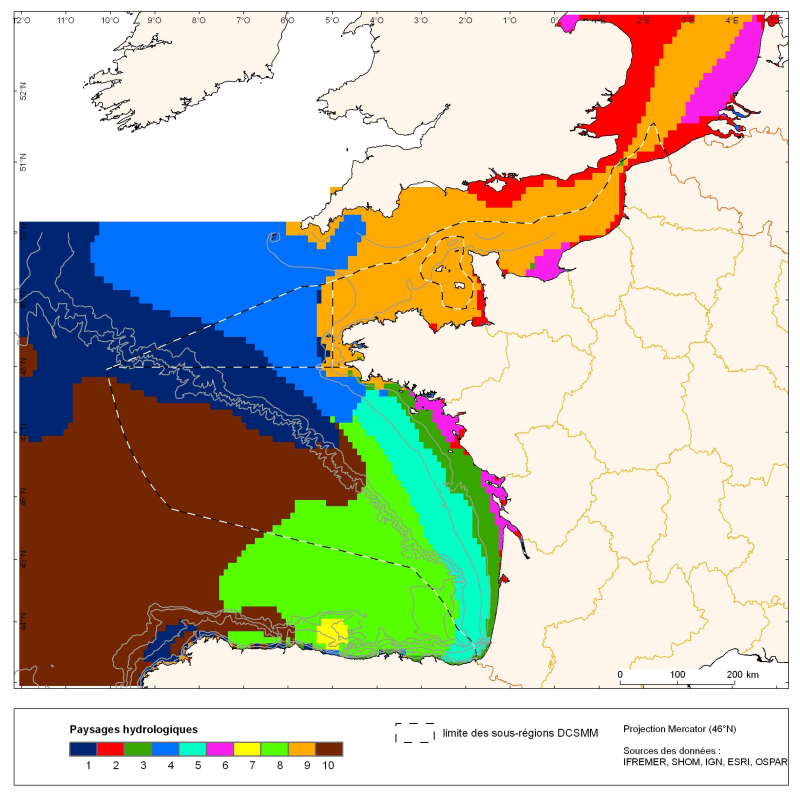
The distribution of hydrological landscapes is determined by a method of comparing multi-tables, to identify groups of individuals with similar variability of hydrological conditions during the year. The data used provides monthly tables showing the selected parameters, calculated over the entire geographic area with a resolution of 0.1 °. The variable chlorophyll-a is extra: it does not contribute to the discrimination of groups. This method identifies 10 hydrological landscapes with a similar annual variability of hydrological conditions.
-
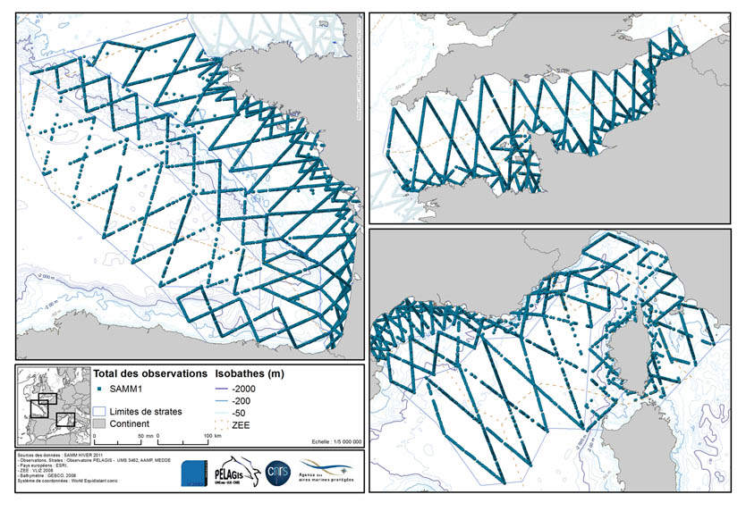
The associated data highlights the sampling programme for the data acquisition campaign of Observation on the Aerial Platform for the SAMM1campaign (Aerial Marine Megafauna Monitoring) conducted by the PELAGIS observatory.
-
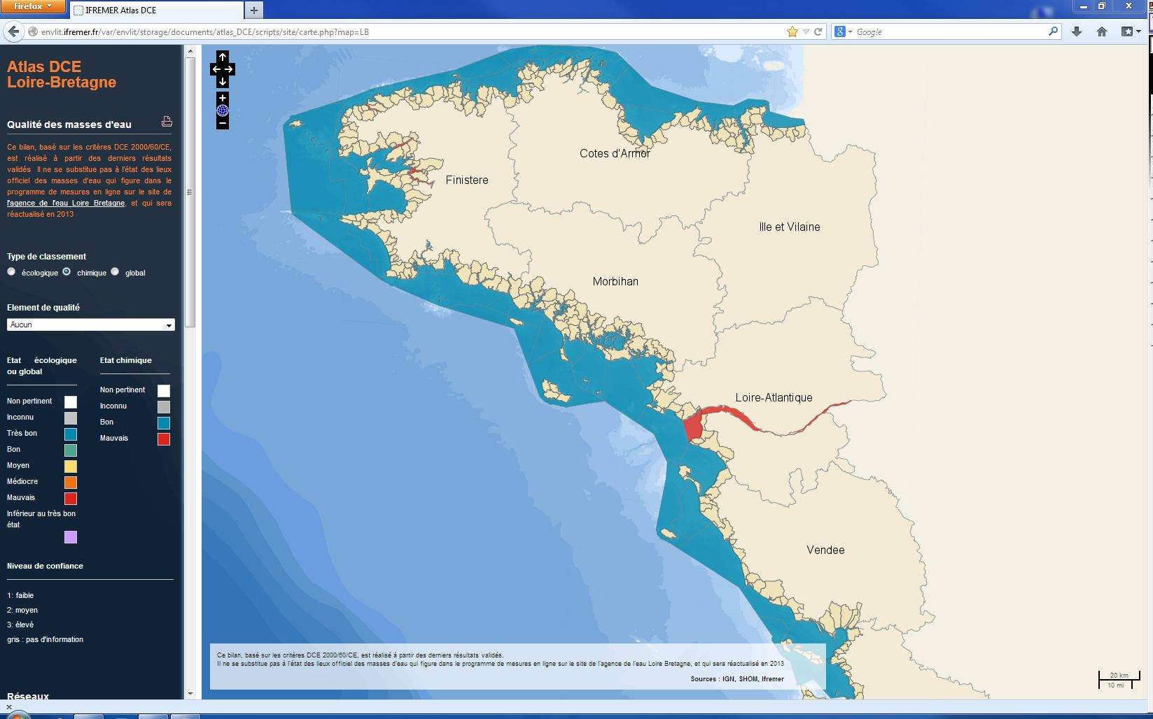
The chemical status of a coastal water body (coastal water or transition water) is determined by the most declassing of the defined states for heavy metals, pesticides, industrial pollutants and other pollutants taken into account by the WFD . The assessment is done once per management plan (once every six years). The most recent assessment of the state of the chemical state is presented in the DCE Loire-Bretagne atlas. Earlier reports are available in annual archives.
-
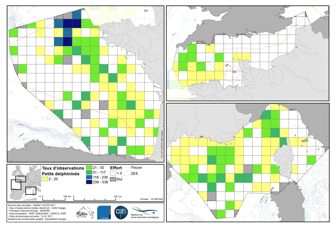
Occurrence rate by observation number for 100km of effort in each 40km mesh in the French mainland EZE in the winter of 2011/2012 and the summer of 2012. Description of the attribute table: survey : campaign Type: observation type Mesh: mesh size in kilometers _no_maille : mesh number The following fields correspond to the calculation of the occurrence rate for the observation number for 1000km of effort for each species or group of species : - [marsouin] common porpoise - [grdDauph] bottlenose dolphin - [lagenor] White-beaked dolphin - [pttDelph] : common dolphin and Striped dolphin - [globiceph] : Long-finned pilot whale + Risso's dolphin - [cakobab] : Sperm whale+ kogias + Beaked whales - [balenopt] : Fin whale + Minke whale + blue whale - [phoque] seal (grey + harbour)
-
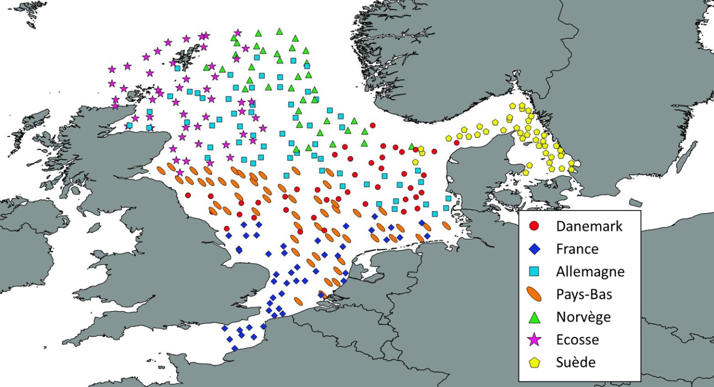
Like all EU Member States, France is obliged to collect and manage the data necessary to conduct the Common Fisheries Policy to assess the abundance and distribution of stocks. A "national multi-annual basic data collection programme" has therefore been set up in which scientific campaigns such as IBTS are integrated. This campaign is carried out in coordination with most of the countries bordering the North Sea, in the framework of the European Fisheries Data Collection Programme (DC-MAP). The research carried out over the last few decades has led to a shift away from fisheries issues stricto sensu (monospecific and geographically limited studies) towards a more integrated vision of the various components of marine ecosystems. This openness results from a desire to better understand the dynamics of exploited marine resources in order to improve diagnoses and management recommendations. The acquisition of data from these compartments at different stations makes it possible to establish a map of biotic and abiotic environmental parameters in the Channel and North Sea during the winter period, a period that is usually little studied, but which is crucial.
-
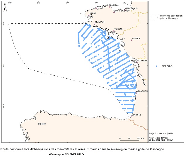
The objective of the PELGAS cruise is to monitor distribution and abundance of pelagic species fished in the Bay of Biscay, using two direct evaluation methods: acoustics and spawning estimates. The cruise was conducted in coordination with France, Spain and Portugal, in the framework of the European council regulations (EC No 1543/2000 of 29 June 2000 and No 1639/2001 of 25 July 2001).
-
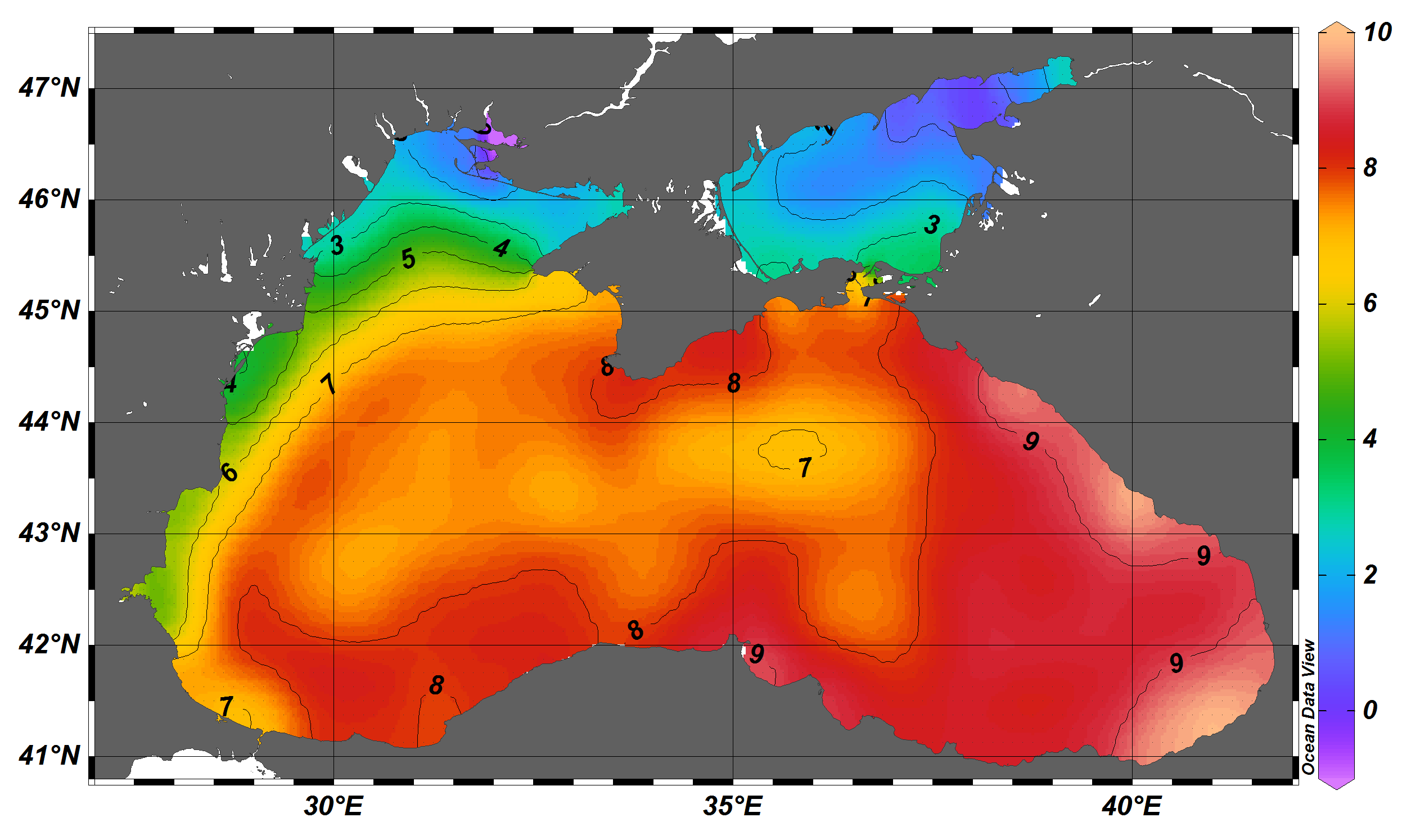
The SDC_BLS_CLIM_TS_V1 product contains Temperature and Salinity Climatologies for Black Sea including the seasonal and monthly fields for period 1955-2017 and seasonal fields for 6 decades starting from 1955 to 2014. The climatic fields were computed from the integrated Black Sea dataset that combines data extracted from the 3 major sources: 1) SeaDataNet infrastructure, 2) World Ocean Database 2018, and 3) Coriolis Ocean Dataset for Reanalysis. The computation was done with the DIVAnd (Data-Interpolating Variational Analysis in n dimensions), version 2.3.1.
-
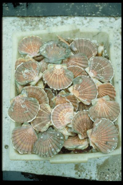
The aim of these cruises, which took place on the Thalia, was to evaluate the abundance of the scallop stock in the Charentais channels.